Pioneer Cemetery

Reading this week:

  • Born a Crime by Trevor Noah
  • She by Henry Rider Haggard (namechecks the Zambezi!)

Feeling glum after not climbing Mt. Sunzu, I wanted to get something out of the trip, so I looked again for Mbala’s Pioneer Cemetery. I thought I had mentioned it before here, but I guess not. During the colonial days of Zambia, colonials of course died here every once in a while, and were buried in a cemetery. Zambia’s Heritage Comission has dubbed these “Pioneer” cemeteries, which strikes me as problematic, but eh I guess. Anyways, we got one in Mbala. I had looked for it before, but hadn’t found it, but hey, now I have.

Frankly, it should have been pretty obvious. It is located on Cemetery Hill. Cemetery Hill is interesting as the most likely location of the “original” site of Chief Zombe’s village. “Original” refers to whenever white explorers decided to roll through the area, and in this case that white explorer was none other than David Livingstone himself. Over on the oft-sited Mbala/Abercorn Facebook page, there was quite a discussion for a bit as to where exactly David Livingstone met Chief Zombe and crossed the Lucheche River. It was never quite settled, but Cemetery Hill strikes me as the most likely. Chief Zombe’s village is currently located about 15km north, and apparently villages used to move around when enough people died, because the village would want to move away from all the dead people. Hence, I suppose, Cemetery Hill.

In my defense, the last time I poked around Cemetery Hill, I did in fact find a cemetery. It was just the currently-in-use one. The Pioneer Cemetery is a bit separate from the most recent graves. Plus, it was easier to find this time around, because they spruced it up for the Centennial, which is nice. As you can see in the top picture, it has a nice sign and a plaque out front, but as you can see in the picture right above since then it has gotten a bit overgrown (it’s the rainy season; stuff grows fast). The reason they cleaned it up for the Centennial is because this cemetery was the original resting place for many of the (white) soldiers that died in Northern Zambia during WWI. After the war they were exhumed and reintured at that cemetery I never found in Ndola (where the Polish Monument apparently actually was). In addition to the soldiers, the cemetery also of course had notable figures from the early colonial days, also relevant to WWI.

To circle back to the Polish thing for a second, the other significant part of the cemetery is the number of Polish graves located there. Mbala was home to one of several Polish refugee camps in Southern Africa and in Zambia. These were people fleeing the Soviet Union in Poland following WWII. Since Polish people lived here they of course also died here, and were buried in the Pioneer Cemetery. A few years back the Polish Embassy in South Africa apparently came up and spruced up the graves, so the ones in the cemetery have a uniform, taken-care-of look and are topped with steel crosses.

I am a minor fan of cemeteries because of what they say about the people who lived in a place and about the history of a place. Finding the Pioneer Cemetery was really cool for all the history it contained, and it would have been a major whiff to leave Zambia without visiting. It is right outside of town, and if you ever find yourself in Mbala make sure to visit.

Not Climbing Mt. Sunzu

Mt. Sunzu

Reading this week:

  • Diamonds are Forever by Ian Fleming
  • The Books in My Life by Henry Miller

This past weekend I did not climb Mt. Sunzu. It wasn’t for lack of trying. As an illustration of how my adventures in Zambia usually go, here is me not climbing Mt. Sunzu.

Mt. Sunzu is arguably the highest mountain in Zambia. It’s something like 2040m tall, according to Google Maps. Sure, if you search for “highest mountain Zambia,” you’ll get the Mafinga Hills, but that hill is actually split between Zambia and Malawi as it is on the border, so us Mbala people hold that Sunzu takes the cake.

Before setting out on these types of adventures, I look the place up on Google Maps. On the sattelite view, you can usually see the roads and bush paths that will take you where you want to go. As I have complained before, Zambia’s biggest problem, tourism-wise, is the fact that nothing is marked and everything is hard to find. There is no marked path up Sunzu, or any signs that say “go this way.” So it pays to map it out beforehand. In the above picture, Sunzu is the green marker. I had to choose between an eastern route and a western route. Initially I wanted to do the western route because it is less mountain to hike up. The only problem with the western route is from the satellite image, there is no route at all, not even a bush path. The other way is the eastern route. There, you can follow a road to the base of the mountain and then climb up the whole way. It is still bushwhacking, but it is only 1km of bushwhacking instead of 6. Oh and you have to scale the mountain like straight up the face of it. Oi.

So the morning of this adventure I got up early and set out a little after it got light out. The previous day I baked myself some bagel balls so I was ready to go. I got into town at about 8 and then started off the next 30km of biking to get to the mountain. The goal is to do as much biking before it gets really hot.

I got to the mountain at about 1100. As you can see from the map above, there is a long stretch of road that goes downhill to the base of the escarpment. At the top of that hill, I started poking around for a road visible on Google Maps that brings you like part of the way to the mountain. I poked around and didn’t see it, and I continued down the hill. Looking into the forest, the bush through which I would have to whack looked pretty thick and difficult to whack, and since I couldn’t find the road I was looking for anyways I continued down the hill, figuring I would just go with the eastern route.

As I was riding down the hill I started to feel a bump-bump-bump coming from my rear tire. I stopped to check and discovered my tire was failing. So like, fuck. I remembered at that point I hadn’t brought a spare tube, but that is moot if the tire itself blows. This is the same thiing that happened to me when I tried to bike the Mwambezi, and I could barely believe it was happening again. This put me in a pickle, because the eastern route I was now shooting for involves biking like 6km off tarmac down a dirt road, and worst case I bike 6km down it just to have my tire burst. But I had come this far (this is usually my downfall on these adventures, thinking I had “already come this far…”), and I was on tarmac anyways (so I could hitch back to town) so I kept on going.

Towards the bottom of the hill I discovered something new: a fence. All along the road starting towards the base of the escarpment was a fence keeping me from going towards the mountain (I did some Googling today, I don’t think it is this place but hey that’s nice to have more farming in the area). At the road that I was gonna follow to the base of the mountain was a fence, but it looked uninviting and so I kept going hoping I could get around it. The answer was nope: the fence went all the way down to the very marshy river and so I was cut off. I was very indignent and I guess this is how the cowboys felt when they invented barbed wire.

So I sat down on the bridge and had some lunch and considered my options. Since I really wanted to climb that mountain, I decided to go back to the top of the hill and poke around again for a way there. Hopefully my tire would hold out, and I could climb the mountain while there was still daylight.

Getting back up that huge hill was exactly what I wanted to avoid with the eastern route and by the time I got up it, it was about 1300. Again on these adventures I start to do math to myself like “well it’s 1300 now so I have five hours of daylight so maybe I could hike the 12km there and back before it is dark and get back to the road and then just hitch to town and hopefully there is traffic and hopefully my water doesn’t run out and maybe worst case I just sleep by the side of the road and my tire doesn’t seem to be getting too much worse…” and really I should know my own warning signs by now but I don’t. Plus as I looked up it seemed like rain clouds were building, so also added to the equation is me playing optimistic weather man telling myself the rain won’t hit me.

At the top of the hill I found a road that looked somewhat promising and went down it. It didn’t go very far and I found a family there having lunch. I asked if there was a path to Mt. Sunzu. They asked me why I wanted to see “her,” and like jeez guys I’ve been biking since like 6 and it is hot and I am tired and now you want me to get philosophical? They said there was indeed a path… at the bottom of the hill. So like ugh, I wasn’t going back down there again. Plus with the rain coming I decided to give up on this adventure and head back into town.

View from the hut.

But the day wasn’t done with me yet! I started biking and got a little ways but then I could see the actual rain coming. Again I tried to tell myself that the rain wouldn’t hit, but the raindrops started falling on my head and so I put on my rain gear and none too soon. The downpour came very suddenly and I had to look to check it was rain and not hail whacking me. The wind was so strong I was veering off course and couldn’t make any progress. Luckily I looked up and spotted a little hut and ducked into there. So now I was soaked, and my feet were wet, and the hut didn’t stop the wind but at least it stopped the rain. Like jeez, the sky, I already couldn’t climb the mountain, why you gotta make this harder?

After about 45 minutes the rain let up, which in its own way was kinda annoying. I set offf biking again in my rain gear while there were some sprinkles but before long it was sunny and it was hot and I didn’t want to stop to take all my rain gear off again. Plus the fact it was hot was annoying. Also also, I no longer had a really solid excuse to stay in town for the night; if it is raining it is hard to bike back to my vil through the raging river that forms on my road, and so I can mentally justify a night in the lodge. But it was a sunny and beautiful day when I biked back into town, with just enough time to make it back to my vil (my tire held, somehow).

But I was tired, hungry, hot, sweaty, disappointed I didn’t get to climb the mountain, and also my feet were wet. I asked my one friend what she would pay to take a shower in my condition, and she said $20. Luckily a lodge is $10, so I decided to stay the night anyways. So I walked over, checked in, unpacked my stuff, went to go turn on the shower and: the water was out.

Tourism in Zambia would go way up if only it was a lot easier, lemme tell ya.

Boats Part II

Sany crane.

Reading this week:

  • Fordlandia by Greg Grandin
  • Burmese Days by George Orwell
  • Out of the Mountains by David Kilcullen

Having achieved at least 50% of the boats I had set out to see, I was gonna catch a minibus back to Mpulungu, but I checked Facebook and lo and behold I had an answer to where the Dame des Isles was. So, exhausted but determined to double my boat batting average I set off for the spot. When I got there, the gate was closed and locked. Poo. But then it opened! And I managed to ask the guard (who was letting someone out the gate) about the boat. Unlike the other people I had asked, he knew exactly where it was. Where was it? The Mpulungu Harbor Authority (the italics are because, as you’ll recall, I had visited there and been turned away). So off I went to the Harbor Authority to Find My Boat.

Since it had been a few hours, I was hoping there would be different security staff at the gate. This was not to be. The same guy who didn’t seem to recognize my picture and told me to come back Monday was there. I asked him again about the boat and if he wasn’t sure it was there. Turns out, he knew exactly what I was talking about and had just meant that they didn’t give tours on weekends. Alas! I was so close to my goal, and yet so far! So I, um, not quite begged, but asked if it wouldn’t be possible to just look at it real quick, don’t I look trustworthy? At this point, being a security guy, he asked for my passport. I handed him my ARC (Alien Registration Card, which looks just like Zambian’s National Registration Card, except it says “Alien;” when these were first described to us new PCVs, with the Zambian accent it came out “Aryan Registration Card,” which seemed plausible if unfortunate and made us all really uncomfortable until a more experience PCV saw our faces and explained our mistake), and man, if you live in Zambia I recommend getting an ARC. Every time I show a Zambian their first, inevitable reaction is “You are Zambian!” and then they are about it.

The Dame des Isles.

The Dame des Isles, from a slightly different perspective.

Since I went from an annoying tourist to fellow Zambian, my new friend Banda, Chief of Port Security, agreed to take me on a (short) tour. So we walked over to the Dame des Isles and I took some pictures. Another success! We were walking back to the gate, but then more exciting than even getting all both historic boats I wanted to see, Banda walked me over to the boats they were loading in the harbor. This was super cool!

Men loading sugar.

My first reaction was “and they said breakbulk was dead.” There were cranes (made by Sany, which I liked the imagine was an off-brand Sony), but the boat they were loading was being loaded by hand by a bunch of shirtless longshoremen. They were loading it up with sugar. According to Banda, most of the port’s traffic are Burundian and Congolese boats shipping mostly sugar and concrete back to their respective countries. I was surprised to find out these were the port’s major exports, but I guess there ya go. The closest cement plant to Mpulungu, by the way, seems to be all the way in the Copperbelt, so that is some well-traveled concrete and I am amazed that for Burundi and the eastern part of the DRC that’s the best way to get it. Banda let me look all around and answered all the port ops questions he could, and then lead me back to the gate. Super neat! I love boats.

Sugar loaded by men.

From there, the rest was pretty straightforward. I caught a minibus where the drunk conductor tried to overcharge me, got back to Mbala super quick, did some shopping, and came home. Quite the adventure.

Boats Part I

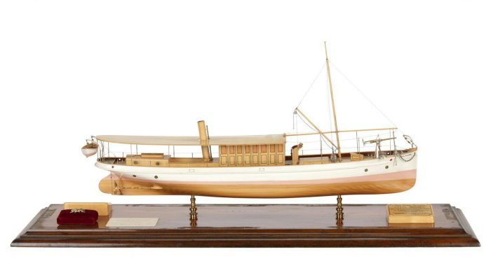
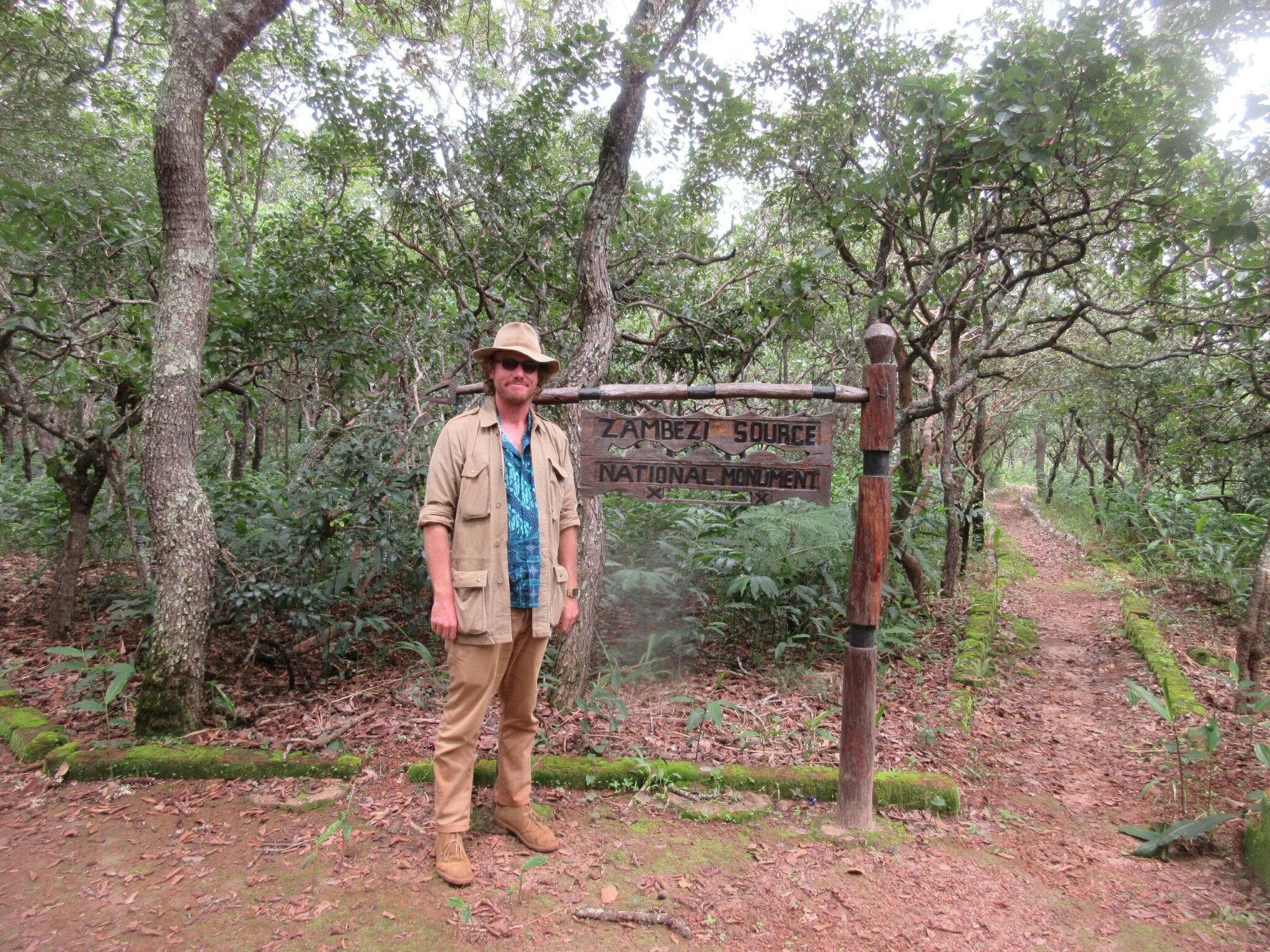
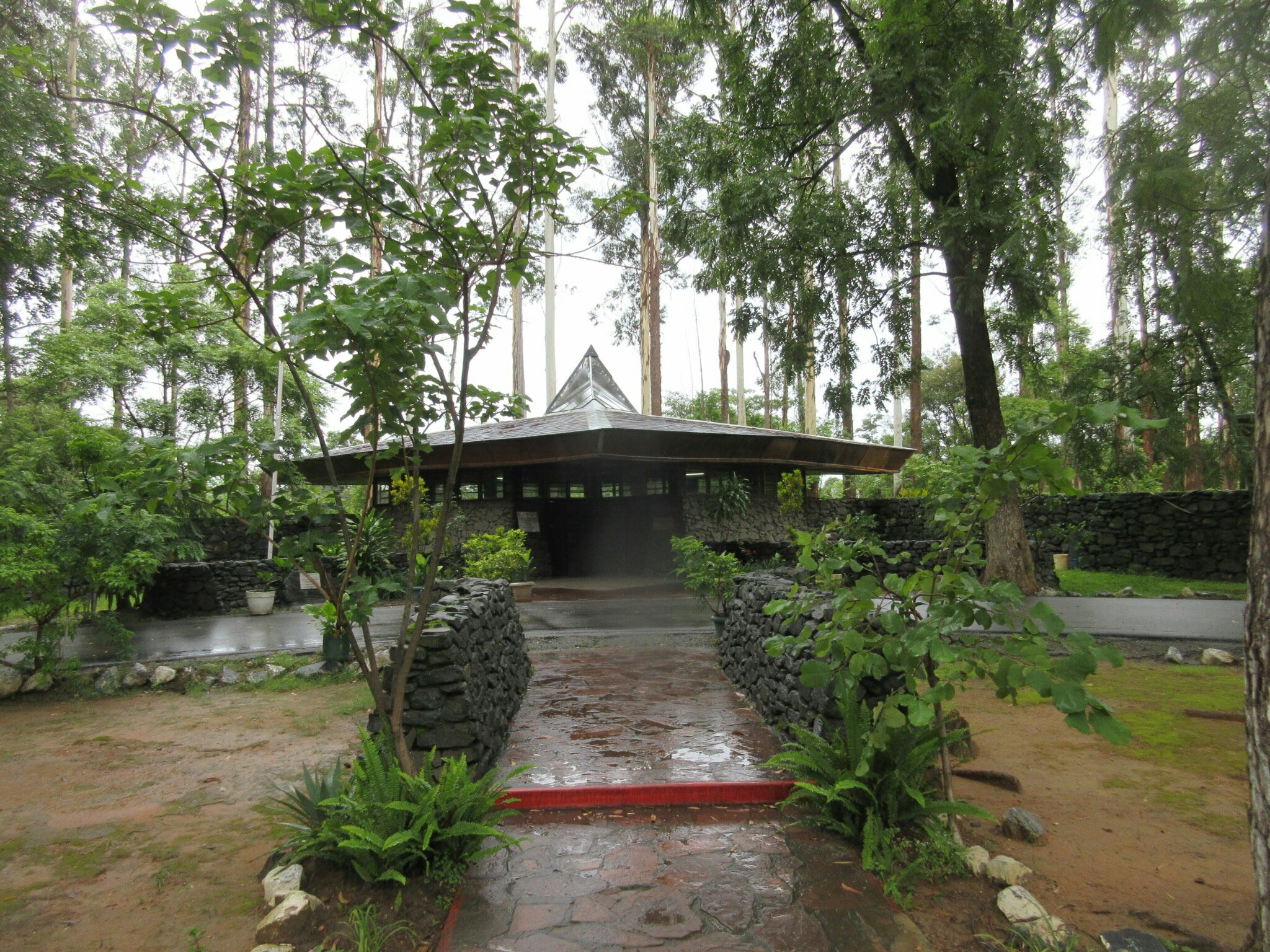
Model of the Cecil Rhodes.

Reading this week:

  • The Snow Leopard by Peter Matthiessen (I thought it would be like Journey to Lhasa but it is much different)
  • Guadalcanal Diary by Richard Tregaskis

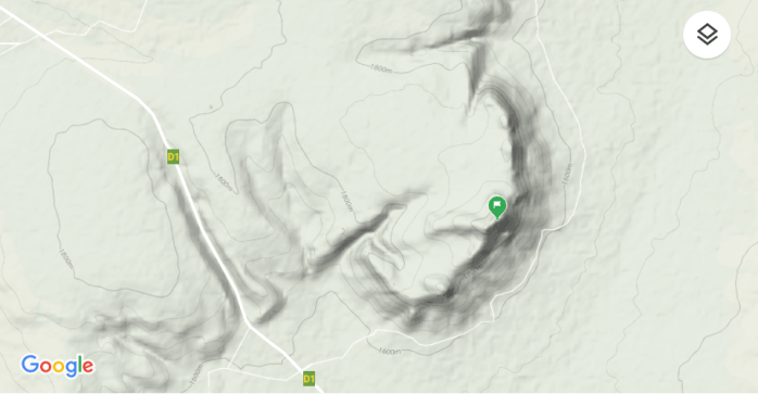
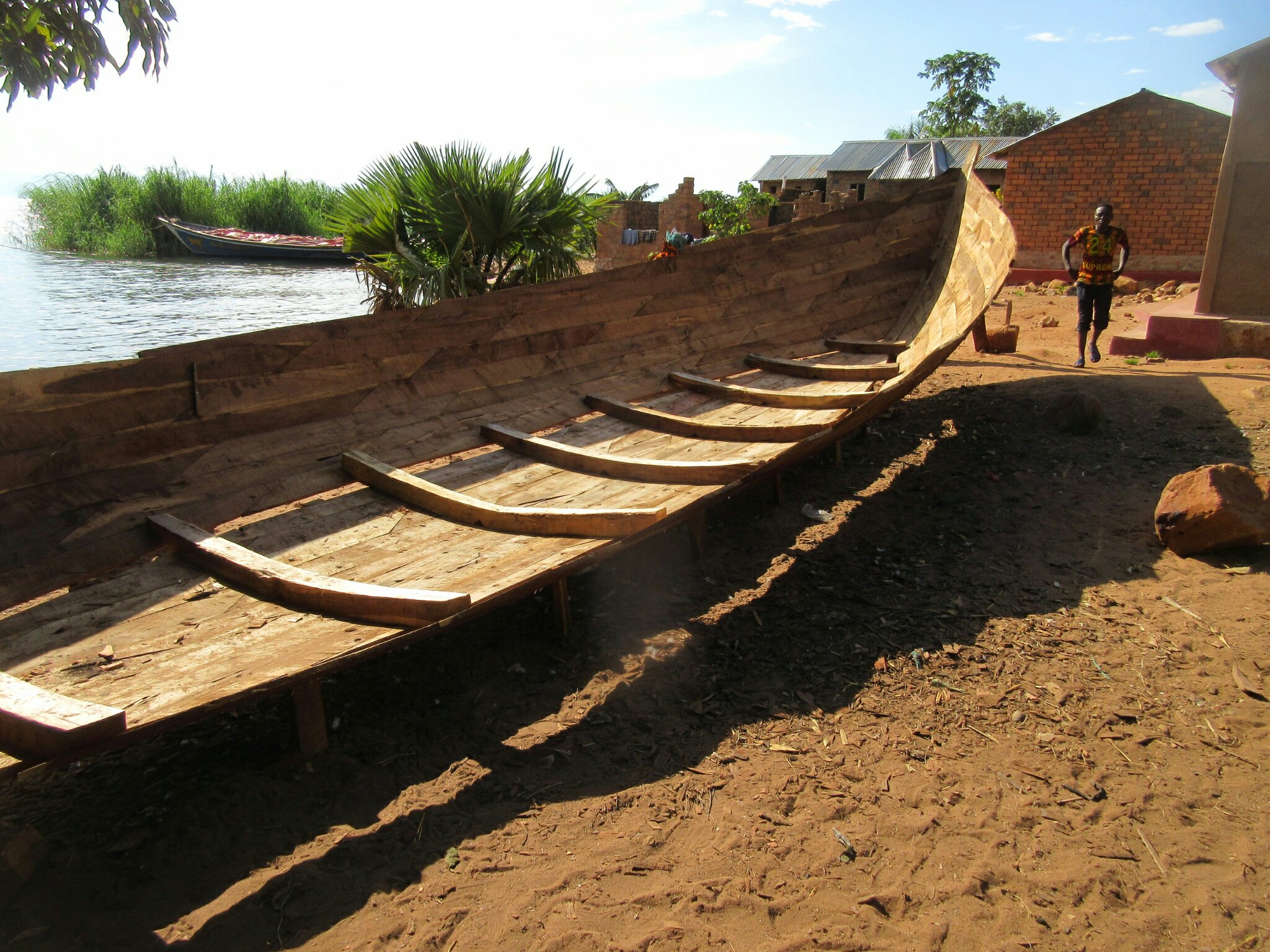
This past weekend I went to go look at some boats, the SS Cecil Rhodes and the Dame des Isles. These boats were both in Mpulungu and so I decided to bike on down there to check them out.

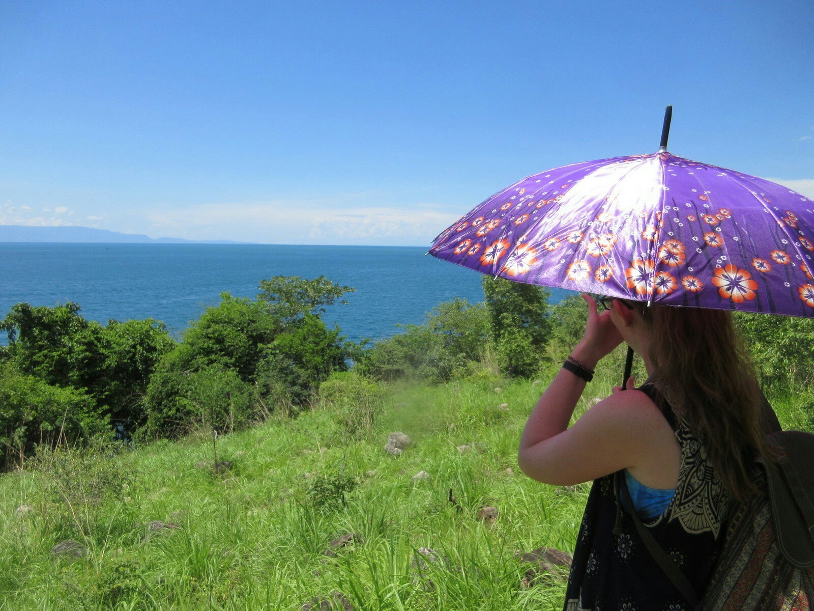
First off, Mpulungu is always farther away than I think it is. In absolute terms, it is 40km from Mbala, and I usually describe it as “all downhill.” This is in fact a lie, as it is only mostly downhill, and man riding downhill 40km still is somehow exhausting. Plus you are losing a lot of altitude, and it is rainy season, so in the first part I was pretty cold but by the time I got to Mpulungu it was very, very hot. Good think I brought like 4L of water on this trek. I set off at about 0700 to try to beat the heat and get as much time in Mpulungu as possible, and made it there at a little before 1100.

First things first was lunch, which was lovely actually, thank you for asking, and then to find these boats. The Dames des Isles I found out about from my most frequented Facebook page, Mbala / Abercorn. The page didn’t list the location, and I didn’t think to ask before setting off. So I biked the waterfront, even stopping by the Mpulungu Harbor Authority where security told me to come back on Monday. I looked around at what I thought would be likely locations in Mpulungu before setting off for the SS Cecil Rhodes, the location of which I knew (mostly). I did take a second to ask the page, however, where exactly the Dame des Isles was.

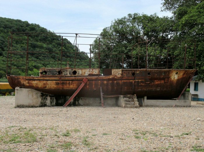
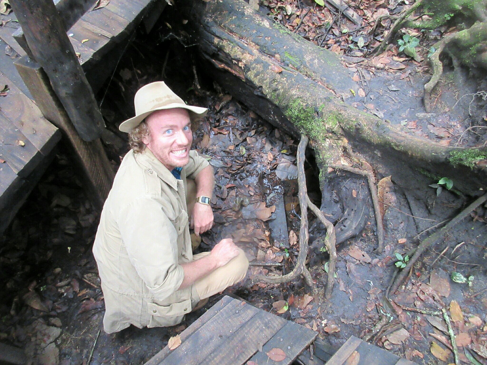
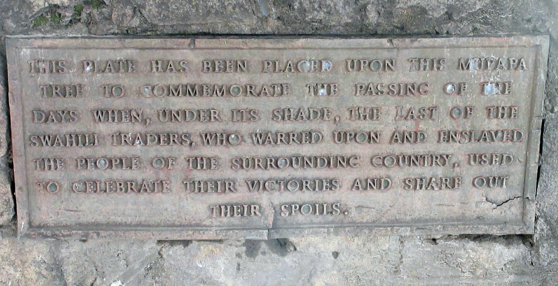
The Cecil Rhodes is not nearly as intact as the Dame des Isles. This thread is where I got all of my information (I found it looking for SS Good News information). The Cecil Rhodes was another early steamer on the lake (I think the second, actually) but failed to find much fame or fortune after the death of its namesake. It rested in the bay west of Mpulungu until the opening days of WWI, when the Germans towed her out into the lake and sunk her. The Germans were trying to prevent her from being armed and entering the Battle for Lake Tang. The Cecil Rhodes by this point was laid up and had her engine out, and maybe wouldn’t have been a threat, but I guess Germans are thorough. Lucky for me though, her engine being, as discussed, out, has laid in the same spot for the past 100 years, ready to be found by your intreprid correspondant.

As you can see from the thread, a previous team had gone out and located the thing, pinpointing the location on a map. I had been meaning to go for a while but never got around to it. Since it was pinpointed, the only thing to do is to go out and look at it, but this is much easier said than done. Mpulungu is hot, and the road to the village, though not too far on the satellite map, is improbably steep and occurs, you know, about 52km into my bike riding. At a particular corner in the road, I tied up my bike and set off into the village.

Walking through strange villages is always fraught. As a white person, when I walk through a village I am usually The Most Exciting Thing To Have Ever Happened Ever. For the record, I humbly disagree with this assessment, but the kids don’t. You start walking through a village, and if you’re lucky people don’t notice. But before long the kids notice, and immediately scream MUZUNGU PELE! MUZUNGU PELE! as loud as they can. I don’t know why they do this. There is one kid in my village that screams my name at me every time I pass. Like, I know kid, calm down. But so now the heralds have sounded in this strange village. At first the kids just stare. This is usually alright, I am used to it. But before long, one kid becomes brave enough and starts to follow me. As soon as one kid does it, then the other kids aren’t scared any more, and the crowd grows. Children come out of the woodwork, out of the trees, out of the water, out of some strange pocket dimension and begin to amass. I always try to hurry lest we form a critical mass and collapse into a singularity, or something. At any rate, they’re really loud and get way too close.

Adults are also very friendly, but tend to want you to stop and talk. They’ll grab your arm in a friendly way and want to greet you. Cool, but these conversations are always them welcoming me to Zambia and being surprised I know how to speak a little Mambwe. I can never quite convince anyone I live here. And none of this helps find the Cecil Rhodes. The trick with adults is to immediately ask for directions. That distracts them and they point you on your way before they can think to ask where you are from. If you don’t employ this method, then before long adults are handing you their naked babies so they can take a picture of their naked baby with the white person, and then you’re just fending off naked babies left and right.

I can employ all these strategies for a bit, but at some point I was gonna have to ask someone about the boiler. Villages are twisty and turny and convoluted and the boiler was half-buried in the ground somewhere. Luckily, I had a picture I downloaded off of that thread, and so I could show people my phone and ask if they had seen it. The first kid I asked knew immediately what it was and pointed me down a path. I walked a bit down that path when I got stopped by a guy who wanted to know where I was going. I showed him a picture of the boiler, and then the only really twisty part of this narrative happened.

Upon seeing this picture of a boiler, he apparently immediately concluded I wanted to go to a lodge. When I showed him the picture he said he could show me and then started walking me down a path. People kept asking him about me (I’m right here, people) and eventually I actually listened and figured out that he was taking me to a lodge. And I was apparently going to pay him 100 kwatcha for this service. This sort of thing has happened to me before, and I always wonder what goes through people’s minds. I know random white guys don’t wander through the village every day, but given that I am, and I speak at least some Mambwe, why is the next conclusion that I want to go to a lodge? After showing you a picture of a hunk of metal in the ground? And the people I specifically ask to walk me somewhere never think I am going to pay them, it is only the people that just start doing it without asking that think they’ll get money out of me? Anyways.

So I figure out we’re going to a lodge, and so I say I don’t want to go to a lodge, and show him the picture again. I figure out he hasn’t spotted the boiler, and has only spotted the lake in the background (we are in sight of the lake this whole time), and at least one of us is very confused as to why I need directions to the lake (it’s very big and hard to miss). Realizing this, I point to the boiler in the picture, which he now notices. He asks what it is, but I had forgotten to look up the Mambwe for “it’s a 100 year old boiler from a ship the Germans sunk,” and when he suggests it is a water pipe, I say yes, because a boiler is kinda sorta a water pipe. So now he tries to take me to a water pipe. Then I try to explain it is a boat engine, but worry that won’t help because it doesn’t look anything like the outboard motor the canoes on the lake use. He is confused; I am confused. I try to show him my Google Maps with my pinpoint and how we have been walking away, but my limited Mambwe also doesn’t cover Google Maps. Eventually he takes me to his brother, who speaks English. I show the brother the picture, he immediately recognizes it, and takes me right to the spot, which was about 20 feet from where I met brother #1. For the record, brother #1 was trying very hard to help and I appreciate it and I really should have learned Mambwe better.

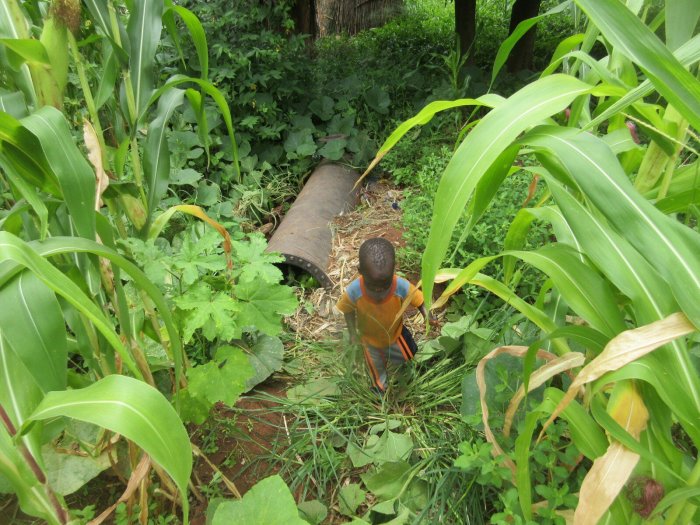
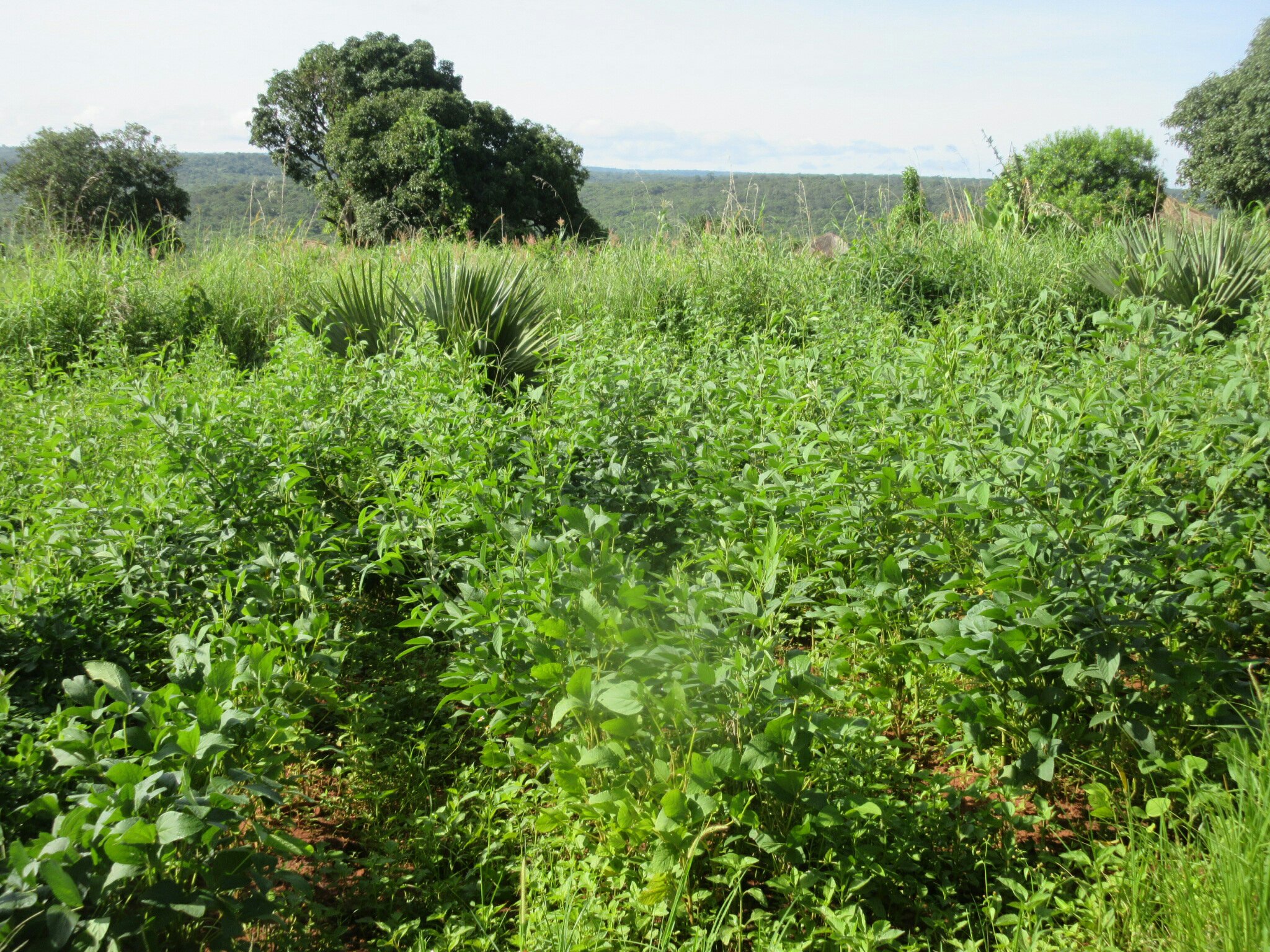
The boiler, hidden in its pumpkin patch.

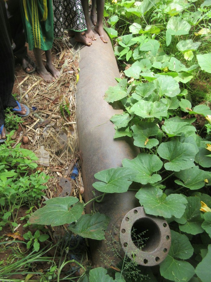
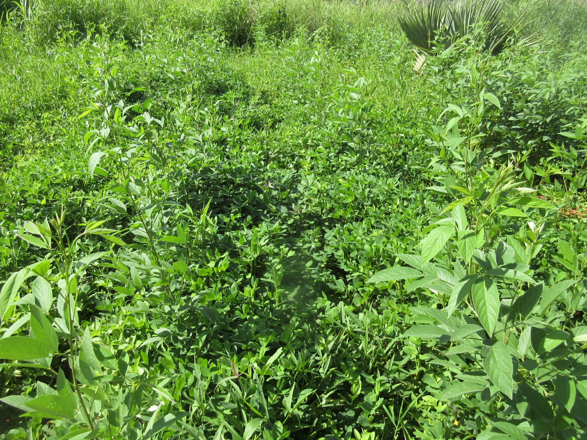
The boiler, and many children’s feet.

But aha! Success! The boiler! It is currently in the midst of a maize and pumpkin patch. Some vines are cleared away, and I manage to take a few pictures of the boiler along with the feet of the small children who can never be scooted away effectively. Meanwhile the owner of the maize patch explains to me that it is a boat engine (his exact words, so I don’t know how to feel about calling it a boat engine myself and worrying that wouldn’t be clear) while trying to explain and sell to me the maize and pumpkin he is growing in this patch. Pictures taken, boiler touched, history interacted with, it was time to bolt, and I head out of the village and back to Mpulungu, sucking down a lot of water because have I mentioned it was hot?

Join me next week for the exciting conclusion, “Boats Part II!”

Books

Reading this week:

  • The Tango War by Mary Jo McConahay
  • A Short History of Myth by Karen Armstrong

During community entry, one day a kid randomly asked me for a book. I don’t know if this was a thing the previous volunteer had done or something, but I had no kid-appropriate books. I had some books for, you know, me to read, but being an erudite adult and stuff they didn’t have pictures. Pictures are significant because most of the kids don’t read English, and anyways this kid was like, I dunno, four? The ages of kids are very mysterious to me. I handed the kid an issue of WorldView Magazine I had laying around along with a book on raising rabbits, which had pictures of rabbits in the back. The kid seemed satisfied, and sat in my insaka for a bit flipping through the things.

But lemme tell ya, the kid was a little too satisfied. Must have told his friends because more kids would show up to ask for books and flip through the same WorldView and rabbit book. Luckily (I type that but maybe it wasn’t so lucky) another PCV’s mom sent down a whole bunch of children’s books. The PCV offered a bunch up for other people to grab so I got some of them. They were children’s books, so big on pictures which was good. Their favorite had to have been one on snakes; I would always hear gasps of “inzoka!” (Mambwe for “snake,” if you hadn’t guessed) coming from outside.

That’s the happy portion of this story. I suppose it is all happy, really, if you’re not a grumpy fart like me. The books raise several problems. First off, I kept them inside, so every time the kids would want to read them I would have to get up out of my chair, quite a task, pick up the books, and hand them to the kids. Their usual routine was to flip through all the books, which took about 30 minutes, and then hand them back to me. Then they would run off only to return like 30 minutes later and ask to begin the routine again. Continue throughout the day, ad nauseum. Even like, wayyyy too early in the morning and way too late at night. Like damnit kids. They would also ask for the books when I was clearly in the middle of something. I appreciate your dedication to literature, small child, but I’m not stopping in the middle of my brick-laying to go get the books for me, no matter how loudly and often you ask. The books could escalate into a whole dramatic thing quickly, when one kid tried to wander with a book, leading quickly to other kids yelling, then their parents yelling, then screaming, and then someone handing a book back to me with a stern or contrite expression, depending on their age.

The whole problem was briefly solved when some kid just walked off with the whole stack one day. Kids would ask for books and I would just say “I don’t have,” and that was that. But then my parents came to visit and asked if they could bring anything, and I foolishly said children’s books. They made this a mission, eventually amassing 60 pounds (max for a suitcase on the airplane) of children’s books. This was too many books, so I grabbed the ones with the best pictures and offered up the rest to my fellow PCVs, and I was back in the book business. And so the endless headaches began again.

The only candid shot I could get; their absolute favorite thing, even more than books or pestering me for books, is getting their picture taken.

My biggest wish is that I could convey to the kids that I don’t care about the books. The kids, they care a lot. I got the bright idea after a while to just leave the books outside in the morning, with the theory that the kids could just take and return books as they pleased. This is a big fat NOPE. The kids insist on asking me every time they take a book. MPEKWINI MABOOKU, they sound in their way too loud children’s voices. And they insist on alerting me every time they put the book back. Cool, kid. The books being outside means I don’t have to stand up as often, but it attracts more kids so I get pestered about books more often, so I’m not sure if it is the better method or not. I think what the kids dislike the most is that it deprives them of their absolute favorite thing, which is returning the books to me. Since I have taken to just continuing to sit in my chair as the kids hand the books back to me, it means they get to come into my house briefly to gawk at the things on my walls and my white person existence. So they parade in through my house one by one to loudly return the books they will inevitably ask for again in 30 minutes. You’d think they would get bored of the same 20 or so books I have eventually, but again, nope. Today, the whole stack of books was outside, but they kept asking me for the “nice book,” which of course a) I have no idea which one that is and b) all the books are in that stack, man. You have all the books (these kids are greedy little bastards and don’t want to share; if one kid has a book every kid wants their own). Children.

But the kids like the books so I make the books available, and I dunno, maybe one of these kids is learning to read or discovering more of the world. I hope the one kid that wandered off with my first stack is using them well, and not just for firewood or to prop up an endtable. The books have gone way better than the brief time I had coloring books and crayons; that was really a zoo with some Lord of the Flies stuff before long (poor Piggy). And when the kids aren’t being selfish and hitting each other to get the better book, and when their big brother or sister comes out to walk them through the book, it is pretty nice to watch them read out there. When they’re quiet at least.

I also got to hold a baby goat today, hooray!

Gardening Pics

Smol

Reading this week:

  • Homage to Catalonia by George Orwell (I wish they had mentioned his non-fiction works back in school, just to teach kids that the same guy who wrote Animal Farm can also write “…when I see an actual flesh-and-blood worker in conflict with his natural enemy, the policeman, I do not have to ask myself which side I am on.”)

Not a lot has gone on this week, so here are some pictures of my garden. The whole thing is vastly overgrown because I have been gone for a month and I haven’t been able to weed it because I had to clean the dirt and mold out of my house.

My pigeon pea forest is coming along nicely. In the middle is soy; the plants growing where I had made charcoal are pretty large and already have seed pods.

In the bottom of this profusion of green and in between the pigeon pea are ground nuts (peanuts). I was hoping they would have been ready to harvest by now but alas, no.

Aaaaand that is the garden. Hopefully something exciting happens by next week.

The Source of the Zambezi

Me and The SOURCE

After my time in Ndola, the real goal of my Northwestern adventure was the source of the Zambezi River. The source is in the very tippy-top northwestern corner of Northwestern Province, and is therefore very out of the way. Seeing the source is meaningful in its own way, as it begins the journey of the river that eventually cascades over Victoria Falls, but really the site is a tiny little spring under a tree. The inaccessibility of the site and the fact it is kinda silly but also important makes it my idea of an ideal adventure goal. So after a week at Lily’s site, we travelled back to Solwezi to catch a bus to Mwinilunga, where we stayed for two nights as part of this adventure.

Mwinilunga is a pretty nice little town, known for growing pineapples and being pretty wet. It’s right on the border of the DRC and the Peace Corps Volunteers that live here claim it is the friendliest town in Zambia and home to the best chicken. On their advice, we booked a taxi with Ba Silver to take us the 50km or so from Mwinilunga to the source (or The SOURCE, as I prefer to type it). The road past Mwinilunga is dirt, and despite a few rough patches I think it is actually nicer than the pot-holed tarmac road between Mwinilunga and Solwezi.

The source is located in a tiny little national monument slash protected forest area, and it is really nice. At the end of the road into the area there is a Visitor Information Center with some displays on the Zambezi, and then behind the center there is a path that leads down to the source. The source itself is located in a valley, and there are elevated wooden walkways to keep you out of the mud. The forest is beautiful and since it is a protected area, it is very dense. The birds were singing in force and apparently there are bushbabies around, though it being about noon and all we didn’t see any.

In addition to the source itself, there is a monument to Independance at the site. The Zambezi River is very important to Zambia. The name Zambia is derived from the Zambezi, and the river is Zambia’s longest (Africa’s 4th longest), forming a part of the border and of course featuring the mighty Victoria Falls. The Zambezi floodplain in Western province is home to Zambia’s most well-known cultural festival. So it is appropriate that this out-of-the-way forest house a monument to Zambia’s very independance.

A cool tree spanning the MIGHTY ZAMBEZI.

The source itself is a tiny little spring under a tree (pictured up top). I don’t know how they decide which little spring specifically is the source, but they picked a picturesque one. The paths that wind through the forest follow the little stream the comes from the spring as it gets bigger. I just thought it was really cool to think that this was the MIGHTY ZAMBEZI that just a few (hundred) miles downstream I have taken a booze cruise on.

With my quest for the source of the mighty Zambezi complete, we went to the other cool part of the park: the border with the DRC. The DRC is a little mysterious for us PCVs because we’re not allowed to go there, but right there at the source is an international boundary marker. So I took a chance to break the rules and illegally cross into the ole’ DR Congo. So that was neat.

After that we went back to Mwinilunga. We only got stuck in the mud once!

Ndola Part II

Reading this week:

  • History of the Twentieth Century (Concise Edition) by Martin Gilbert
  • Circe by Madeline Miller (fantastic)

Having completed my two major goals for the day by 0930, I decided to go visit the Dag Hammarskjöld Crash Site Memorial. This site is a bit hard to get to if you don’t have a car (I always wish I had a car or a bike or even a razor scooter on these adventures), though that is a function of being at the location where Dag’s plane crashed, and I can’t hold that against him. I toyed with the idea of trying to hitch or take a bus and walk, but it was raining and I decided to just take a taxi. My taxi driver was a nice guy named Honest, and after conferring with his taxi driver friends to figure out where the place was, we were off.

Honest and I had the site to ourselves. The caretaker of the memorial seemed very bored and was very enthusiastic about telling us about the site and especially around the consipiracy theories involving Dag Hammarskjöld’s death. I leave it to the internet to discuss the UN General Secretary’s (extensive and impressive) legacy, but the site is very nice. I think they put a lot of effort into keeping it up because of its proximity to Ndola, and the fact that a memorial is held every year on September 18th to commemorate the crash. The President of Zambia and delegations from the UN come to pay their respects.

The spot where they found Dag Hammarskjöld’s body.

There is a pavilion that houses displays about the crash, Dag’s mission at the time, and the function of the UN, along with a small “library” of relevant publications. There is a cenotaph in the center of the site with quotes from Dag, and at the exact spot where they found his body another marker. The site is very pretty and worth a visit, though we left kinda quick because I found the caretaker a bit overbearing. I think Honest enjoyed it though.

With those adventures wrapped up by lunch, it was time to do something a little less certain: try to find the Polish Memorial. So far these have been impossible for me to locate. There are actually several Polish Monuments in Zambia, which commemorate Polish refugees that came to Northern Rhodesia during WWII. There is one in Mbala I have never located, and I didn’t locate the one in Ndola either. The map in my travel guide showed it at a spot about 6km from my hotel. I asked one taxi guy if he knew where it was but thought I was looking for shoe polish, so I set off on foot. Unlike the morning, where it was raining and I didn’t bring a rain jacket, this time I brought a rain jacket and it was hot and sunny.

The 6km took me a little over an hour and some sunburn, and brought me to a concrete factory. That was interesting to look at, with the rail line leading to it and the canals around it, but didn’t bring me to the Polish Memorial. After scouting around for a bit and deciding I had failed, I was lucky to flag down a company bus from Zambezi Cement Company that was nice enough to give me a ride back and drop me off at the hotel. If I have a major criticism for Zambia, it is that doing anything touristy outside of Livingstone is extremely difficult. It’s hard to find where stuff is if you even know it exists, and there is no infrastructure to get you there. I think investments in tourism infrastructure could go a really long way into making Zambia a destination popular with far more than just the chartered-flights-to-safaris crowd. But that’s just me.

My final adventure was to the Ndola Boating and Sailing Club. I am a huge sucker for yacht clubs and was excited to find my second in Zambia. My big plan was to go here for dinner, which was dashed after I arrived and found out they didn’t serve food. They did serve beer though, which is the only requirement for a yacht club. I mention that because they didn’t have any yachts. I’m not actually disappointed in that, because if they did I’d just be jealous because Mbala’s yacht club doesn’t either. Still, the place has a lovely view, and there were two dudes in a canoe poling about.

Overall my time in Ndola was pretty nice. I saw what I wanted to see. I do wish I had a car because then I could have really gone on some adventures. Zambia has so much to offer for sightseeing and adventures that aren’t crazy expensive safaris, but man do you need a 4×4 and a lot of gumption to really do it.

Ndola Part I

Reading this week:

  • The Lonesome Bodybuilder by Yukiko Motoya

My service is coming to a close here in a few months, and so I messaged our HQ here in Peace Corps Zambia to ask how many vacation days I had left and found out I had a whopping 14. It was too late to plan an extravagant foreign adventure, and I have my COS trip coming up anyways, so I decided to go visit Lily up in Northwestern Province (also because as I was complaining about all these vacation days I had to spend, she asked “why don’t you just come visit me?”). I couldn’t just hang out at her site for two weeks however; I gotta make an adventure of it. The first part of that grand adventure is hanging out in Ndola.

Ndola is a Copperbelt city, and the third largest in Zambia. I haven’t heard a lot about it, frankly, because there isn’t much Peace Corps presence here due to it being fairly well-off from all the copper mining in the area. Zambia (Other Places Travel Guide) notes that Ndola “reflects the glory days of the 1960s,” by which it apparently means when the price of copper was high and not British colonialism. This reflection is specifically in a bunch of colonial-era buildings like the one pictures at the top. I stayed at the New Ambassador Hotel, which is one of those buildings and notes on the sign to the restaurant that “smart dress” is required.

I had two nights and a whole day to spend in Ndola seeing the sights. The first of these was the Slave Tree. The Slave Tree is a mupapa tree under which, apparently, Swahili slave traders held councils of war and held meetings concerning their slave trading. The slaves from this area were apparently sold to traders in modern-day Angola. The Slave Tree these days is in a sort of out of the way corner of central Ndola but still has commerce going on around and under it, but of a far more palatable nature (carpentry, specifically). Ndola is actually the oldest of the officially incorporated Colonial-era towns in Zambia, having been “founded” in 1904 but was obviously a commercial and trading center from long before then.

As I have mentioned before, slavery and the slave trade is perhaps the major driving force of much of the history of the past few centuries in this area, and it is important to think about how that shapes the current landscape. The commemorate this history the Slave Tree has a plaque noting that history.

With the Slave Tree visited, my next stop was what had actually brought me to Ndola, The Copperbelt Museum. The national museums in Zambia are the Livingstone, Lusaka, Choma, Moto Moto, Nayuma, and Copperbelt Museum. I had been to the others (except Nayuma, which is out in Western) so to be completionist I wanted to go to this one. It took me a bit to find it even though it is right where the map says it is; it’s in a regular-looking building tucked between two other shops on the street. I showed up when it opened at 0900 and had the place to myself.

Ceremonial dress worn by a Likishi dancer from Northwestern Province.

The museum is pretty small. I was expecting to spend a few hours in there but ran through it in 30 minutes; then again, as discussed, I am a pretty experienced Zambian museum-goer. It has two galleries, including an ethnographic exhibit and a geography exhibit. The geography exhibit is about showing off the natural resources of the copperbelt region. It discusses the mining and smelting of copper, from traditional methods to modern-day. It also shows off the gemstones and other minerals found in Zambia. As the DRC is well aware, this area is one of the richest in mineral resources.

Forge for working with iron and copper.

The ethnographic exhibit was pretty excellent even if it was small, with a wide range of artifacts and some interesting stuff on witchcraft. It also had a very small side gallery with stuffed birds from the area, and a butterfly exhibit that has seen better days. The artifacts are mounted right on the wall instead of behind glass cases, which I guess isn’t great for the artifacts but really let me get a close look. I always like to mentally prepare for a hypothetical where I am deposited on a deserted island or something and have to re-create civilization, and it’s good to know how to make a bubble pipe for tobacco, you know?

Please join me next week for the creatively titled Ndola Part II!

Lake Tang for New Year’s

Reading this week:

  • The Namesake by Jhumpa Lahiri (it’s phenomenal)
  • The End of Poverty by Jeffrey D. Sachs

For New Year’s, Lily and I went to go visit Lake Tanganyika. We stayed at Luke’s Beach, which is the go-to for Peace Corps Volunteers because it’s the cheapest. It is a very nice facility, but you have to bring in all your own food and charcoal and stuff, hence the low price. We decided to camp, although they have chalets.

Lake Tang this time of year is very nice. It’s rainy season, so you do get the occasional rain storm, but besides that it is sunny and warm and there are palm trees and it’s very quiet and relaxing. So that’s nice. The coolest part of our visit though was that while we were waiting on the water taxi to take us there, a woman walked over and introduced herself to us as Hope. Hope is the current manager of the Kalambo Falls Lodge, which somewhat confusingly is on the lakefront. I didn’t even know the place existed, but Hope invited us over to visit the next day and hang out.

So the next day we made the relatively short hike from Luke’s Beach over to Kalambo Fall’s Lodge and man that place is nice. They have a whole chunk of the shoreline with piers going out into the lake that look like a lovely spot for a cocktail. They are expanding and have chalets and full-board service. Hope, who’s business card reads “Manageress,” is very nice and enthusiastic about the lodge. When we walked over she served us up tea and then took us on a tour of the place.

The lodge was originally founded as a fish breeding center. The guy who originally built the place would breed and sell the cichlids from Lake Tang to the exotic fish market. In more recent years, the lodge has opened, and its major clientele are actually different research institutes who come in and use the lodge’s unique facilities to study the lake’s ecosystems. Their star attraction is Sir Percy, who they believe to be the only Golden Nile Perch in captivity. The suckers are apparently fairly rare, and can’t usually be captured alive. Sir Percy is 30 years old and in good health, and could apparently live to be about 60. Hope was kind enough to toss him a fish for us to watch him eat it, and the guy is faster than he looks.

After an afternoon hanging out at the lodge, we head back to our tent, passing through a fishing village on the way. Lily wasn’t feeling well, but I stopped anyways to get a picture of a boat being built on the waterfront. There are two standard designs for boats on this end of the lake, including a small canoe and a larger boat, pictured above halfway finished. I didn’t get a chance to ask many questions, but the fact that all these boats are built by artisans all around the shores of the lake is pretty cool. They’re sturdy vessels and last a good chunk of time.