Pohnpei Part V

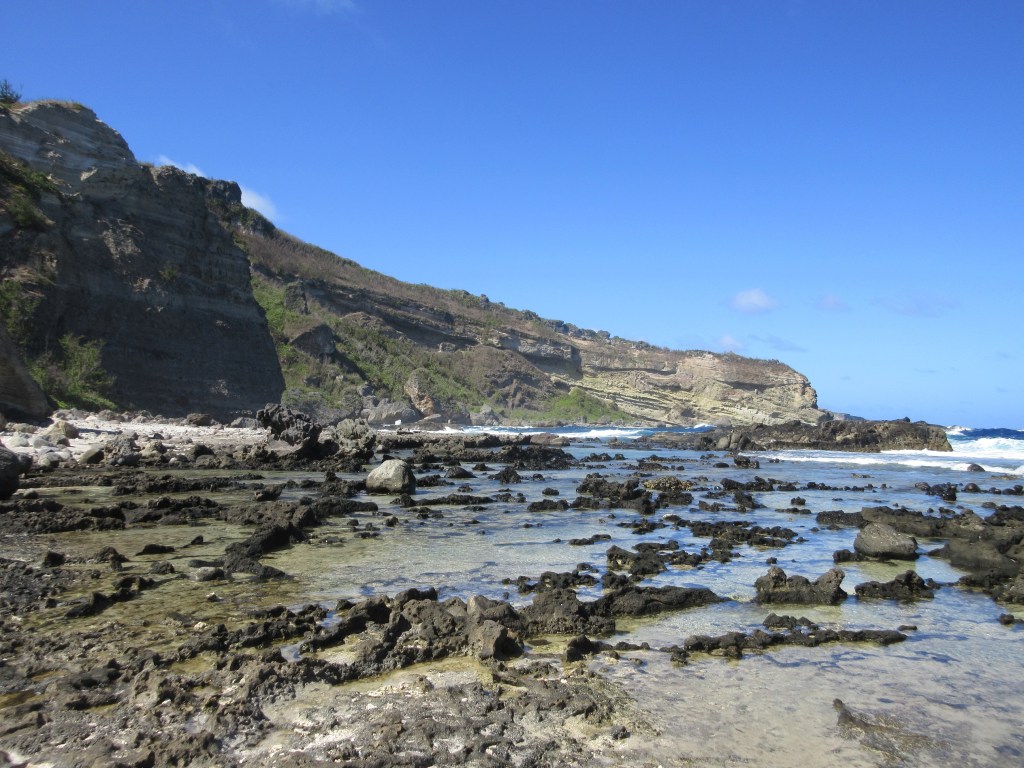
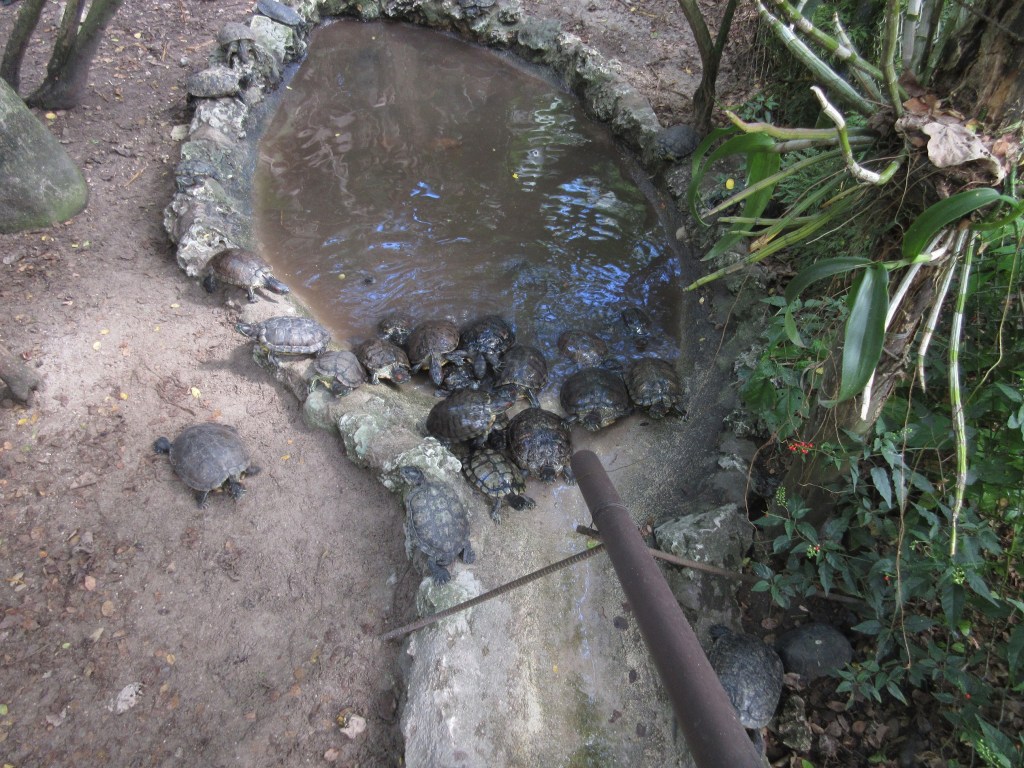
I’ll skip the bit where I crossed one of the channels and traversed a treacherous span of mangrove roots in order to get a closer look at the quite well-preserved side of one of the seawall islets. It was getting kind of close to the time when I told the guy I rented the kayak from that I would be back, and I didn’t want to find out what Pohnpei’s emergency services team looked like. Getting back was a little bit frustrating at first. The adrenaline rush of adventure was wearing off slightly and I had a sunburn and my hands hurt from kayaking. My initial thought was to paddle beyond the reef line so my faithful kayak could actually float, but a glance at the afternoon weather ix-nayed that idea. I even got tossed from my kayak once crossing back onto the beach from the short span of “deep” water I had to cross, though I recovered and dried off quickly. The only really scary moment was when I was wading across the reef and heard a giant splash. Bravely, and probably looking a lot like a variety of action heroes, I leaped up into my kayak. This 6″ vantage point gave me a perspective on my own perceived manliness and a fairly large skate swimming its way to deeper water.

Once I got into the deep water of the mangrove forest and off the beach it was easy paddling. I took some time to admire the forest on the way back and listen to the birds and all the wildlife. On the way I ran across a man paddling across one of the waterways on a raft, very much Venice-style. He marked the first person I saw that day in all my adventures in the ancient city. That is pretty typical of Nan Madol. I was pretty beat by the time I made it back to MERIP but I hauled the kayak up the boat ramp, walked up the hill to return the paddle, and changed into some dry clothes I had brought. I had paddled into the ancient city and gotten my first glimpse of Nan Madol.

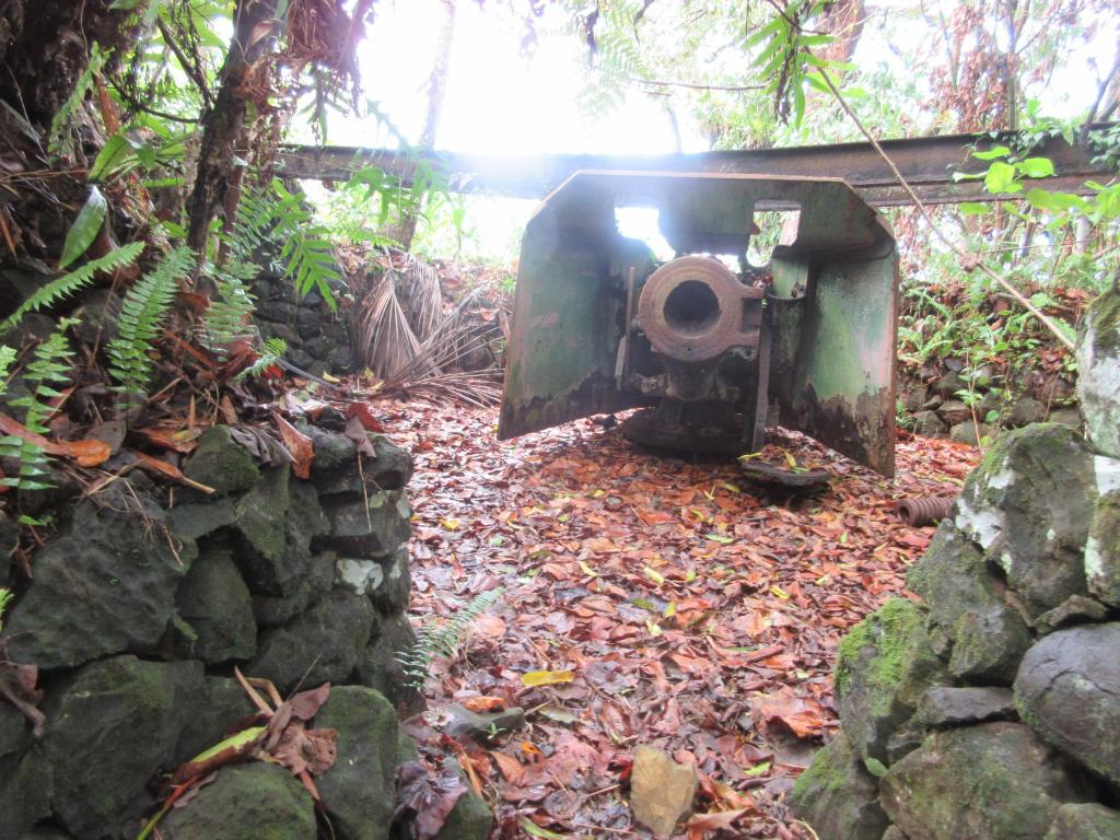
Also on Temwen island are some old Japanese guns at the melodious Dolopwuropwur Gun Battery. Since there were still some hours of daylight left after my paddling adventure I decided to take a look at the guns. I continued onto Temwen island from MERIP and found a place to park and started down the road identified by pohnpei-adventure.com. Eventually I found some likely-looking dudes I could ask for more exact directions and one man proffered up his teenage-looking sum for a guide (for a fee of $10). This, I was beginning to realize, is pretty standard for Pohnpei. Without much in the way of friendly signage, the only way you’re going to get around Pohnpei really effectively is with a guide. Maybe you can start to do without when you’ve gotten a better feel for the area, but if you’re cruising through on a weekend away from work, it is best to contact someone before you get to the island and arrange for someone to take you to where you want to go. Pohnpei-adventure has a rundown of a few local guides which is where I found Kenji, my guide for Sunday. The usual gig on Pohnpei is also to charge a few dollars ($3 is pretty standard it seems) admission for the sights, most of them being on private property. My first instinct was to forego guides, being that they cost money and all, but it’s a bargain at twice the price. The “admission” you’ll pay for Nan Madol is a whopping $7, and I paid a grand total of $50 for a very informative guide to show me around nearly all of Sunday. He was nice enough to drive and gave me a very tasty sandwich as well. The guides are worth it.

Anyways, we marched on up to the battery. My newfound friend was largely the strong silent type, but he got me strait to the guns and I would never have found them without him. I have seen a WWII Japanese gun emplacement or two in my day at this point and I was pretty impressed with this one. The whole place is overgrown, having been presumably just abandoned after WWII, but you can still see that it was built to last. The roof has disappeared, but the walls are still sturdy with some impressive masonry. There are four large guns up there, largely intact if suffering from some decades of disuse. Around the site are various alcoves for storage and the site is worth the very short hike. It also features a stone lookout tower that has crumbled away somewhat. The view is obscured by foliage, but it is easy to tell that the location would have been commanding and easily defended if it had been invaded. After I marched around and took plenty of pictures my reserved friend lead me back to the main road and we parted ways.

After a well-earned shower and spending some time nursing my sunburns (I should know better), I decided to hit the town. Pohnpei doesn’t have a bar scene, or at least one that I found. As I was driving around, I noticed several bamboo shed-lookin’ things with a pool table inside, so maybe I missed out on the local culture by not visiting one of those. Instead I visited the Mangrove Bay Bar, which is on the bay and is part of the Mangrove Bay Hotel complex. It was quiet, but the highlight, besides watching a middle-aged Australian dude chat up a local girl, was a drink called the Pohnpei Screwdriver. I ordered it only because it had “Pohnpei” in the name. I then spent the next five minutes watching the construction of one of the most carefully crafted beverages I have ever seen. Your local speakeasy got nothin’ on this. The drink itself featured, among other things, island limes squeezed before my eyes. Garnish was provided by several more strategically placed lime slices. It came out pink and slushy, served in a goblet, and with a maraschino cherry on top. I don’t usually wax poetic about booze, but believe me. If you’re at the Mangrove Bay Bar, get the Pohnpei Screwdriver. Shortly after that I headed back to the hotel to turn in for the night. I did swing by the Joy Hotel, being the only place I identified with a gift-shop type place where I could buy silly touristy crap. I picked up a box thing that I think is meant to store a betel-nut “kit.” I picked it because it said “Pohnpei” on the side. A day well spent, I slept soundly.

Pohnpei Part IV

“Nan Madol” translates into “the spaces between,” which besides being one of the first facts you discover in a quick internet search refers to the channels between the islets of Nan Madol. The city was built on a reef and is made up of man-made islets that are surrounded by a constant comparison to Venice. The seawall I keep referring to is the outer wall of a series of large islets that compose the outermost ring on Nan Madol. Further up the seawall I eventually came across a channel that gave way to the city proper. This gap in the seawall was spanned by two lines of rocks that extended from the wall and into the channel. I think these were wave-breaks to reduce the effect of the ocean on the thoroughfares of Nan Madol. I spotted these first and as I turned the corner I spotted my first distinct islet. I was ridiculously excited about this little thing. My first glimpse of the seawall when I turned the corner in the kayak had my heart racing, but that corner didn’t have the log-cabin style architecture (it was boulder stacked very neatly on other boulders). Further along the seawall it transitioned to well-stacked basalt columns, but turning the corner to see the islet was my first real “wow, this is Nan Madol” moment, and that feeling just kept getting topped as I continued in this city.

The islet that I spotted and had been swooning over was Peinering. It rises out of the surrounding channels and is completely log-cabin style. From ankle-deep mud, you look up at walls ten feet high. The main entrance is on the side opposite the sea, and the wall has crumbled in one corner. The islands are not entirely basalt; they are constructed with basalt walls but the in-fill is coral. This coral is extremely sharp. This proved very difficult to navigate in flip-flops, and I recommend that anyone visiting Nan Madol wear close-toed shoes. The next day I wandered around the city in tennis shoes that drained easily and those worked well, but those tennis shoes wound up in the trash once I got home. I think a solid pair of reef shoes would be ideal.

I asked my guide the next day what he thought the floors originally were, since no one credits the ancient Ponapeans with the invention of the tennis shoe. His theory is that on top of the coral in-fill there would probably be a layer of smaller gravel and then a final layer of dirt or sand. The topmost layer would serve as the walkable surface. In the intervening centuries the normal course of erosion has washed it away.

Continuing a theme, I took an embarrassing number of photos and selfies on Peinering, not knowing if I would manage to see a finer example of Nan Madol architecture. The islet features at least two smaller structures made of basalt and rising to about waist height. My initial thought on seeing these was “brick pizza oven,” harking back to the Italian connection. I might not have been too far off; Peinering was used for the production and storage of ceremonial coconut oil, so these structures had something to do with that.

Standing in one corner of Peinering and looking out over the channel and into the mangroves, I spent some time really trying to imagine what the city must have been like in its heydey. Coming in from the sea you would have seen a towering seawall hundreds of yards long and dozens of feet high. Paddling in on your canoe you would have entered a city of nearly a hundred islets, criss-crossed by channels. Nan Madol was the center of the culture and home to a God-king, and it was a city of priests and ceremony. The average Ponapean in modern times lives in a house, but you’ll still see (as you traverse steep slopes in your Yaris) examples of the traditional thatched architecture put to various uses around the island. A newcomer would have transitioned from his village of thatched huts to a city of stone temples and palaces. If you gained a vantage point, you would look out over more than a hundred acres of city, the smells and sound of the sea mixing with those of coconut oil and ceremonial chants and all the normal chatter, highlighted in the bright tropical sun. It would have been beautiful.

Pohnpei Part III

So I set off into the great unknown! Here I was! Patty Weeds! Adventurer! Now with that exciting intro, time for more geography. The Nan Madol ruins are on the eastern side of Temwen Island, which is off the southeast corner of the mainland and earns its island status due to a small (10′ wide) channel crossed by the Temwen causeway. The MERIP facility is shortly before the Temwen causeway and the causeway is on the opposite side of the island as the ruins. So to get to the ruins I had to kayak around the island. It is largely a very lovely kayak trip. It was a bit choppy at first, but as I got into the lee of the island and in the mangrove swamp it was smooth paddling. The current was too strong through the 10′ channel for me to paddle through, but a nice man who happened to be fishing helped me haul my kayak over the causeway. The paddling took me about an hour, but I am not exactly in paddling shape, and I stuck a little too close to land, leading to several groundings. It was a nice illustration of how a mangrove swamp reclaims land and helps cement the shoreline of an island, but not a good illustration of boatsmanship, which I was embarrassed about. The paddle features views of the ocean and mountains and mangrove islands (I’m always somewhat bewildered that mangoes don’t grow on mangroves) and dizzying array of bird and aquatic life.

Eventually I made it. Reconstructing the event later, I managed to paddle right past the entire southern edge of the seawall of Nan Madol (obscured, as it was, by mangroves) and eventually landed at the southeast corner. I had turned a corner and this time was faced with ocean & reef instead of mangrove. I looked up and to my well-trained seaman’s eye it was evident that a rain squall was about to hit (large dark clouds are a dead giveaway), so I pulled my kayak onto the beach and ducked into a gap in the trees and then there it was. Construction on Nan Madol started somewhere around 700 years ago. The rocks that make up the architecture of Nan Madol are basalt, and since these rocks don’t appear on Temwen, that means the rocks were quarried somewhere else on the island and transported. So that means every time you look at a stone at Nan Madol, someone put that there. The legends say it was constructed by two magicians using dragons. Having been there, facing that seawall, I see how that theory seems the most reasonable.

The seawall I came across is still impressive. Nan Madol has been abandoned for about 400 years, and this seawall has suffered from four centuries of tropical cyclones and no maintenance. Still, massive boulders stacked 20′ high is a daunting sight now and must have been mind-blowing in its prime. Not knowing the extent of Nan Madol at this point or how much of it I was going to be able to see, I took my time in this nook. It was raining anyways so staying in the jungle was a pretty alright option. I clambered over the wall in my flip-flops and got my first look at the classic Nan Madol log-cabin-but-with-basalt architecture. I took an embarrassing number of selfies with various bits of rock and eventually noticed it had stopped raining, so I decided to continue on my kayak.

The next major feature I came across as a I paddled northeast along the seawall was a coral lagoon (later identified as Namwenkau). The reef line is fairly far out, and since the tide was out I spent a lot of time dragging my kayak behind me as I walked through ankle-deep water. In this section the seawall formed a horseshoe and the shallow reef gave way to a deep pool surrounded by coral and mangrove. Eels were sacred to the people of Nan Madol and I spotted more than a few on the reef and in this pool. As I saw each one I made sure to say a little thank-you mentally for letting me hang out on their turf. It’s always a good idea to curry favor with the local animal deity when paddling through ancient cities.

Pohnpei Part II

My first move on Pohnpei was a tactical mistake. I was super excited to see Pohnpei and I knew I might never have a chance to go back, so I was trying to cram as much into this adventure as possible. The website pohnpei-adventure.com is brilliant and an absolute must for Pohnpei research. Having looked up a likely-looking falls to explore, I had copied down some directions. With those in hand I set off from the hotel to try to find the place. This ended with me not finding the falls. There is one main road that circumnavigates Pohnpei. Branching off from this road are smaller unnamed roads that lead up to people’s houses and the like. There are not a great deal of landmarks or roadsigns. The instructions on pohnpei-adventure are therefore written along the lines of (in this case) “drive over the bridge and proceed 10.4 km, and then turn right.” Although the Yaris’ odometer was in miles, I figured that as long as I ballparked about six miles the rest would be fairly obvious. It isn’t; the instructions from the website are excellent but you need to actually follow them instead of guestimate. My ballparked six miles plan was thwarted by the several roads branching off in the vicinity. I explored a few of them, and have come away with a new appreciation for the mountaineering capabilities of the Yaris. After attempting as many of the roads as I could along a two-mile stretch of road, and finding no obvious “last house on the right” I was willing to try, I gave up and headed back into town. So, lesson for you: once you land, go out and get these Eco-Adventure Guides, and then go from there.

In the morning I woke up to birds singing. I’m telling you man, Pohnpei is the lush tropical island you think of when you think of lush tropical islands. Buoyed by my feathered friends I wandered over to the hotel restaurant to have breakfast (I went with “the islander” omelet, which is a corned beef fried rice omelet. There is no better breakfast than an corned beef fried rice omelet). Some rain really nailed down the lush tropical island theme. The hotel also featured several dogs that hung out on the grounds, who were at this point fairly bedraggled. When I stopped to pet one he was mostly surprised that I would pet him.

Watercraft for rent.

Before my 10.4 km adventure of the previous day, I had managed to talk to a guide for Nan Madol, but he wasn’t available until Sunday. I was entirely unwilling to wait that long, and since I expected to go on foot to Nan Madol on Sunday I decided that on Saturday I would approach by sea. I had read on pohnpei-adventure.com that it was possible to rent a kayak at a place called MERIP. The directions were again “drive over the bridge and proceed X km,” but this time when I set off I was armed with a metric conversion. It took about an hour to drive to MERIP and this time I was aided by a sign for Nan Madol at the crucial turn to the left. A little further down the road I came across a rather large compound that is currently mostly a church and formerly the Pohnpei Agriculture and Trade School. The MERIP building itself is located at the bottom of the hill down a gravel road and was smaller than I expected. Since I had also expected (hoped) that there would be a convenient “NAN MADOL KAYAK RENTAL” sign or something, I was disappointed to find MERIP closed and no touristy kayak rental cabana in sight.

Undeterred, I looked around and in the shed next door, I found a man, accompanied by his family, working on a car. I asked him about kayak rentals and he directed me back up the road to a roadside store. I got back in my car and headed up the road, where I saw another man. I asked this man if he knew anything about roadside stores and kayak rentals. He apparently knew what I was talking about, because he got in his car and told me to follow him. Upon our arrival to the store, he had a conversation in Pohnpeian as I tried to not look silly. They had no kayaks. But I was to follow another man, and this man took me to his son. His son, it turns out, works at MERIP (I think), and was anyway willing to rent me a dusty but very serviceable ocean kayak for the Pohnpei-Adventure reported price of $10. He asked me when I thought I would return so he could make sure to call for rescue if I didn’t get back in time.

Pohnpei Part I

As much as Saipan was an exciting adventure for me, it was really just a dry run for the ultimate goal of my brief but memorable island-hopping campaign: the mysterious island of Pohnpei. First, of course, some background. The reason you’ve never heard of the place is because it is a tiny spot in the western Pacific, northeast of Papua New Guinea and on the other side of the equator. It is part of the Caroline Islands formation and Pohnpei is the capital island of the Federated States of Micronesia. It differs from Guam and Saipan in some important aspects. First off, we (‘Merica) don’t own the place. It is an independant country, and although the US is a close associate, this was travel to a foreign country for me. Second, the people on Pohnpei and in the Caroline Islands are Micronesian instead of Chamorro. The most significant thing about Pohnpei, for me anyways, is that it is the home of the ancient ruins of Nan Madol.

I first heard of Nan Madol when I saw a documentary on the ruins, I think. When I came to Guam I was surfing Atlas Obscura when I found out that the ruins were just a short hop away from me. Nominally, anyways. I filed it away as a place I really ought to go and then spent the next three years dilly-dallying about it. I took one shot at it but travelling to Pohnpei was slightly more than trivial for me when I was on the submarine and it fell through. In limbo up at squadron, however, I spotted my chance and decided to take it. I actually went AWOL to take this trip, playing hooky from work on a Friday and travelling internationally without permission to make it happen. The upswing of all that is I only had a weekend on the island, which is far too short, and the only person I told about visiting the island until I was out of the Navy (like I am by the time this is posted) was my grandma.

I departed for the island early on a Friday morning. United is the only airline that regularly flies to the island in a short island-hopping route from Guam, to Chuuk (sometimes spelled Truk), Pohnpei, and back from whence it came. This plane only comes around three times a week, which gives you a indication of the interest in travelling to the FSM. The flight over, including the Chuuk stopover, is about three hours and is gorgeous. The Carolines are spotted all over with stunning coral atolls that look like they’d be treacherous to navigate by sea but are beautful from the air. Landing on the islands is other-worldly. Kudos to the pilots, because the runways on both Chuuk and Pohnpei are terminated on both ends by water and you could tell it took skill to set that plane down safely. The islands themselves are incredibly lush and I was glued to my window during the whole approach. Pohnpei is one of the rainest spots you’ll find and gets somewhere north of 25 feet of rain a year. Seattle gets something like 38 inches. The rain means central Pohnpei is usually surrounded by mist, with a cloud forest in the highlands of the island, and the rest covered with dense tropical rainforest. I considered Saipan to be a bit run-down, but my impression of Pohnpei is severly underdeveloped. You can’t even consider the largest city in Micronesia to be a one stop-light town; iPhones have reached the FSM, but stoplight technology has not. The lack of development (which is a good thing) and the jungle make Pohnpei look like an island lost in time and I wouldn’t have been all that surprised to see a dinosaur emerge from the edge of the runway, Isla Sorna-style.

After picking up my bag and surviving the toughest grilling I’ve ever gotten from a customs agent, I picked up my rental car (a Yaris this time) and headed to my hotel, the Cliff Rainbow. Driving in Pohnpei is a bit of an adventure. Like I said, there are no stoplights, which I am very much alright with, and also not much in the way of traffic laws in general, which I am also very much alright with. I think I saw one speed limit sign my whole time there, but everyone is kept travelling at a relatively safe pace by the sheer number of dogs, chickens, and small children occupying the street at any given time. I managed to go my entire weekend without hitting anybody or anything, but that was only by learning the ground rules: dogs have the right of way, and are none too eager to move. I got to my hotel in short order, checked in, and headed back out the door.

Driving on a main road.

Saipan Part V

Time to wrap this story up with the embarrassing parts, but first I’ll mention Wild Bill’s. Wild Bill’s 2 is on Guam and is a pretty decent little bar. They will serve you alcohol and also bar food. Wild Bill’s 2 is the second one because the first one is on Saipan and is called Wild Bill’s. Wild Bill’s is a Thai restaurant that will also serve you beer. The success of my bar hopping attempts should have been an indicator for the rest of the night.

Having struck out, like I mentioned a while ago, with my Shanghai connection (but not after a conversation that included the un-memorable line “You’re not into cuddling, are you?”), I decided to sample the night life on Saipan. The only obvious strip club I spotted on Saipan was a place called “King’s Club.” I thought this place was terribly quaint. When I first walked in at nine, an hour I usually consider perfectly reasonable but is apparently way too early for the rest of the world (kids these days), I was the only guy in there and I thought they were closed. I took my seat and soon after a sizable mass of Chinese tourists walked in and the show began. Eventually things went as they usually do in strip clubs and I started talking to Angie. Angie was from Mongolia. When she first started talking to me she thought I was Russian. I think this whole experience is demonstrative of the effects of globalization and the efficacy of racial profiling. To give you a sense of the Saipan economy, stripper drinks cost $25 and the VIP area was $100. She related to me that her friend had gotten a visa to Guam where the opportunities were reported to be fantastical. I confirmed for her that the strippers were better paid. I eventually left when the place closed at four in the morning somewhat poorer, but, you know, when in Saipan.

The next morning, or more accurately mere hours later, I woke up with the obligatory headache, as much from my sunburn as the meager amount of booze. I am getting old. I took a shower and gathered my things and went out to face the day. I went for breakfast at a cafe by the park called Cafe by the Park. It featured a cute waitress in high-wasted jeans. I got the fried rice. I regret not getting the banana crepe. I paid with the remainder of my stripper $1s. For entertainment that morning I checked out the American Memorial Park, across the street from the Cafe it lent its name to. It is a very nice little park with a high-quality museum and was apparently recently hit by a typhoon. The Carolinian thatched hut was not there, presumably showing the one weakness of thatched-hut living vis-à-vis typhoons. I bought a lapel pin at the gift shop and checked out a Japanese pillbox until it was time to head to the airport.

Note the tanks.

Places like Saipan amaze me. Who has even ever heard of the place? To answer my own question, apparently tons of Asian and Russian tourists. The amount of tourist traffic to the Marianas kind of blows my mind. On one hand, I enjoyed the island entirely. The island is smaller than Guam but didn’t feel small while I was visiting. Saipan has a great deal of natural beauty, the upswing of being underdeveloped. The abruptness of how the cliffs of Saipan meet the ocean gave you a sense of power that Guam doesn’t quite have for me. On the other hand, it’s a tiny out of the way spot where the airport has all of two airline counters but somehow manages to garner enough tourist traffic to warrant a luxury brands shopping mall. Just to shoehorn in this reference, by the way, the mascot of Saipan is a panda with a weird nose. It is called the “Saipan-da.” I didn’t get it at first, but when I did I was all like “ha, okay.” I’m on the side of the Asian tourists here though. I liked Saipan. It is out of the way and has that somewhat run-down tropical feel that I love. If you ever have a weekend free and find yourself in the Marianas give it a go.

Bye Saipan

Saipan Part IV

I apologize again that I’m the sort of person that thinks it is okay for me to milk one weekend in Saipan out into what looks like it’s going to be five parts. Thanks for sticking with me. Just think, with writing this good, you don’t even have any need to go to Saipan yourself. It’s like you lived it. To save myself some space, and to skip over some more forgettable parts of this trip, I’ll volunteer the following: I went to Tank Beach where the only really memorable thing was a giant penis made out of rocks, and, despite my best efforts, I was unable to find the purported but I’m convinced mythological botanical gardens of Saipan. Exciting stuff.

The internet had told me that the drive up to Mt. Tapochau would be treacherous and that I should have a good car. The place wasn’t hard to find at all due to some conveniently placed spray-painted signs. I figured I would keep going until the road was too bad, but I got all the way to the top and had the place to myself for a while. The wind was very strong the day I went up there and I had to hold onto my hat lest I lose it in all it’s stupid-looking glory. The views up there are pretty magnificent. Although it reveals the depth of the research I did before going to the island, I didn’t realize that Tinian was so close to Saipan until I got to the top of the mountain. Up on the mountain there is an obligatory shrine and some signs talking about the American invasion of Saipan. The most notable thing I learned is that the Japanese were aware that if they lost Saipan, it would open the floodgates to American attacks on the Japanese mainland. The Japanese were told to fight to the last man. We all know how the story ended, but that gives the reasoning behind the fierce suicide attacks staged by the Japanese. To bring us back to the mountain, however, you can see the whole south end of the island and see as the island stretches into the north. There were plenty of houses up towards the top of the mountain, and although I don’t imagine that any of the cars I usually drive would make it on a daily basis, it must be a really nice view out their window every day.

My driving tour of Saipan complete, I decided it was time to hike down to Forbidden Island. This is one of the classically picturesque spots on Saipan, featured in the influential “Islands of the Marianas” calendar, available at an ABC store near you. The island is forbidden because it is supposedly haunted. After the hike, I think this was a clever trick by Chamorro moms not wanting their kids to break their necks on any sharp cliffs leading down to the place. But except for some steep rocky bits the hike isn’t too bad, and offers very nice and increasingly close views of the island itself. I suppose I didn’t do the math before the hike, but I got over to the beach and was somewhat surprised that I couldn’t manage to get over to the island itself. You know, because of the water that makes the thing an island. It looked closer from farther away. The beach was a nice place to wander around and I quickly discovered a Chinese couple. They were snorkeling. The man saw me taking pictures of the place and offered to take one of me. I had worn my stupid-looking hat for this hike, but since it looked stupid I took it off and struck decided to strike a pose for some reason that was somewhere on the low side between “Napoleonic” and “somewhat dazed.” My newly selected photographer, for his part, crouched to get a good angle I guess and decided to frame the picture not with Forbidden Island in the background, but another random large rock. I’m not one to criticize other’s artistic choices, but between the two of us Ansel Adams we ain’t. It was nice to get a picture that wasn’t a poorly shot selfie though.

Wandering the rest of Forbidden Island Beach, I looked at tide pools and watched as the waves crashed over some rocks a little offshore. I also spent more time marveling at the geology of the island, with the entire cliff-face looking like it was cast out of concrete. The water was incredibly blue and there were many colorful fish swimming about. “Very beautiful,” in the words of my beachside artistic accomplice from before. Eventually I steeled myself for the hike back up the cliff and walked away from the experience with a sunburn. Wiped out from a now rather full day of Saipan sightseeing, I headed back to the hotel and took a shower before dinner.

Saipan Part III

The view from Suicide Cliff

Not to half-ass my journey through Saipan locations famous for mass suicide, I next drove up to Suicide Cliff. The background information is the same for Suicide Cliff or Banzai Cliff, except like I said in Saipan Part II (this is getting long for one weekend to Saipan, I know, I’m sorry), Suicide Cliff is inland and below it is a thin strip of jungle and Last Command Post Park. Reaching Suicide Cliff just requires an easy drive up the back side of the mountain, and there is a small park with a parking lot and several small shrines and memorials. Walking up to the cliff, the views are fairly spectacular. At Banzai Cliff you could feel the power of the ocean, but at Suicide Cliff you can look out over it for miles. The land between Suicide Cliff and Banzai Cliff used to house a very large airfield, but is now mostly jungle, interrupted by a Veteran Cemetery with no dead people and a landfill. Despite the landfill, the view is well worth the short drive.

Although it’s not my usual habit, shortly after landing in Saipan I had fired up Tindr. By this point I had started chatting with one woman who was on Saipan out of Shanghai on a company trip. To avoid any cliffhangers, we didn’t see each other, but she did mention that the Grotto was “so amazing.” She mentioned this about three times. She related how Saipan was pretty boring for her, except for the Grotto, which, like I mentioned, was “so amazing.” I’m not a diver, so I didn’t dive the Grotto, but I did stop by to see if I could find out what all the fuss was about. The Grotto itself is a pool that is protected by a rock overhang and connected to the ocean via an underwater passage. I drove to the site and walked down a set of fairly steep steps. It was nice to see, with some colorful rocks and some weird tadpole-looking things and water rushing in and out with the waves. Upon further pressing, my Shanghai connection said there was a shark and some coral stuff underwater, if that wets your tastebuds. Above the waterline, however, the Grotto’s Entertainment value was spent and I headed out.

To round out my tour of northern Saipan, next up was Bird Island Overlook. I’ve waxed and waned about the cliffs of Saipan, and of Bird Island I can say the cliffs continue with earnest. Bird Island itself looks like a broken-off edge of a crater, and it provides a nice focal point for more gorgeous views of the Pacific Ocean. I did see some birds, but no more than were to be seen on the rest of Saipan.

Prior to leaving Guam I had gone to the ABC store to buy a hat. It was a stupid hat. I did not set out to buy a stupid hat, and normally I have an array of adventure-appropriate hats, but these were packed away and I needed a hat to keep the sun off my head and the ABC store isn’t known as an ample purveyor of fine hats. So I bought a stupid hat. I ripped off the stupid-looking hat band to make it a slightly less stupid looking hat, even though that left a bead of hot glue around the crown. All of that to say, at the Bird Island Overlook I spotted an opportunity to wear my stupid hat in the form of a sign saying “Kalbera Cave.” At the time I didn’t know what it was. Further internet research has revealed it’s a largish cave where the natives at one point possibly hid from the Japanese and subsequently American invasions, but on that Saturday I was forging into unknown territory. The direction which the sign alluded to was down a dirt road, and since I didn’t know the condition of the road or the exact contents of my SUV rental agreement, I decided to take off on foot towards Kalbera Cave. My morale on this hike quickly degraded, however, with every pickup truck that slowed down next to me to ask if I was alright. The journey was pleasant enough I suppose, with me gawking at cliffs and avoiding carabao dung, but with more and more road and no Kalbera Cave to be found, I turned around and decided to just drive to Kalbera Cave. I made it back to my SUV, but my Kalbera dreams were thwarted by the site being an active construction zone. It looks like it might be a really nice attraction someday, but today was not that day.

Thirsting for excitement nonetheless, I forged on past Kalbera Cave, over increasingly deteriorating road. This is where I was glad to have an SUV, cresting over hilltops, forging across streams, bouldering in some nice air conditioning, thinking that maybe I should have read that rental agreement after all. Eventually, despite getting lost only once, I made it back to a paved road. I could have, of course, just stayed on paved road the whole time and had the same effect, but I’m not one to take the logical, sensible way out.

The Guam Zoo

I went to the Guam Zoo today. I went just to see it. I don’t suppose there’s any other reason to ever go to a zoo, but I wouldn’t have gone, except that I found myself with some bonus time on Guam and I figured I would add it to my “Second Chance Guam Bucket List.” The Guam Zoo is an attraction I had passed by many times in my time on Guam, and I hadn’t ever really regretted that decision. Most of the signs for the zoo are in Russian, it’s nestled behind a California Pizza Kitchen, and most of the time all I ever heard from the place was the sound of dogs barking, so I hadn’t expected much. Reality didn’t do too much to dissuade me from that assessment, but it was nicer than I thought it was going to be.

Approaching the zoo, it rather bombastically pronounces itself to be the Guam Zoological, Botanical, and Marine Garden. At the front gate, you push a button to ring for the zoo attendant. He was a nice old guy. He accepted my $20 bill and wandered off to fetch me my $5 change while I inspected the first animal, a carabao. I was already pleasantly surprised, frankly, because all I had really expected was various species of boonie dog. “Boonie Dog,” for those not in the know, is the affectionate name for the feral dogs that can be found in large numbers on Guam. The carabao seemed mildly interested to see me, and I admired his nose ring. As the man returned with my change he also brought a tuna can full of generic animal feed, thus revealing the source of the carabao’s interest. At the zoo various animals had little chutes you could tip some of your tuna can-borne feed into, thus attracting the animals out of whatever hidey-hole the zoo had provided. So that was cool I guess. I was most amazed by how even the turtles knew the gig, following me around the edges of their enclosure until I provided some food.

Late on a Sunday afternoon, I had the zoo to myself. If I could read an expression on any of the animals, it was the macaque, and that expression was mild surprise at seeing a visitor. Passing by the zoo attendant building, the white board on the outside delineated that the zoo wish list included a second-hand refrigerator and a rake, to give you a sense of the scale of this operation. Like I said though, the place was nicer than I thought it would be and had a far larger variety of animals than I anticipated. It wasn’t a huge variety, but it was larger than I anticipated. They had emus, and ostrich, the macaque I mentioned, an American and Nile crocodile, African crowned cranes, tortoises, sea turtles, and small sharks. The variety of African animals threw me off; was there a sale someplace at some point? The zoo also had exotic animals like a pigeon, rabbits, pigs, and goats, but it was interesting to see some of the local animals they had on display. The carabao is a given for Guam, but they also had a Sandbar deer, which helped to clear up my confusion on a deer I saw on the south side of the island a while ago. There is also a cage full of Marianas fruit bats, of which there are apparently less than 50 left in the wild. The star of the zoo, however, is the Ko’Ko’ bird, which is a small flightless bird that resembles a kiwi and is extinct in the wild on Guam. It is displayed across from its unnatural enemy, the brown tree snake. Despite the island apparently being infested with them, I had never seen a brown tree snake on Guam before today. So now I know what the enemy looks like.

The Guam Zoo isn’t going to win any awards any time soon for creativity, originality, or overall animal well-being, if the expression on the American crocodile’s face is any indicator. The zoo, however, is obviously trying to do its best to display for the public as many interesting animals as it can and be as educational as any zoo can be. I don’t think it’s the place to go if you’re looking for a solid afternoon of entertainment, but if you’ve got $15 ($8.50 for 12 and under) and are interested in seeing some easily excited turtles, it’s worth a visit. And if the zoo keeps alive at least a small population of the critically endangered species of Guam, it’s a noble enough institution to keep around.

Saipan Part II

After an excellent night’s sleep in Saipan, I was out the door the next morning at 7:30 to explore the island. Since I only really had Saturday to see much of anything, I headed out that early to make sure I saw it all. I probably could have slept in a little later. Leaving town, I hung a left and headed north towards Banzai Cliff and eventually the Grotto. From my various tourist maps obtained from the car rental place and the hotel, I surmised that if I just kept driving north I would find Banzai Cliff. Neither of the maps I managed to pick up were in English, so I had to just take my best guess based on the pictures. The first place I came across was Last Command Post Park. It is not hard to find, as it is right next to the road and beneath a towering cliff.

I noticed the cliffs first, which isn’t really an impressive feat of observation. These things are massive and rise nearly strait up 650 feet out of a strip of jungle at their base. We don’t have anything like them on Guam. The other major contrast from Guam is that I noticed all sorts of birds flying around. Due to the brown tree snake infestation, Guam has been de-birded, leading to the famed spider infestation. There are still some birds on Guam, but unless you count roosters wondering around listening to bird song isn’t really a thing. The pleasantness of the bird song was contrasted sharply, however, by all the trash littering the Last Command Post Park. I don’t know how regularly the place is cleaned, so maybe I caught it at a bad time, but the place had those tourist coconut drinks all over the place. Clearly more than one bus full of tourists had been dropped off here after coming from the beach and decided that “anywhere” was an appropriate place to deposit their finished coconut, straw and all. Beyond the trash, the park was perfectly pleasant and about what you would expect. The signs weren’t too explanatory, but you could walk into what I assumed was the eponymous command post. It was at this point a bit of a fixer-upper, but you could tell at one point it was a fairly fortified place and would have been imposing to attack. Also around the park, in various late stages of rust and decay, were all the usual examples of military hardware including a torpedo, a small tank, and antiaircraft guns. Exciting stuff for students of corrosion.

For those of you looking to enter a new field, you could probably make a comfortable career for yourself by moving to Saipan and setting up a peace memorial construction company, if Last Command Post Park is anything to judge by. There were examples from at least Japan, Korea, and Okinawa. I had the place to myself early on a lovely Saturday, and they were therefore in fact quite peaceful.

I managed to find Banzai Cliff, but only because curiosity sent me down a random side road. If you’re coming from Garapan, Banzai Cliff is a left turn across from Last Command Post Park. As I alluded to in Saipan Part I, I think most people are familiar with Saipan as that place where many Japanese committed suicide in the face on the oncoming American invasion. According to the museum I visited on Sunday, the Japanese had spread propaganda among their population on Saipan that the Americans would commit atrocities to the Japanese population if the invasion was successful. Instead of face that, many Japanese chose to take their own lives both at Banzai Cliff and Suicide Cliff. Suicide Cliff was the cliff that buttresses the Last Command Post, and Banzai Cliff ends in the Pacific Ocean at the north side of the island. To take a step back before I tell you about the place itself, my major thought that calling the place “Banzai Cliff” is probably a bit insensitive in the first place, and that putting a sign that in all caps says “WELCOME TO BANZAI CLIFF” is jarring. According to the aforementioned museum, enough people committed suicide from Banzai Cliff to impede boat traffic, bodies were so thick in the water. But, you know, welcome! My other impression of the place is that there were less beautiful places to end it all.

The location is beautiful. There is no reef around this portion of the island, so a sheer cliff drops into the deep, royal blue of the Pacific Ocean. It was windy the day I visited, and that was kicking up waves which were crashing all along the cliff. When the waves hit at the right angle a geyser of water would shoot out of a cave to my right, sending water into the sky and reminding you of the power of the ocean in front of you. The view is nothing but unbroken Pacific Ocean and gorgeous Western Pacific sky. The deepest parts of the Pacific Ocean lie off the Marianas Islands and if you contemplate that, it makes it all the more magnificent that these islands rise out of those depths. Given its history, Banzai Cliff is lined with small shrines and memorials, and with those in the background the location is a powerful if not peaceful spot to sit and think for a while. Or fish, as one dude I spotted as I was leaving was doing. I don’t know if he caught anything.

The view from Bonzai Cliff