Fort Zombe Update

This past week I have been talking with Colin of Abercornucopia, who reached out to the Moto Moto Museum for more information about Fort Zombe. Turns out, it is not an indigenous fort, contrary to the information I had before.

Mary Mbewe, the Assistant Keeper of History (one of the cooler job titles out there) at the Moto Moto Museum forwarded (via Colin) a report she put together on Fort Zombe. She concluded that there was no way the fort was indigenous and was built by the British during WWI. This is disappointing to me, because it knocks several hundred years of history off the structure. As she details in her report, the fort comprises 2km of stone walls, and it rather stunned me that the British would go through all that effort to construct such an extensive fort. I also learned that the fort complex includes trenches on the northeast corner of the hill, which also included a water source which presumably was used to supply the fort.

In addition to the report, Colin forwarded some pages of A History of the Northern Rhodesia Police by Tim Wright. The relevant part of that book detailed that the garrison of Fort Zombe included one company of the Northern Rhodesian Police, armed with two machine guns and a 2.5 inch mountain gun.

I would like to upload the report, but WordPress apparently won’t let me do that. I’ll link to it when Colin posts it on Abercornucopia, but in the meantime let me quote some of the relevant portions:

The fortifications in Mbala were built by British forces at unknown dates but between 1917 and 1918, the period when the war between Zambia and Tanzania intensified… [Fort Zombe] was constructed on a hill called Kalwazi – “foot” in iciLungu – because the top of the hill is shaped like a human foot. The hill is sometimes referred to in the local language as Kamba, meaning camp, for the fact that British soldiers camped on the hill for a considerable duration of time as evidenced by the fortifications. Kalwazi hill on which the stonewall fortifications are found is one of the highest hills of the range of hills in this mountainous area, and was strategically chosen for the fortifications because it has a commanding view of all directions, especially on the side facing Tanzania…

The fortifications comprise an outside enclosure measuring approximately two kilometers all round. These stonewall fortifications were built as a defensive fortress by British soldiers. Before collapsing, the walls of the fortifications are reported to have been about 4 meters high and of considerable thickness. The fortifications have since collapsed.

Inside the enclosure are separate systems of stone fortifications which must have been used as bunkers, sleeping quarters, observation/sniper points and for storage of weapons among others. The inside fortifications are very elaborate and interesting. At several places along the outside enclosure are heaps of stones forming approximately a meter buffer which military personnel whom I took to the site conclude were sniper points. There are at least four such heaps on the
North Westerly side of the camp which is also the side were the German forces were advancing
from.

In the centre of the camp, about 100 meters away from the inside fortifications is an unmistakable remain of a gravesite with part of the tombstone still intact. The concrete slab reads ‘erected by E P Chesnaye, est dist comm., Abercorn.’ The grave belonged to a British soldier who must have met his fate at the hill. The grave was reportedly exhumed by ‘foreigners’ in the 1980s and the
remains of the deceased presumably taken back to his homeland.

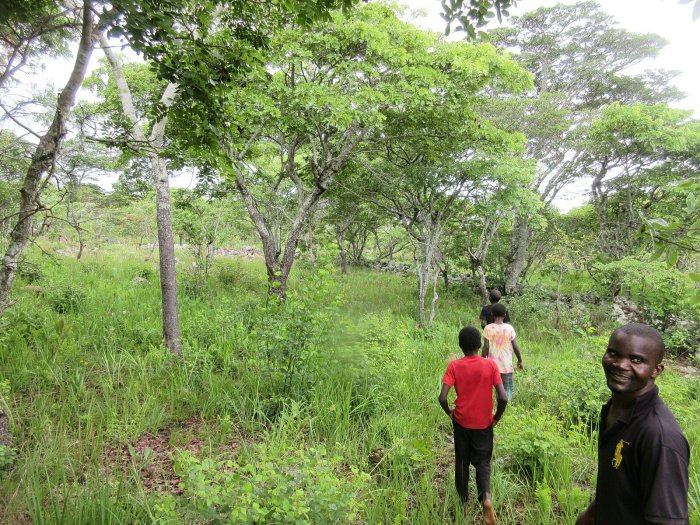
One of my friends, another PCV, lives in Zombe (he was on vacation when we visited the fort) and has been told that the last soldier to die in the war here in Zambia died on that hill. Presumably the gravesite in the report is the gravesite of that soldier, whether or not he was in fact the last soldier (European soldier, anyway) to die in the conflict.

Also last week I said that I was unable to identify this large structure in the middle of the fort:

The report has a similar picture to this one and identifies it as a “bunker.” So that is interesting to find out.

I was really hoping Fort Zombe was an indigenous structure to rival Great Zimbabwe and similar structures found farther to the south here in Africa. As a British fortification, it is still a very interesting piece of history, and worth visiting for the views alone. What I said last week about encouraging tourism in the area holds true, I hope the site is better publicized in the future. The report also says that the Zambia National Broadcasting Corporation put together a two-part documentary on the fort, so perhaps Fort Zombe’s fame is well on its way.

Fort Zombe

Me and the headman.

12/30/2018 – Update to this post: It’s not indigenous.

This past Monday I got to visit Fort Zombe, which is one of the cooler things that I have gotten to do, frankly. Fort Zombe is not well publicized, and I only found out about it via the very well done A Guide to Zambia’s Heritage, which is published by Zambia’s National Heritage and Conservation Commission. Allow me to quote the book in its entirety on Fort Zombe:

Fort Zombe is located about 10km from Mbala on the Mbala-Kasesya Road. It is west of Chief Zombe’s Palace and is perched on a high hill overlooking the valley. The site is the only known indigenous fortress built in dry stone walls in Zambia. The site, high and vast is overwhelming to the visitor. One immediately thinks of transfiguration when on top of this historical masterpiece of a compound built in dry stone. Apart from the Iron Age Communities that had settled there several hundreds of years ago, the British Soldiers had also used the Fortress during World War I as evidenced by remnants of battle gear like helmets and bullet shells.

So this is more than a little bit mind-blowing. When you’re talking stone fortifications in southern Africa, the only real other example that comes to mind is Great Zimbabwe. So here in my own backyard is a stone fortress and you’ve never even heard of it. So I roped in my friend Katie and off we went to go see it.

Seeing it is actually not so simple. The first step is talking to Chief Zombe. Fort Zombe is not the original name of the site, which currently appears unknown, and is instead named after the village of Zombe along with Chief Zombe. I don’t think the uh, Zombians were the original builders of the site, because I know Zombe village was at the site were Mbala is now, at least circa the 1870s when David Livingstone visited. But it resides in what is currently Chief Zombe’s chiefdom, and to see it you have to go through him. I happened to run into him at the Centennial, and he gave me his phone number, so when we wanted to see the site we called him and set up an appointment.

We arrived at his palace at about 1000 and greeted the Chief. He invited us inside and served us rice, potatoes, and pumpkin, along with tea which was extremely kind of him. He introduced us to his daughters, including both his firstborn daughter, and the first daughter born after he became Chief. He told us this daughter is the Chisulo, and the first child after becoming Chief has to be a daughter. This signals that the Earth has blessed his chieftanship. If he were to have a son, he would lose the chieftanship. The second child, however, must be a son. But since the chisulo has the blessing of the Earth, if she greets you it is extremely good fortune, and “you will find you become a minister or president!” So watch out world, vote PatInTheWorld for President in 2024.

We told Chief Zombe that we wanted to see the fort, and if he isn’t busy the Chief apparently generally likes to take people up himself. He was busy, however, and so he went to the village headman of Zombe village and asked him to take us up. So off we went!

Commanding views of the surrounding valleys.

The fort itself is on top of a hill right behind Zombe village, and is only about a 3km hike, but that is largely straight up the mountain. Walking up the hill, it’s easy to see how hard it would be to attack the fort and why it was built there. The fort offers a nearly 360 degree view of the surrounding valleys, and is a commanding vantage point for many many miles around. When we finally got to the top of the hill, the whole fort was much larger than I expected. From what I could measure on Google Maps, it appears to be a little over 4 acres in total, just within the fortress walls.

The fort must have been designed to house a very large population of people. There isn’t any information that I could find about the original purpose of the fort, but my guess is that it was built to protect against Arab slave raids. The area around Mbala, where I live and where the fort is were all on Arab slave trading routes in East Africa. The Moto Moto Museum has a diorama detailing how during the time of Arab slave trading, people in the area lived in fortified, stockaded villages to protect themselves against attack. My theory is that people the lived in the area got together and built Fort Zombe in order to protect against these attacks. I don’t think people were stationed in there long-term. It is on top of a mountain, so I don’t think there could be a source of water. Hauling water all the way up there would be difficult, and impossible under siege. Food would also be an issue; I spotted a few collapsed stone structures that seemed like they could have been storehouses to me, but they were not very large. I think that when it was evident that a slave raid was approaching, the village could haul enough food and water up to Fort Zombe to hold off the attackers until they gave up and left for less fortified villages.

Walking around the fort, I tried pretty hard to identify different aspects of it. The outside wall as it currently stands is in most places about waist height, having largely collapsed. It is built from stones that look to me like they mostly came from the top of the mountain, so people weren’t hauling building materials all the way up. Besides the walls and the “storehouses” I mentioned, there was a large structure in the middle of the fort that I couldn’t identify. At one end there was a circular section with a depression in the middle, and then a long, thinner section (pictured above) running for maybe 20-30 yards. I asked the guys showing us around, and they said it was a “house,” but I don’t think that is right. My only other guess is some sort of water storage, but that is a long-shot guess.

A section of the wall.

Our guides, and a section of the wall running into the distance in the back.

Evidence of WWI?

The most recent use of Fort Zombe was during WWI. Chief Zombe related to us how during WWI, British soldiers took advantage of the existing fortifications and commanding view and used it as a Fort to keep an eye on the Germans approaching from German East Africa. They have apparently found helmets and bullets on the site. As I was walking around I found the above tin can sitting on a wall. I like to believe it is evidence of WWI rations, but I guess it could be more recent. But maybe it’s from WWI! I put it back.

Katie, our guides, and myself probably spent about an hour wandering around Fort Zombe. I wish there was more to know about it. I haven’t heard of any archeological research into the site and it is quite phenomenal. I didn’t even know there was a stone fortress in Zambia, and it turns out it is right here in my backyard. Chief Zombe taking such a personal interest in it means it is important to local heritage, but nearly all history about it has been lost. The area has to be such a great opportunity for an archeological dig to find out about how the local people protected themselves and, if I’m right, the effects of the Arab slave trade in this area. If Zambia were to invest in making it more accessible, adding a walkway to it, and putting up some signs, it could be a major attraction in the area. I hope more people visit.

Gardening This Year

The whole shebang.

Reading this week:

  • To a God Unknown by John Steinbeck

The rainy season appears to have finally begun in earnest so it is time to do some gardening! The above picture is mostly all of my available gardening space. Last year my gardening started with just a few sunflowers, but pretty soon the project snowballed and I had taken over the whole yard. This year I felt like I couldn’t back down from what I did last year, so I did the whole yard again. This actually gets me a lot of credit; because everyone farms or gardens here, me having a somewhat sizeable plot earns me some street cred.

This year I wanted to mix it up a bit from last year. However, orange sweet potatoes are of course a necessity, so I have planted about half the yard with vines just this morning. Of the half of the yard that is sweet potatoes, about half are the same variety that I grew last year (“Olympia,” I think), and half are a new variety we got this year, called Chumfwa I think. That wasn’t super intentional; I just didn’t harvest enough Chumfwa vines down by the ponds and I was too lazy to go back. But some of the vines from last year grew back and so I just used those as seed. This picture is a few of the ridges I just planted; it doesn’t look like much right now, but promise there are some vines in there and it is gonna be like, so many potatoes:

In the rest of the yard I have planted groundnuts, soya, and pigeon pea. The groundnuts I planted literally just to make Jimmy Carter comparisons. Of all the things I planted so far, they’re actually doing the best, and I am excited for a nice big harvest. Gonna boil, mash ’em, and stick ’em in stews even. The pigeon pea I am growing because it grows into a nice big tree and I am excited to have a whole forest of it in the yard. I intercropped it with both the groundnuts and the soya, so hopefully those ripen before the pigeon pea has grown to its full height. The goats will of course probably tear down all the pigeon pea by the time the rains are even over, but until then I can dream of my pigeon pea forest. The soya I decided to grow to encourage other people to do the same, as it is a great source of protein, and way more profitable to grow than maize. All three of these crops should also do a lot to put nitrogen in the soil, and I am hoping that next year when they plant stuff their minds will be blown at how well it grows in my (then former) yard.

The groundnut/pigeon pea/soya beds.

Finally, on the other side of the house I have a small garden, currently in need of some weeding. There I am growing garlic, which is going like gangbusters, and carrots, which have just sprouted. In just a few months I am going to be able to make a super awesome sweet potato, ground nut, pigeon pea, carrot, & garlic stew. I didn’t bother to put a fence around the tinier garden this year, because it did nothing to stop the goats anyways.

Two beds of garlic in the middle (the left one I planted much earlier), with one of the carrot beds in the background and weeds everywhere.

And finally for dessert? Pineapple. As it turns out you can just grow more pineapple from the top of another pineapple, I decided to plant pineapple this year. Unfortuately, turns out it takes a few years for it to fruit, but in the meantime I hope it will look pretty cool. I also hope it will root; I just planted it today after letting it dry out for a bit (per the instructions). Once it roots I’ll plant it over in the garden with the garlic and carrots.

My pineapple with some moringa in pollipots my host dad planted behind it.

My garden here has been my biggest project for the past few weeks. I tried to get an early start this year but some ill-timed events somewhat delayed me, and most recently a week long dry spell put a damper on planting activities. Hopefully now rain is pretty consistent and everything will grow quickly. Just gotta keep it all weeded, and it’ll be legumes for days.

Effect of WWI in Zambia

Tenga-tenga

As a follow-up from last week’s post, I wanted to write a bit more about the effect of WWI on the people of Zambia. It’s a pretty devastating history. The contributions of the people of Africa to a European war are, I think, largely forgotten especially when you focus on things like Archduke Ferdinand and the Triple Alliance.

In Zambia and Southern Africa, Africans contributed to the war effort in two major roles: as Askari and as Tenga-Tenga. Askari is an Arabic word meaning “soldier,” and referred to Africans serving as soldiers for colonial powers in Africa. The colonial powers were all initially reluctant to allow (or draft) Africans as soldiers, believing them inferior or unreliable. But as the war progressed and resources strained, the majority of each army was composed as African soldiers. By the end of the war there were opposing armies of mostly African soldiers fighting each other for a European war. In Zambia, men were initially enthusiastic about signing up for the army due to the prestige and relatively good pay, but this enthusiasm waned as word of harsh treatment spread. For the askaris, 75% of deaths were from disease alone.

Racism was pervasive in the treatment of the askaris. They were denied boots and marched and fought barefoot, because the belief was that boots were unsuitable for African feet. White soldiers were resistant to going on patrols or serving alongside African soldiers, leading to tension. In Zambia, the headquarters of the Army were in Livingstone, but most of the fighting was in the north along the border with Tanzania (then German East Africa). The closest rail link to the border ended in modern-day Ndola, leaving soldiers to march on foot 1000km to reach the war front.

The lack of transportation required the use of the Tenga-Tenga, or war carriers. Due to the tsetse fly, draft animals could not be used throughout much of Southern Africa and so there were no roads through most of the areas where soldiers were fighting. All of the materiel required to fight the war therefore had to be carried on top of the heads of the tenga-tenga. Up to 6 tenga-tenga were required for each soldier in the field. They carried a load of 27-37kg, on top of which they had to carry their own blankets, cooking pots, food, and other supplies. This often totalled more than 60km. They walked an average of 24km per day. The tenga-tenga were poorly paid for their labor if at all. They could be whipped for unsatisfactory performance and when they collapsed were often left to die.

Where there are records of askaris that served in battles or were notable for acts of bravery, the service of the tenga-tenga are largely unrecorded. Their numbers were huge. At least 80,000 tenga-tenga were drafted during the war, out of a taxable male population in then Northern Rhodesia of approximately 100,000. This number doesn’t include the many women also drafted as tenga-tenga, and other portions of the population that served as cooks or in other roles. In these large concentrations of people, disease was rife with dysentery, typhoid, and pneumonia spreading through the ranks, and with little or no medical care to keep it in check. Askari and tenga-tenga returning home would bring these diseases to their villages.

Besides the direct impact on the populations, the war had follow-on effects in the villages. With so many of the men drafted for the war, villages were left without labor to clear the fields or plant the crops. This lead to mass starvation as there was no food grown. What little food there was could be confiscated by the army, and villages were often raided or burned by enemy armies. The depletion of labor in some areas was at nearly 100%; in Kasama, where there were about 5000 taxable males, 5000 tenga-tenga were drafted. Men started hiding in the bush when government recruiters would come. To force men to join, the recruiters started arresting their wives if then men had disappeared. These women suffered imprisonment, rape, torture, and assault until their husbands joined the war effort.

When I learned about the horrors of WWI, most of the horrors focused on trench warfare and the hardships that soldiers faced on the Western Front. If I was aware that WWI was also fought in Africa, it was because I learned it watching The African Queen. I didn’t know about any of this history until I was living here in Mbala, and for months I didn’t even know the Cenotaph commemorating the war existed despite biking by in every time I was in town. You have to search pretty hard to find information on the cruel hardships the people here faced on the behest of their colonial masters, at the end of a whip or gun. The Zambians though are proud of their history. People display the awards won by their grandfathers and like I said last week the country pulled out all the stops to commemorate the Centenary. For hundreds of years the entire history of this region has been dominated by cruel hardships imposed by outsiders, from slave traders to European wars. Since its independence, Zambia has prided itself on being a peaceful nation. They’re proud of their history; maybe they learned from it.

The source for this article was “The First World War in Northern Rhodesia: Experiences of ‘Askari’ Foot Soldiers and the ‘Tenga-Tenga’ War Carriers,” published by Zambia’s National Museums Board.

As follow-on reading, here are some news articles on the effect of WWI in Zambia:

WWI Centenary Commemoration

The cenotaph decked out in flags.

This past weekend I got to witness a once in a lifetime event, the WWI Centenary Commemoration here in Mbala. Ever since I figured out that I would be living in Mbala district on the 100th anniversary of the end of WWI, I’ve been looking forward to this event. For those not in the know, WWI actually ended here in Zambia. Although the armistice was signed in Europe and went into effect on November 11th, 1918, it took some time for the news to reach Zambia (then Northern Rhodesia). Fighting ended on November 14th when General Von Lettow-Vorbeck was handed a telegram informing him of the armistice. A monument marks the spot where this occurred on the banks of the Chambeshi river, about 100km south of Kasama. British forces then ordered him to march his troops to Mbala (then Abercorn) for the formal surrender. That took just shy of two weeks, so the formal surrender ending WWI in this region was signed on November 25th, 1918.

I tried to encourage as many PCVs to come as possible to come to this event. Since centenaries only come every 100 years or so, it was a unique opportunity to witness it. As well as it being important to commemorate the sacrifices Zambia and other African countries have made, I figured it would be a lot of fun and I am always eager to show off Mbala. In the end we had 18 PCVs make it up here, including some from as far away as Southern and Northwestern Provinces. A good chunk of us showed up the night before the Centenary, because according to the schedule I got from my host dad, there was supposed to be a cocktail party and fireworks. Both of those events were a bit of a bust but we had fun anyways. In anticipation of the cocktail party, everyone dressed up as well as they could, all of us being Peace Corps Volunteers that live in mud huts. But we looked good and what we lacked in tailoring we made up for in enthusiasm. First we swung by the Golf Club which I had never been to before. The Mbala Golf Club has a good vibe and I recommend it. While we were there we spotted some armored vehicles over at the Yacht Club, so we went over there to check them out, but by the time we arrived they had left. We had a few drinks anyways. Back to the Golf Club where we watched some live music and had a good time. We asked if we could play, despite none of us knowing how to play any instruments, and they seemed enthusiastic but it never quite happened. At the appointed time we went over to the Cocktail Party at Lake Chila Lodge only to find out that it wasn’t happening. We had our own party anyways. Fireworks also happened, but two hours late, and by that time we were all in bed.

A whole lotta Chiefs.

The next day dawned very bright and very hot and after breakfast we assembled at the cenotaph to watch the ceremony. This event was the most crowded and most colorful I have ever seen Mbala. They really pulled out all the stops. For a few months we had been watching them spruce up the roundabout that contains the cenotaph. The day of however, the whole area was filled with flags from around the world. Several tents had been set up to shelter the hundreds of Chiefs and other dignitaries that had assembled for the event. The crowd was huge and it was hard to jostle for a spot. I eventually settled into a spot next to the dignitary tent, which had a relatively good perspective on the cenotaph and the stand where President Lungu was going to deliver his speech. It was hard to see over the crowd, but I am so glad so many people were so excited to come and witness the event.

It took a little while for all of the dignitaries to make their arrival. There were various ministers and the service chiefs of Zambia’s armed forces. Representatives from a lot of organizations came, including from various Commonwealth soldier organizations, the German military, and General Von Lettow-Vorbeck’s grandson even came. The ceremony kicked off with prayers and an invocation, and then the centerpiece of the ceremony, which were a series of wreath-layings. President Lungu laid a wreath, and then many many more wreaths were laid by the many representatives in attendance. Then it was time for speeches.

Wreath laying at the cenotaph.

The first speech was by General Lord Richard, who is a former Chief of British forces and was representing the African Rifles Association. He outlined a lot of the events of the war, and detailed the roles of Africans in the conflict and the hardships they suffered. He also commented on the wider world not forgetting the conflict here in Africa. After that was the Provincial Minister for Northern Province, talking about the legacy of the war in the area. Finally, the keynote address was given by President Lungu. Unfortunately, his microphone was broken and we couldn’t hear him, but according to news articles he spoke about the sacrifices people made, and how he intends to increase awareness of the contribution of Zambia to the conflict by making sure it is covered better in school textbooks.

President Lungu addressing the crowd.

At about this point we ducked out because it was hot, we couldn’t hear President Lungu, and to beat the crowds. After getting some lunch, most of the rest of the evening was spent relaxing again over at the Mbala Golf Course. We found a great spot fairly near the bar but overlooking Lake Chila (confusingly labeled in the banners around town as “The Lake Chila Mystery”). Good times, great friends, and an historic moment. I am really glad I got to see the Centenary and I hope that the wider world gets a better perspective on Africa’s contribution to WWI. I didn’t know anything about it before coming here, and still a lot of my PCV friends are confused as to why Germany was even in Zambia (despite me droning on about it like every chance I get). It is well worth remembering the hardships that Africans had to suffer as colonial forces fought a European war, and I am glad Zambia pulled out all the stops to commemorate the event. Can’t wait for the next one in 2118.

Chillin’ at the Golf Club.