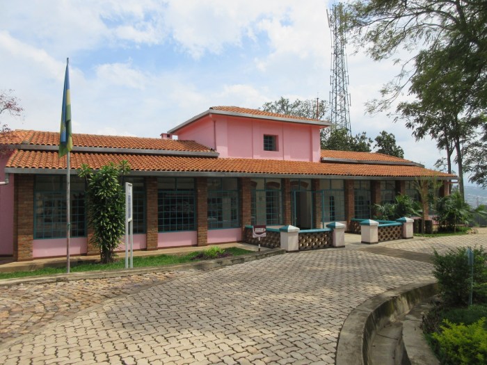
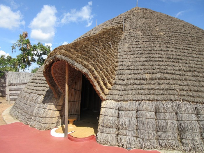
Brooklyn Part I

IMG_3446

Reading this week:

  • Farsighted by Steven Johnson

Right off the bat the title of this article is wrong. Pretty much none of what I write about will take part in Brooklyn. But for Thanksgiving I went down to visit my aunt and uncle who live in Brooklyn, and the rest of the family came up. Thanksgiving itself was pretty quiet and involved turkey and stuff, and then we stayed in New York for the weekend. On Friday and Saturday we went around and did tourist stuff. I’ve been in New York several times before, almost all those times to visit said aunt and uncle, but I think this is actually the longest amount of time I’ve ever spent in the city. I’m practically a native now.

The first thing we did on Friday was to head off to Rockefeller Center. Dad seems to like the place. He wanted to watch the ice skaters and the windows over at Sak’s across the street. So we did that. I think I would have rather gone shopping; I could use some new shoes. But whatever we watched the skaters. Those are the top photos. They were pretty neat I guess! There are other skating rinks in Manhattan with better views but I guess this one is significant or something. Sorry for being such a downer?

IMG_3449

The single most exciting part of the day for me was St. Patrick’s Cathedral. Not for the cathedral. I don’t really care about Christian religious structures period, and as far as cathedrals go St. Patrick’s is pretty whatever. I’ve seen better. But I learned about the St. Killian’s candle burning system! This thing amazed me that it existed. The boxes of candles spread throughout the place proudly proclaim that it is patented. Patented candle burning system! The audacity! The appeal of the system is that it is low maintenance. All those little candle holder thingies have a hole in the bottom, so when the candle burns low enough it just drops through and the candle holder is ready to accept another candle. A huge think of wax builds up below, and a) I don’t understand how that never catches on fire and b) someone has to clean it but it must be easier than cleaning out individual candle holders, but that is the only drawback. I even contemplated donating $2 so I could light a candle (no one was guarding them I could have just lit one but it didn’t mean that much to me and if I want to affect the church’s finances I’ll advocate for them to pay taxes) but I decided to just google them later instead. So that was exciting.

IMG_3460

The second big adventure of the day was to go to St. Patrick’s cathedral. Wait didn’t I just say I was there?! I did indeed. I suppose the other St. Patrick’s isn’t a cathedral, it’s a basilica, but whatever. It is the original St. Patrick’s before the congregation decided they were cool enough to need a whole cathedral. The draw of this St. Patrick’s, besides being further downtown, is that it has catacombs that you can tour. The catacombs are mostly neat for being like, modern catacombs. The burials are not modern, but the place has been kept up and has modern ventilation and stuff (and lights, but the tour promises to be a “candlelit tour,” though the candles are electronic) and so represents what a catacombs would look like if you decided to build one anew. The tour was interesting but would have been better if it was one hour instead of two.

IMG_3478

The final exciting thing was going up the One World Trade Center slash Freedom Tower. Plan A was to go up and watch the sunset from up there, but despite the elevator being blisteringly fast we didn’t get up there in time (plus our tickets were for too late) but still seeing Manhattan all lit up is pretty gorgeous. Eventually I figured out the “handheld night scene” mode on my camera but taking pictures through glass never helps. So we looked all around, admired a bunch of stuff, took some photos, bought a lapel pin (I got two lapel pins this day), went down, went home, and had burgers. Excellent times in New York.

Corpus Christi

IMG_3271

South American Porcupine wants a smooch.

Reading this week:

  • War on Peace by Ronan Farrow

This past weekend my mom and I went to go visit my sister in Texas. My sister works at the Texas State Aquarium in Corpus Christi and performs in “Wild Flight,” which is the aquarium’s bird and animal show. Mom found some deal on Southwest to fly us down there so we bundled up and away we went.

IMG_3241

The aquarium.

The whole state of Texas quite frankly makes me uncomfortable. Back at the Academy there was a “movement order” you could participate in to go see a bowl game the Navy football team was in over in Houston. I went and got kicked out of a bar for being too drunk (I was, in fact, too drunk) and then left Texas the next day and I haven’t been back since. Also it seems to be a very flat place from what I saw of it. And full of Texans. But my sister has made for herself a rather comfortable living there and so yeah. We went.

IMG_3252

My sister rockin’ the show.

The first day we were there we accompanied my sister to work at the aquarium. We sort of had to because she only has her one car, but also of course she wanted to show off her work there and got us in for free. It is a pretty nice aquarium though if you know someone who works there I highly recommend it. She got us in to several animal encounters throughout the day and we got to meet a whole variety of animals, like the porcupine up top.

Pretty Kitty

Me and a cat you had to be very gentle around.

Besides the cat and the porcupine, we also got to meet a giant octopus (though they were a little shy) and a tiny baby alligator and a whole variety of birds. So pretty awesome! We spent the whole day at the aquarium (because, you know, my sister works full time) and then head home.

IMG_3244

The next day we spent the whole day at the USS Lexington. The Lexington is right next door to the aquarium, and I didn’t think we’d wind up spending like a whole day there, but we did. It is, after all, a pretty big ship. It’s an aircraft carrier though, which like, lame, but hey these things have engineering spaces so they’re not a total wash. This ship is of course the second Lexington, the Lady Lex having been sunk and CV-16 here named in her honor. Her nickname was the “Blue Ghost” because she used to be blue and was reported has having been sunk a lot. But she never sunk!

On the ship they have a wide variety of planes from throughout her service career, and like, two different Blue Angels at least. That, uh, that’s really all the intelligent things I have to say about planes. This ship has an escalator to get the pilots to the flight deck, but if you didn’t want to climb 12 decks worth of ladders frankly you should have gone submarines. That’s why I went subs after all.

Besides the flight deck, the ship has extensive self-guided tours throughout most of the other operational portions of the ship. You can even go down into one of the enginerooms. They didn’t let you go into any of the boilerrooms, though I got to run around tracing the main steam piping from the bulkheads to the engines. This being an aircraft carrier they had both high pressure and low pressure turbines connected to the shaft via reduction gears, and I was rather stunned at how small the high-pressure turbines were, though I guess yeah of course. I don’t think they could have been much bigger than our turbines on the submarine. But they had a low-pressure turbine to go with it and those guys are in fact pretty big. So there ya go.

After that our third day in Texas was a trip to go look at the South Padre Island seashore (it was quite windy) and then to go antiquing. Before antiquing mom lectured me that the point of antiquing was to look at stuff and not to buy stuff (I wondered how mom thought she had never given me a similar lecture in my 30 years of life) but it was only her that wound up buying stuff. The next day my sister dropped us off at the airport on her way to work and back to Maryland we went!

IMG_3245

Pirate Hunting

IMG_3161

The high seas.

Reading this week:

  • China’s Second Continent by Howard W. French

Back over the weekend before the 4th of July, we went pirate hunting. For the holiday my mom went off on a cruise with some of her sisters, and so my dad, my brother, and I went off to go look at pirate stuff enroute to my grandma’s house for the holiday. Specifically, we were looking at Blackbeard stuff. Eddy Teach there, during his illustrious two-year career had made the Outer Banks island of Ocracoke his favorite anchorage. So, three hundred years later, my brother decided that Ocracoke was the land of his swashbuckling dreams.

Ocracoke is a lovely little island much better known for its beaches and touristy vibe. People drive around in golf carts, lifted trucks, and jeeps. We had a two-wheel drive Jetta. To get there we took a ferry from Hatteras, and I am always a fan of any high-seas adventure. I wasn’t in charge of this trip, and was literally just along for the ride, so I hadn’t done any research into where crap actually was on this island. Neither, apparently, had anyone else on this trip. After a brief consultation of a decorative illustration based on a 300-year-old map and a comparison of said map to Google Maps, we set off down a dirt road that quickly turned to sand that quickly turned to us getting stuck.

IMG_3134

Luckily for us, the beach towing dude happened to be driving by and spotted us in our plight. I mean this is exactly where you’d get stuck if you were dumb enough to get stuck so I assume he just hangs out here all day. He was very nice though and gave us some directions. Personally, I had been pushing to visit the lighthouse first because Google Maps said it closed at 1700 and it was around 1500 by the time we got to the island and got some lunch. Our tow-line enabled friend told us in the midst of rescuing us that Teach’s Hole, which is where Blackbeard liked to anchor, was near the lighthouse and nowhere near our fateful sandtrap. So finally off to the lighthouse we went.

IMG_3135

The lighthouse is pretty nice! The worry about it closing at 1700 was silly because you can’t go into it (I guess you can go into the bottom sometimes), so all you can do is stand nearby and look at it. It proclaims itself at the second oldest still-operating lighthouse in America and well um. Sure. Besides the above picture I took another picture from somewhat closer and both depict a 75′ tall brick tower.

IMG_3140

But finally we set off down a trail in a little miniature state park and we came upon Teach’s Hole! There is of course nothing much to look at because by definition an anchorage is just a stretch of water and stretches of water look much like any other stretch of water. There were people swimming. We did not swim.

IMG_3144

There is also on the site the above boarded-over well. This well was apparently used by Blackbeard. So that’s neat.

IMG_3157

IMG_3156

Ocracoke also takes advantage of its pirate history for some good ole-fashioned tourist stuff. One of these things is “Teach’s Hole,” which is mostly a pirate-themed gift shop with a small set of Blackbeard-themed displays. The entry fee for the displays is $4 (free with $15 purchase in the gift shop) and the displays were probably worth about $4. They’re very nicely done but my favorite was a diorama depicting “Blackbeard’s Beach Party” because they used Duplos to put it together. All the rest of the displays are well-done replicas and models and things but then out of nowhere they use kid’s toys to display a party so legendary we’re still talking about it three centuries later.

IMG_3174

After a night on the island we set off the next day on the ferry back to the mainland, landing on Ceder Island and driving on down to Beaufort, NC. Beaufort is home to the North Carolina Maritime Museum and that place is really nice! First off the admission is free and let me tell ya it is worth every penny. We got there only 45 minutes before it closed so we didn’t have a long time to look around, but we got the gist of it.

The museum is most famous for hosting artifacts from the Queen Anne’s Revenge. The QAR, as the museum referred to it, was of course Blackbeard’s ship. They found it a few years back and brought up a bunch of artifacts and stuck them in the Maritime Museum. The QAR section of the museum is the largest section, but they also have a lot of displays on other watercraft from the region, the local marine life, and maritime history. They also have a library that is decorated exactly how I would like a library in my own dream house decorated, so always nice to get some #DesignInspo along with my #nautical.

IMG_3176

Our final pirate-related adventure was a block away to the Old Burying Ground which contained the grave of Captain Burns, an American privateer during the War of 1812. Mostly I wanted to go because it was on Atlas Obscura, but I got to find out his ship was called the “Snapdragon.” This is funny to me because on the submarine we had these exercises called Snapdragon and we hated them (maybe that was just me) so we called them “Snatchdragon” and this dude’s got a whole boat named that. Poor guy.

IMG_3191

And so with that we were off to grandma’s house. Far fewer pirates at grandma’s house.

Rwanda Day 4 & 5: End of the Trip

IMG_3092.jpg

Kandt House.

Reading this week:

  • Men Without Women by Haruki Murakami
  • The Looting Machine by Tom Burgis

After milking my COS for literally months of blog posts, my trip is complete!

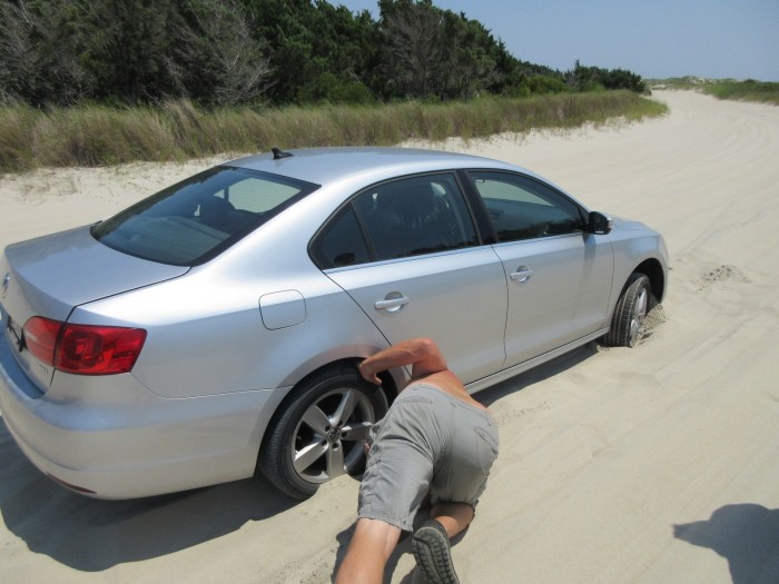
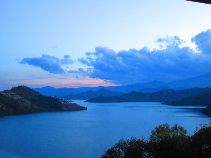
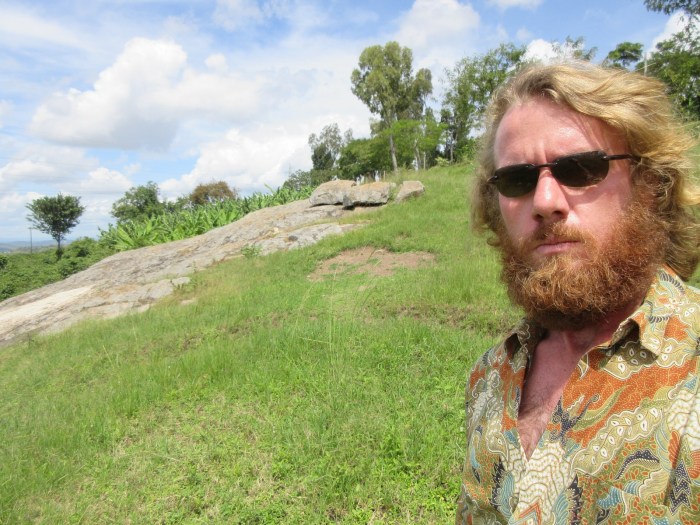
Leaving Kibuye I got a little adventurous. After waking up early to watch the clouds change color as the sun rose, I wanted to explore some of the peninsulas that jut out into the lake. I was driving around and eventually I went down a road that was just someone’s driveway, and which ended at a gate with no way to turn around. I had to back some ways down a bumpy dirt road where if I went too far I’d fall of a cliff. I’m still alive, but decided to call it after that. The road to Kigali was perhaps the scariest so far for being a little pot-holed and right up against the tallest cliffs I’d seen in Rwanda. The weirdest sight (out of context) was a dude by the side of the road just holding up a catfish he was trying to sell. It looked like the only one he had and there he was standing near a bend holding up a catfish, staring at people driving by.

IMG_3081

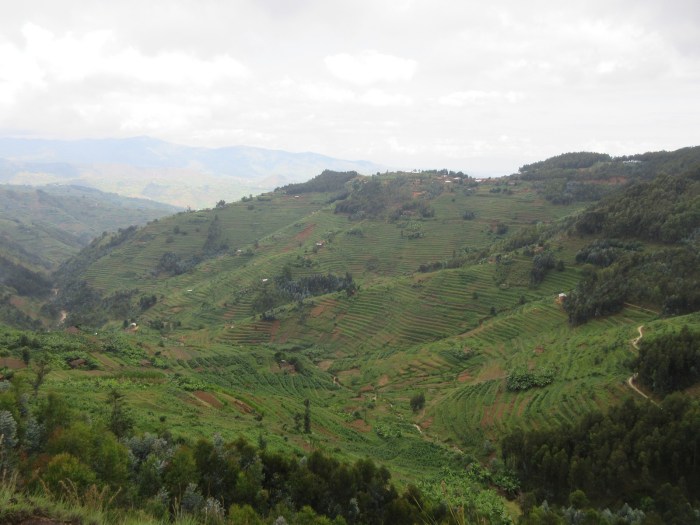
On the way to Kigali.

I made it to Kigali in good time and decided to go to the National Art Museum. I had been using maps.me to get around, and it had been pretty good in Rwanda but failed hard in Kigali. The problem is that it contains a lot of “roads” that are more or less impassible dirt tracks, and also it wants to take you on the absolute shortest route. So first it lead me to the wrong side of the airport, trying to get me to cross over behind the airport via a dirt path. I didn’t go down because there was a motorcyle that wouldn’t move, and almost couldn’t make it back because the path was too steep. When I went on the other side of the airport it had me go down this side road and then up this dirt path that was also impassible, and I spent some time turning around again. Then I found another road, and it lead me to another dirt road, which I felt couldn’t be right because the art museum is in a the former Presidential Palace, but it lead me there. There is a tarmac road that leads straight there but I guess it isn’t the absolute shortest path so maps.me didn’t take me that way.

IMG_3085

Back yard of the art museum, because they don’t allow pictures inside.

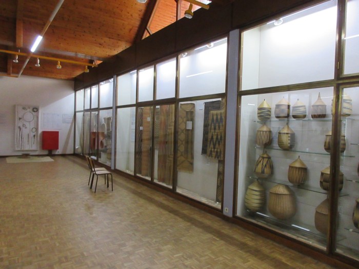
The art museum was nice. I had the place to myself and was lead around by a rather nice lady. No pictures though which was disappointing, and being lead by a guide made it a little weird to see the museum. You can’t really stand there and contemplate art when she is explaining stuff and leading you around. There was one piece I liked, but maybe it was just the well-carved boobs. The president had some nice digs, but it was built in 1976 and looks like it. We also went to the Presidential Plane Crash Site, which is just out back. This was where the President’s plane crashed, sparking the Rwandan Genocide. There are parts of the plane strewn about, but more interestingly is the 17 or so crested cranes walking around. Apparently they use the place as a crested crane rehabilitation center, and the cranes are beautiful.

I drove to my B&B with relative ease, but driving through Kigali is a bit of a trip. Cars and motorcycles drive on the same roads and the same time, but they’re not really part of the same system. They both tend to both drive without regards to the other and it was my experience that the system worked best when you in fact drove your car more or less without regard to the motorcycles (I mean, don’t hit them). I had the whole next day in Kigali, so I wasn’t so pressed to fill up all my time, but I spent the evening on a walk around the neighborhood.

The next day, the first place I went was the Genocide Memorial. They search your car and give you a patdown before you go in; I wonder what threats they have had. The genocide memorial has a whole museum that is pretty well done. I have a lot of disparate thoughts here. First off the memorial also has a cafe which, I dunno. “We will never forget the horrible things that happened! Never again! Enjoy our cafe and free wifi!” One bit I found weird was a line in the memorial talking about the some of the benefits white people brought to Rwanda, including Christianity. The very next line notes the role in the Catholic church fostering racial/ethnic divides between the Tutsis and the Hutus, both helping to elevate the Tutsis more and then also telling the Hutus they were being oppressed. Again, there ya go. I exited via the Genocide Gift Shop. I bought a lapel pin.

IMG_3088

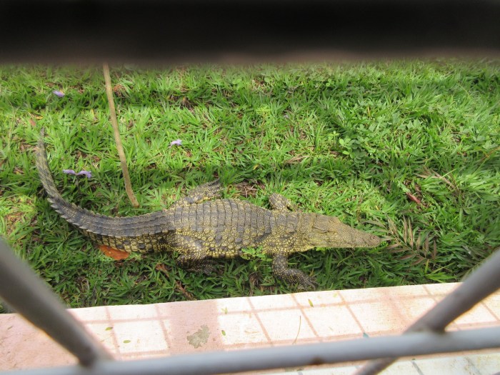
Leftover from the Natural History Museum.

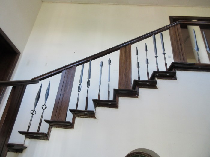
From there I went to the Kandt House Museum. The weirdest part of the museum was right before I arrived, because just up the road is a garage or something. As I was driving a bunch of guys jumped out and kinda surrounded the car and I was worried I was going the wrong way or something. Turns out they just had a car wash deal. The museum used to the be the natural history museum so around back they have a single, small crocodile and several snakes. Neat. The house itself is pretty nice and contains displays on the history of Rwanda. Some things I learned: Making a single traditional hoe from the ore requires 300kg of charcoal. This means that around 1907, when a bunch of pictures on display were taken, and presumably before that, the country was largely deforested. This was also beneficial to provide pasture for raising cows. The Kings all had like, one of five names, depending on what they needed to do doing their reign. These names were things like “Warrior,” or “Yari,” which means “Peace.” The museum had two wheels that had been used to transport a steam launch (I thought it was named the “Dampfbarkasse” but turns out that just means “Steam Launch” in German). They had a display on traditional courts, and the two punishments mentioned were making beer to provide to everyone, or death. Quite the delta there. The guide also related a story of how apparently the Rwandan people though the whole world was between the three hills of Kigali. Then the Chief climbed Kigali Hill, and saw, like, the rest of Rwanda, and that’s how they found out there was a whole world out there.

From there, off to the Campaign Against Genocide Museum. This is in the parliament building. Again, you gotta get patted down and have your car searched. The displays are interesting (in a “kinda weird”) sense. The museum focuses on the RPF’s actual military campaign against government forces. The museum is where it is because the 3rd Battalion (I assume that is what “3BN” means) of the RPF forces were stationed in the parliament building as part of the Arusha Peace Accords. So when the genocide began there was an RPF force in Kigali already. What clicked at the museum is that like, Kigali itself was a battlefield. They have a war painting of the RPF attacking the sports stadium. That put a new perspective on things. The interesting/weird part though was it was a bit technical. They had a display that they repeated a few times that looks like a powerpoint slide from some military strategy presentation, talking about phases of operation and arrows for things like “media efforts.”

IMG_3095

Gumboots.

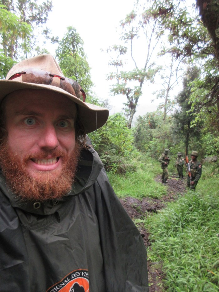
The most stunning thing to see was the RPF’s uniforms, which included gumboots as combat boots. That amazed me. I’m not making fun of them for being poor, I am just impressed. I was stunned when all the rangers climbed Virunga in gumboots, and here are these people fighting a war in them. There are apparently some statues and stuff outside, but it was raining so I didn’t bother to look, and I wasn’t feeling great, so I just went back to the B&B. And except for the trip to the airport, that wrapped up my Rwandan vacation and COS trip.

After 24 hours or so of travel and a layover in Qatar, I landed at Dulles airport. Then I stood in the line for customs for 2.5 hours. Frankly if I had known the line for America was that long I might not have come. Me and the customs guy: How are you? I was good two hours ago. Where you coming from? Rwanda. Did you meet anyone there? Nope. Have any business or any friends or relatives? Nope. So you met no one at all? Nope. Why did you choose to go to Rwanda then? Because it is beautiful. What is your profession? Nothing at the moment. What did it used to be? Peace Corps Volunteer. Do you have any food or anything to declare at all? Nope. He let me pass but I don’t think he liked me. And so after 27 months I was back in the US of A. Dad drove me home and I napped.

Rwanda Day 3: Chimpanzees

IMG_3020

Reading this week:

  • American Spy by Lauren Wilkinson

The big highlight of this day was chimpanzee tracking. I woke up early early in the morning and met up with the group at the Gisikuru Ranger Station. From there we drove about an hour and a half to an isolated patch of forest where a habituated group of chimpanzees live. The gorillas gave me high expectations for the chimpanzees, despite warnings. We parked our cars at the edge of the forest and set out on foot. The walk was farther than I anticipated, though not actually that far, though the guide kept saying things like “we are close” when our definitions of “close” differed significantly. Eventually we went off the trail, down a slick near-vertical portion of the hill. “Not far!” I was annoyed and the views of the chimpanzees weren’t that good. We kept shifting slightly over the cliff face there to try to get a better view, but it was only faraway glimpses of chimps through trees. Ugh. We eventually went back to the trail and things got better.

IMG_3045

IMG_3005

A small group of the chimps (three or four) were walking down the trail and we were basically following them. I got some pictures of chimp butts. Eventually though the chimps climbed a tree to eat some fruit and we scrambled up the hill a short ways and were pretty level with the chimps and got some great photos. One of the dudes on the trek had this huge camera he had a porter carry. It was impressive. We hung out for a while watching the chimps eat and climb around some and then eventually they left and we did too. I was annoyed on the way back because some of the people were super slow and it took forever to get back but we got back.

IMG_3055

From there I set off for Kibuye. The drive is fantastic. Most of it is right along Lake Kivu, hugging the hills that descend into twisty bays all along the coast of the lake. I got to Kibuye and was hungry for lunch. I wound up at Home Saint Jean to get some food. I was trying to find another place but Maps.me lead me there and I was okay with that. It’s this gorgeous castle-looking place perched on a hill that juts out into the bay, maybe 100m up from the lake. I had a rather good lunch and the manager convinced me to get a room because it was only 15000 francs and a pretty nice room with a lake view.

IMG_3061

IMG_3056

Continuing my collection of national museums, I darted off to visit the Museum of the Environment. The tour guide showed me around; it is a pretty nice museum though very small. The most interesting thing for me is the Apollo Moon Rock that Reagan gave the country back in 1973. They had a display on energy production and I found out a drill platform looking thing I spotted in the lake from Rubavu is the methane extraction platform so that’s neat. Also that Rwanda produces a good chunk of electricity from peat. The guide told me that the evolution display is kinda contentious in Rwanda, and that he has had trouble convincing people that butterflies come from caterpillars. They have some stuffed animals and I think their star display is of a crocodile found with some shoes undigested in its stomach (the shoes are also displayed). On the roof they have some native plants which were neat to see and then the museum was pretty much over. After that I came back to the hotel and just hung out because frankly I was pretty exhausted from all the traveling. I haven’t been to the Mediterranean but you could have convinced me the view was in the most picturesque chunk of Italy or Greece.

IMG_3073

Rwanda Day 2: Nyungwe

IMG_2851

The whole country is picturesque valleys like this.

After sitting in the car for a bit writing down all my thoughts to process them, I drove to Nyungwe. Nyungwe National Park is gorgeous. Most of Rwanda is cultivated. I kept stopped today before the memorial to take pictures of valleys, and they’re all amazing with these patches of farm and different terraces. But then you get to Nyungwe and it is just forest so it is very different (except for the national parks, Rwanda is almost entirely under cultivation). Plus I kept gaining altitude as I went west (or at least the hills are taller and so I guess the valleys deeper) and on top of a lot of the hills the clouds were touching them and seeming to rise from the forest itself. I kept wanting to take pictures but I was trying to get to Uwinka Reception Center before 1300 to make the Canopy Walk on time. It’s a pretty and fun slash scary drive because of all the curves and hills. Later on I passed a truck that had crashed right into the wall of the hill because it didn’t turn fast enough. Better than barreling over the side. The driver was cooking some food as I passed so he’s okay.

IMG_2876

Nyungwe.

IMG_2867

Jean D’Amour

I arrived at the visitor’s center there and arranged to go on the canopy walk tour. It’s overpriced frankly at $60, but I also arranged to see chimpanzees the next day for $90, and what I am telling myself is that chimps is actually a bargain at $150. Anyways. My guide was Jean D’Amour and he was very nice. I was alone; it isn’t exactly tourist high season here. We went down the trail and he told me some stuff about plants and things. He showed me a plant people use as toilet paper because it is soft, and a vine that is taking over the park because only elephant and buffalo eat it and both are extinct in the park. Plus a medicinal tree. Neat. But trouble was brewing. First he ran into a guide that told him the bridge was broken. But, he said, a Canadian was fixing it. Then we ran into said Canadian. He said he was off to get tools and it would be 1-2 hours. Jean suggested we just wait at the bridge. We kept going and then ran into more Canadians. One was named Ian and was very friendly. He told me about cool bridges like this one in Vancouver, and that he had installed a zipline going from the Foxwoods Casino in CT to the Foxwoods Museum, and also that the museum wasn’t doing so hot and only got 50,000 visitors a year despite the casino getting 1,000,000, and the zipline was a ploy to get more. He also said that the bridge cost $800,000 to build and the park gets $500,000/year from it, which is like 8000 something Non-Resident Foreigners. But he also highly doubted the 1-2 hour time estimate to fix it. So Jean made some phone calls and arranged for me to see the bridge the next day, provided it was fixed.

Canopy Walk

Sex appeal.

But we went to the bridge anyways because I could go to the first platform (there are actually two platforms and three bridges, with the big center bridge between the two platforms out of commission) and check it out. It was in fact pretty neat. Jean insisted on a like, full on photo shoot so I have 20 pictures of me on and around the bridge.

After the bridge I had a nice little lunch at the place. I was heading out and the receptionist guy asked for a lift to Gisikoro and I was happy to oblige. That was pretty neat because he answered some questions in the car. Along the road in the forest there is an army guy stationed every few hundred meters. I figured they were for poachers but he said they were also there because the forest is on the border with Burundi and there is fighting there. So that’s kinda scary? We saw a monkey along the way, and he told me that the name of the swamp in Kinyarwanda means “Swallows Elephants” because back when there were forest elephants in the park I guess they would get stuck in the swamp.

IMG_2911

The tea process.

I dropped him in Gisikoro and then went to the Gisikoro Tea Factory for a tour. That was very informative! It cost $10 and I was again alone so I had what I think was the foreman leading me around. The tour was of the processing facility. We went to the loading dock where the tea leaves are delivered from the fields. They are first tested for the proper ratio of good and bad leaves. “Good leaves” are the new tea leaf shoots, so the end of the branch plus one or two leaves. They require 65% of the incoming leaves to be “good” leaves. The other 35% are the “bad” leaves, which are any leaves other than the apical portion. Once they verify the ratio, they go on “withering” beds, which are large beds with screens on the bottom through which warm air is blown. This happens for 12 hours and the leaves lose 30% of their mass from water evaporation. After that they are loaded into bags and onto a hoist system, and then taken to a chopper. They are chopped very finely using first a regular looking cutter and then like shredder wheels. These wheels go so fast they make steam come out of the leaves. The smell in this portion of the process is a lot like fresh cut grass.

IMG_2918

Tour guide and fermentation beds.

So the leaves come out into very fine chunks and then go onto these conveyors that use paddles (and speed I assume) to control the heat and there the leaves ferment. They go from green to brown in this step. What makes black tea black is fermentation; green tea is just dried with no fermentation. After fermentation the leaves are dried using a steam drier. Then they are sorted and graded. Apparently tea bag tea is lower quality and contains stems. He showed me a tray with different grades of tea and you could really see the difference. It was pretty neat. We went out back to check out the machine shop which was very nice and used to maintain equipment like the cutting rollers. We also saw the wood-fired boilers that provide the drying steam. They are very large and there were dudes tossing in logs. They made sure I got some good pics. The boilers were made in England and have been operating since 1974.

IMG_2933

Tea grades.

IMG_2937

ATTENTION TO BURN. I always brake for boilers.

After that I set off and found a lodge. That involved me driving some places I shouldn’t have, and I very nearly got stuck in a bad spot of road where the necessary wheels of the car were not on the ground. At the lodge I ran into some people that knew a friend of mine, and some other people that climbed Nyiragongo the day after I did, which goes to show that Rwanda is I guess a small country. I spent some time reflecting on how one day could involve seeing genocide victims and then hiking through the most stunning natural beauty of Rwanda, and finish with a tour of a tea factory. Africa is a great deal more complex than most people give it credit for.

IMG_2942

Tea fields.

Rwanda Day 2: Murambi Genocide Memorial

IMG_2863

Murambi Genocide Memorial. They ask visitors not to take pictures at the site.

Reading this week:

  • Citizen of the Galaxy by Robert A. Heinlein

My first major observation on my second full day in Rwanda was that if you don’t like passion fruit, you should just leave. They serve it for breakfast and dessert and all the time. After my passionate breakfast, it was some errands and souvenir shopping. I stopped by a Huye coffee to buy some souvenir coffee for friends, and as happened often to me in Africa there was a dude “sneakily” taking selfies where I just so happened to be in the background. After I said to him “you could just ask, you know” (I did a whole photoshoot with two dudes while I was at Great Zimbabwe because they asked) he sheepishly put away his phone and walked off.

The major destination for the day was the Murambi Genocide Memorial. I got a little turned around, but eventually came across it. I had the place to myself, tourist-wise. I could have parked closer but I didn’t know that and it felt more appropriate to walk up to the memorial. The memorial, which was going to be a technical school, is perched on top of a picturesque mountain surrounded by other picturesque mountains and farms. It’s really stunningly beautiful and the grounds and so peaceful and serene. I walked in the front door and the lady working there gave a short explanation and I was off into the exhibits.

The first part is an explanation of the history of the genocide. It’s really well done though a little abrupt (I feel like they skip some details), but then again they do it in three languages so every time you add anything you add triple. The biggest thing I learned I think was about the participation of the French. The French troops were supporting the government which was initiating the genocide. At Murambi specifically they repeatedly gang raped the girls there and played volleyball pretty much on top of a mass grave. They fought to repel the RPF, who are credited with ending the genocide. At the end of these exhibits there are two “burial chambers” where bodies were supposed to be on display. I knew they had bodies at Murambi and so I steeled myself but when you go into the rooms the chambers are empty. So I was somewhat relieved, frankly. That was the end of this part and for the next part the lady took you around the outside.

Outside, they have an uncovered (and empty) mass grave to give you a sense of the scale of the killing (as numbers go, approximately 50,000 people were murdered, which makes it 5% of the total victims of the genocide). Then you go back into the former dormitories. In the first few rooms they have clothing that was removed from some of the bodies and used for identification by the families. She took me to the location of the former volleyball court and where the French had installed rockets to repel the RPF.

Then she took me to the bodies. I thought I had “gotten out of” seeing the bodies, but before you know it she is showing you the rooms. It was not what I expected. I kinda figured they would be behind glass or something because I had glimpsed glass cases through some windows. But you turn the corner and you are just in the room with the bodies, with nothing between you and them. You can smell them. Some of the people still have hair and some still have clothes. They are laid out on platforms and are skeletal. On some the skin has broken and ribs are exposed. There are adults and children and babies. I went into all the rooms in the first block because I felt I had to. There were maybe 20 people per room. I think there were four or five rooms. After those rooms were the rooms I had seen with the glass cases. In the first two rooms the cases were filled with just femurs, sorted by age and sex. “Female over 30,” “Male under 30.” I tried counting but couldn’t. I think each case represented something like 30 people. Then the next few rooms had skulls, neatly laid out in rows and again sorted by age and sex. Some of the skulls were smashed or had whole chunks missing. Somehow to me the femurs were more impactful than the skulls because skulls are people but femurs are just kind of the anonymous tolling of death.

In that block I think there were the remains of 200 or so people, which is such a tiny fragment. There were two more blocks but I couldn’t bring myself to go look. The last stop was the mass grave where the people were re-interred. She said that there were 50,000 people in it. It’s just a white tiled platform on the top with flowers laid on it, but it’s where 50,000 people are. And then with that tour is over and you are walking down the driveway of the memorial looking at those picturesque mountains again.

Rwanda Day 1

IMG_2804

The Rock of Kamegeri. I don’t know why I made this expression.

The rest of my COS trip I spent driving around Rwanda and looking at stuff. To drive around Rwanda I of course rented a car. This was fantastically simple. I called up this car rental agency and 30 minutes later they showed up to my hotel with a car. They didn’t even look at my driver’s license or anything. We drove together to an ATM so I could get cash to pay them, and then they left on a motorcycle taxi. So there I was in the middle of an African city in charge of a car when I hadn’t driven in 27 months. I can happily report that I never crashed and only got pulled over once. I did several times find myself driving on the left side of the road instead of the right, but thankfully there was no one else around.

IMG_2808

Some lumps of clay that will be pottery someday. I took this picture just to justify my trip to this pottery place.

My first destination was the Rock of Kamegeri. I stopped in town first to get some lunch. Due to my lack of French I only got fries and a salad, but it was pretty good and I went off for the rock. I blew past it at first because it didn’t have the promised sign, but went back, took a picture, and I was on my way to Gatagara Pottery. My usual shtick when left to my own devices on vacation is to look at as much stuff as possible, and in Rwanda I was going hard and fast. Gatagara is supposed to feature local artisans you can see at work. When I arrived no one was there, but the guard at the next door hospital called a dude for me. No one was potting that day, and the dude just opened up the gift shop for me. I bought a bowl and a cup (they both look pretty cool) mostly out of guilt for dragging the guy out there, but it was only about $6.

IMG_2815

Outside of the King’s Palace.

IMG_2812

The roof of the palace. The place was fantastically sturdy for being grass.

After that I was bound for the King’s Palace Museum. I went to three of Rwanda’s eight national museums that day. The King’s Palace Museum was pretty amazing. So the king (and according to the guy at the Ethnographic Museum, most Rwandans) lived in a giant hut made of grass. It’s woven like a giant basket and seems pretty darn sturdy no matter what the three little pigs taught me. It was amazing just to see the structure. We also met the small herd of royal cows with gigantic horns. The cows are just decorative though; they don’t eat them, and bury the cows when they die. They also had the “palace” built for the king by the Germans (It’s a rather nice and airy house) which was neat.

IMG_2819

Royal cows.

Then I was off to the nearby Museum of Rwesero, which is housed in the new palace the King was having built after a tour of Europe and seeing the other king’s digs (he died before it was finished). The museum used to be the art museum, but is now kinda nothing, and housed on the ground floor some iron smelting products (kinda neat actually) and upstairs an exhibit on fashion, but that was only bad pictures. I didn’t spend long, though I admired the banisters made out of spears. After this it was off to Huye.

IMG_2829

The Rwandans were big into spears, the king especially so. I asked the lady working there and she confirmed the spears were original to the new palace and thus at the King’s own behest. I liked his decorating style.

I arrived at Huye at about 1630 and wavered as to go to the Ethnographic Museum, since it closed at 1800. I decided to go and it was enough time. I got a guided tour by an extremely knowledgeable tour guide who was able to answer some random esoteric questions I had about the artifacts. There’s nothing too crazy in the museum (by which I mean I’m not new to the concept of a winnowing basket) but it is very nicely done and has a lot of stuff and like I said the tour guide was excellent and I was alone in the museum. The tour took an hour and I poked around by myself for a few more minutes and then head out. A whirlwind first full day of my actual Rwanda vacation.

IMG_2832

Displays from the Ethnographic Museum.

Nyiragongo Part 2

IMG_2739

Goma and Lake Kivu from the top of Mt. Nyiragongo.

In our last installment, I had climbed a volcano only to look at fog.

But then! We were sitting in the kitchen and I was looking out the window when suddenly I got a glimpse of Lake Kivu! It was clearing up! So we rushed out and the other two guys got their gear ready to take some pictures. It was so stunning to see the whole vista of Lake Kivu from thousands of meters up, and to see the city of Goma spread out along its shores with its million inhabitants. But by the time we could get a really good view the fog came again. But then the crater was clearing up! We could see the lava! So we ran over to get a better view of the lava but then it got foggy again. But then the lake cleared up again! It switched back and forth a few times and we kept bouncing back and forth before the fog really socked in again.

By that point we settled into dinner. Dinner was phenomenal. The chef announced each course which I thought was downright grand for being on top of a volcano. It started with soup they had hauled all the way from the bottom and heated, and dinner was rice, vegetables, and a delicious grilled porkchop. Highly recommend hiring a chef. Also thankfully after dinner the fog cleared again for a bit giving us a good long look at Lake Kivu. After hanging out for a bit we all went to bed exhausted.

IMG_2765

I noted on Facebook it was “like a lamp I used to have,” but then my mom helpfully pointed out we still had my lava lamp.

Around midnight they woke us up to get a view of the lava lake. The fog had cleared enough to give us a really good view. Right as we got up there to the crater I bothered to look up and you could also see the stars. Because of the other clouds though it was like we were alone in the world except for the stars and the volcano. It was a really powerful sight. I took some pictures and video but mostly I just stood there staring at the lava. You could hear it, even all the way up on the rim, and it’s amazing to watch it bubble and smoke and steam. I thought it was kinda like a pot on a brazier where the heat isn’t totally even and so the pot doesn’t all boil in the same spot. It’s so amazing.

The next morning started pretty early. When I first woke up it was entirely quiet and calm, and I just sat in my sleeping bag for a while listening to the volcano and the wind. I got up, packed, and then stepped out of my hut. Right when I stepped out of my hut it was phenomenal. At that moment the clouds at my level cleared and I could look out over the landscape and a layer of relatively low, patchy clouds added depth to the whole vista. Breakfast was an amazing omelet (I asked, jokingly, if when they needed to start the fire they just dashed down to the lava lake to grab some lava, but our chef just said “no, it would be too hard.”).

We stepped off at 0700 and again the fog was dense, which again I was in favor of because the first part of the hike, all steep rock face, had me scared shitless. The nice part about the descent is that it gets easier as you go along, and the day kept getting nicer as we lost altitude. The way down was relatively uneventful, as we passed the rest points quickly and when we finally dropped below the cloud layer the sun came out and it was a very pleasant hike. We made it down in a tad over 3 hours. We checked back in, loaded up the land cruiser, and head for the border. The border crossing went fairly smooth, though paying for another Rwanda visa is more complicated than I thought it should be. I took a bus back to Kigali despite the taxi driver that took me to the bus stop offering to drive me to Kigali for $100, then $80, and then $50. The bus is only $4 though and it leaves on a schedule, which utterly amazed me.

When I sat down to write my journal for the day I was in a rather nice hotel in Kigali and I could barely believe I had woken up on a volcano that morning. Soon though all my muscles were desperately sore and I passed out almost directly after I had some dinner. Seeing the volcano and getting to experience the beauty of the DRC and Virunga National Park had never really been on my list until I just happened to see it in an Instagram post (on National Geographic’s feed) so it was so serendipitous that I got to do it. I’m going to be looking for any excuse to go back.

IMG_2784

The crew (minus my French friend who was taking the photo).

Nyiragongo Part 1

IMG_2724

There’s lava down there, purportedly.

Reading this week:

  • True at First Light by Ernest Hemingway

It was time to climb Mt. Nyiragongo. This was the other highlight of my COS trip. Nyiragongo is an active volcano in the south of Virunga National Park just over the border from Rwanda in the DRC. People climb the volcano every day and it is a two day event, climbing up one day, staying at a camp at the summit, and then climbing down the next. After another luxurious night at Kibumba Camp I woke up early for breakfast and was driven over to the volcano.

When I arrived at the start of the trailhead there was a pretty big crowd and I was kinda disappointed, but it turned out most had just come down from the summit and I would be climbing up the volcano with just two other guys, Jeremy and YP. They were French and Swiss, and worked for Olam. Jeremy was actually familiar with the Isanya Coffee Plantation near Mbala which was pretty neat. But since the guides spoke French, and these two guys spoke French, I was the only Philistine around that didn’t speak French. They held all the briefings in English for my benefit and man I should have studied my French harder.

I had opted for the full package, so at the trailhead they had a backpack waiting for me with most of the necessary supplies. It included a sleeping bag, a fleece sleeping bag liner, a fleece sweater, a parka, and a rain poncho. I packed a change of clothes, extra socks, a notebook, and my little camera. I should have brought a flashlight but didn’t even think of it. I also should have brought toilet paper, because there isn’t any at the top, but, uh, this didn’t come up. I was actually woefully under-prepared for this whole event, because I only had kinda crappy tennis shoes instead of hiking books, just regular clothes, and my little point and shoot camera felt massively under-powered compared to my Francophone friends’ massive rig. Hiring a porter was an option, but being a manly man of manliness I opted out. Food was taken care of by our amazing chef Honoré and a porter hired to haul food for the whole party.

IMG_2689

IMG_2705

At one point it rained on us.

I suppose I’m not exactly a mountaineer but this hike is tough. The trailhead is at about 2000m and the summit is at 3470m, and the trail is 8km long. I guess on average that’s a 9% grade, but it gets steeper and steeper as you go along. We wound up doing it in about 5 hours which is pretty much dead average. The guides will do the trip 2-3 times a week. The first part was a fairly pleasant hike through the jungle. There are a four pre-planned stops along the way and you eat lunch as you ascend (they had given us sandwiches and fruit at the trailhead).

About halfway up you pass by the vent that was the source of Nyrigongo’s 2002 eruption. The trail until that point is on a stretch of lava from the eruption, and the vent is still visibly off-gassing a bit. Besides that though, you couldn’t tell the area had been a lava-strewn hellscape only 17 years before. The lava from Nyrigongo flows extremely quickly, and given the steep sides of the volcano it moves fast. So we are told. The other interesting fact about the vent is that it is at the same height (again so they told us) as the lava lake inside the crater, and there was a lot of mountain left to climb.

IMG_2711

Last rest stop before the final rock scramble.

IMG_2779

After ascending into the cloud line it is very cold. On the way up though I was just in a long-sleeve t-shirt and was still sweating. Don’t try this climb without a change of clothes. Depending on the time of year apparently it may or may not be cloudy at the top, but for us it was walking through pea soup. Not having ever seen the Alps, between the wind and the fog it felt very alpine, which was amazing considering we were hiking through steamy (not that steamy) jungle just that morning. Frankly I was glad the fog was there. The last chunk of the mountain is a steep rock scramble with a big heavy backpack and I was glad I couldn’t see how far I had to fall. Until we were back down it the next day I was scared of the descent the whole time I was up there.

Finally though the small “cabins” of the summit camp came out through the fog and we were at the top! I was a bit ahead of the other guys and one of the guides pointed out the smell, and initially I thought he was talking about the toilet. It was of course the sulfer smell of an active volcano. Besides our immense joy at having finished the hike, exhausted as we were, the top was a bit anti-climactic for us because it was solid fog. I had convinced myself that the heat of the volcano would keep the crater clear but this was not the case. It was pretty amazing to hear the lava boiling some 700m below us. After settling in and changing clothes we mostly hung out lamenting the lack of view for all that hiking. We took some pictures of us with fog and then hung out in the kitchen hut because there was a big warm brazier there. They gave us some tea and hot chocolate and it was a lovely time.

IMG_2720

Chillin’ in the kitchen hut.