

While looking up the sorts of things I am wont to look up, I stumbled across the story of the Gordon-Gallien Expedition to map Kalambo Falls and since it is so neat I now share it with you.
The information I am getting on the expedition comes from the July 1929 edition of The Geographical Journal where the results of the survey were published. You could do like I did and buy a copy of the relevant articles that were cut out and separated from the edition (I tried to buy the whole issue but couldn’t find one but for some reason just a cut-down version was available). The big advantage there in doing that is the article came with a very lovely map of the falls and expedition route suitable for framing, but also you can just read the articles online here! For the purposes of this post I have scanned in the photos published in the articles but as you read along I also point you to the wonderful Lucerna Magic Lantern Web Resource which has a number of slides from the expedition which I assume were used during the presentation to the Royal Geographical Society that is covered by the above-linked papers. There are a lot of really really cool photos in there.

But back to the story! The Gordon-Gallien expedition was named after its singular protagonist, British adventurer and pilot Mrs. Enid Gordon-Gallien. I am gleaning this from the Wikipedia page from where I also stole the her very apt appellation, but after adventures during the First World War, driving across the desert to Baghdad, and being shipwrecked near Australia she decided to turn her sights to something really exciting and took up surveying. She then asked what would be useful to survey and the answer from the Society was to tackle Kalambo Falls. The existence of Kalambo Falls had been known well before this (here it is in a photo by LMS missionaries probably around 1910) but seems like no one had gotten around to putting it on the map exactly. In fact according to the comments made by Col. Sir Charles Close (President of the Royal Geographical Society when Mrs. Gordon-Gallien was giving her presentation), the Anglo-German delegation that went out to survey the border between Rhodesia and German East Africa didn’t even know it was there. And Sir Chuck would know because he was in charge of the British half!
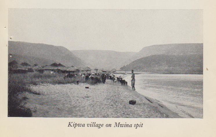
And so Mrs. Gordon-Gallien set off to map the falls and also do what would be a dream trip for me. She had gathered up surveyor J.W. Cornwall and geologist Colin Rose and off they went. They took the train from Dar es Salaam to Kigoma, where they lingered for two weeks waiting for the next boat. During the fortnight there they got the expedition ready but also did a favor to the German authorities and took the longitude of Kigoma, which apparently no one knew. Tell you what man, you kids these days with your GPS. Back in the day you had to wait for a wealthy British lady with cool hobbies to decide to do an expedition to even find out where your own major colonial center and railhead was! That out of the way, they hopped on the MV Liemba and got dropped off at Kasanga to make the final overland trek to Kalambo Falls.
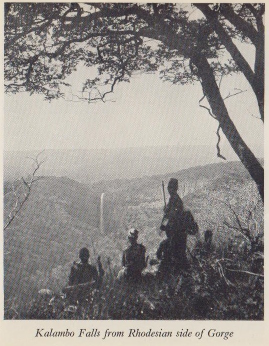
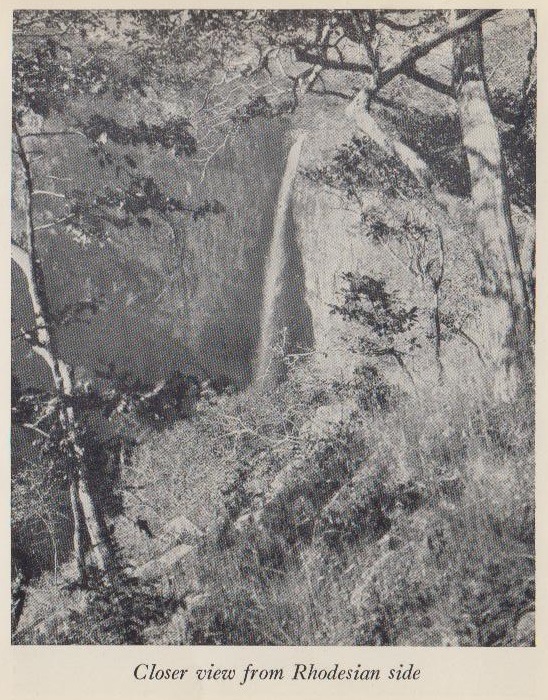
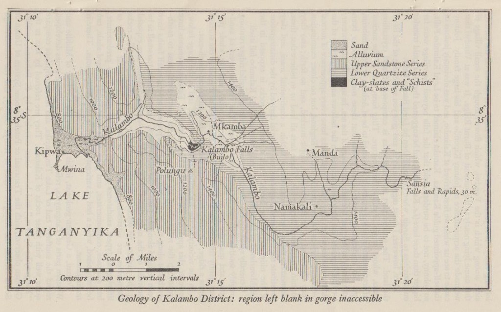
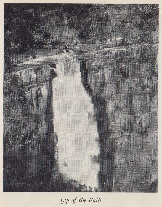
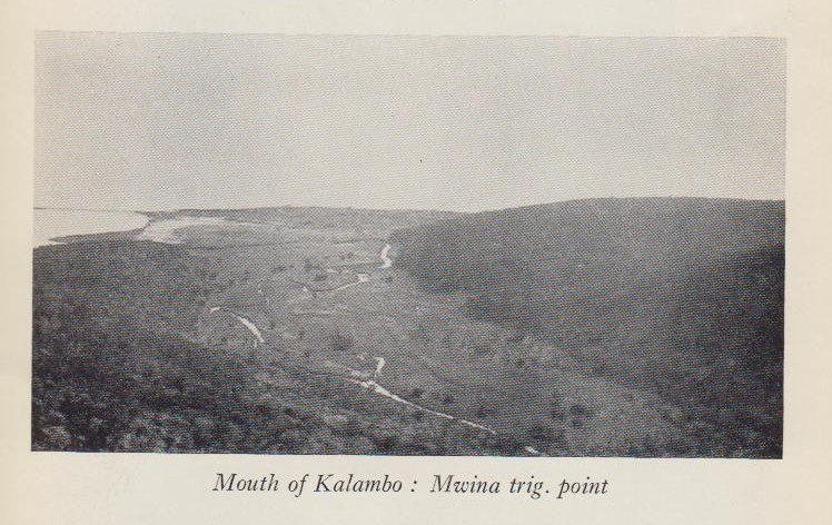
Once at the falls they settled into their work. They set up camp and scouted the area and worked to find the old triangulation points from the border-mapping expedition. They checked out the falls further upstream and the outlet of the Kalambo river into Lake Tanganyika. They climbed to the bottom of the falls and got an accurate height and took pictures of the falls and surrounding areas and, you know, did survey stuff. Pretty cool! The report really is a lively read of measuring various distances and altitudes. They spent a total of six weeks doing this which is a pretty good way to spend a summer I think. There is a whole undercurrent of rivalry between locals Johnny Kipondo and Kanuka, each vying to show their at least informal dominion over the falls area. Also some shade thrown at the German border surveyors for not putting permanent marks over their trig points. Those silly Germans!

When it was time to pack up they did not return to the lake but instead marched over the border to Abercorn (now Mbala). There they picked up a car and started driving back up through the south of German East Africa, coming to the path of the railway again not terribly far from Dar. That must have been a beautiful trip but the description given in the Journal is achingly short. Mrs. Gordon-Gallien quotes J.W.’s journal to describe “Even from the car we saw herds of mpala and duiker, or dik dik; the mpala, slim and graceful, standing for a moment to watch us before disappearing with great bounding leaps…” while the geologist Rose only has time to say that “the sight of the Great Rift Valley lying at our feet will always stand vividly in my memory.”
All in all a very cool story of a very cool expedition led by a very cool woman and you should pop on over to the article linked above to read all about it.


You must be logged in to post a comment.