

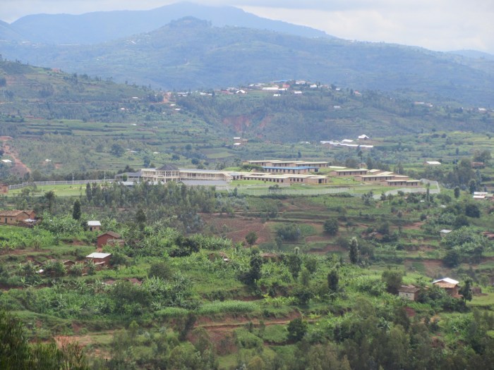
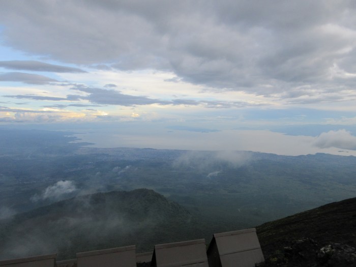
The whole country is picturesque valleys like this.
After sitting in the car for a bit writing down all my thoughts to process them, I drove to Nyungwe. Nyungwe National Park is gorgeous. Most of Rwanda is cultivated. I kept stopped today before the memorial to take pictures of valleys, and they’re all amazing with these patches of farm and different terraces. But then you get to Nyungwe and it is just forest so it is very different (except for the national parks, Rwanda is almost entirely under cultivation). Plus I kept gaining altitude as I went west (or at least the hills are taller and so I guess the valleys deeper) and on top of a lot of the hills the clouds were touching them and seeming to rise from the forest itself. I kept wanting to take pictures but I was trying to get to Uwinka Reception Center before 1300 to make the Canopy Walk on time. It’s a pretty and fun slash scary drive because of all the curves and hills. Later on I passed a truck that had crashed right into the wall of the hill because it didn’t turn fast enough. Better than barreling over the side. The driver was cooking some food as I passed so he’s okay.

Nyungwe.
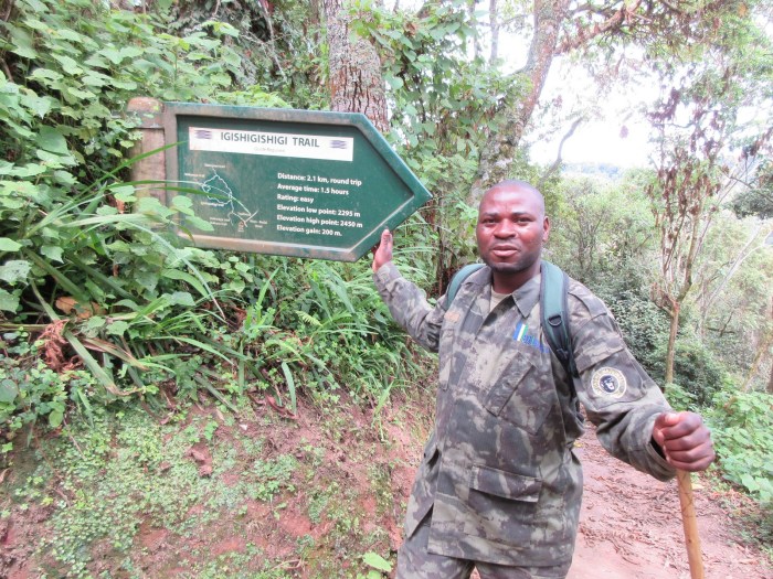
Jean D’Amour
I arrived at the visitor’s center there and arranged to go on the canopy walk tour. It’s overpriced frankly at $60, but I also arranged to see chimpanzees the next day for $90, and what I am telling myself is that chimps is actually a bargain at $150. Anyways. My guide was Jean D’Amour and he was very nice. I was alone; it isn’t exactly tourist high season here. We went down the trail and he told me some stuff about plants and things. He showed me a plant people use as toilet paper because it is soft, and a vine that is taking over the park because only elephant and buffalo eat it and both are extinct in the park. Plus a medicinal tree. Neat. But trouble was brewing. First he ran into a guide that told him the bridge was broken. But, he said, a Canadian was fixing it. Then we ran into said Canadian. He said he was off to get tools and it would be 1-2 hours. Jean suggested we just wait at the bridge. We kept going and then ran into more Canadians. One was named Ian and was very friendly. He told me about cool bridges like this one in Vancouver, and that he had installed a zipline going from the Foxwoods Casino in CT to the Foxwoods Museum, and also that the museum wasn’t doing so hot and only got 50,000 visitors a year despite the casino getting 1,000,000, and the zipline was a ploy to get more. He also said that the bridge cost $800,000 to build and the park gets $500,000/year from it, which is like 8000 something Non-Resident Foreigners. But he also highly doubted the 1-2 hour time estimate to fix it. So Jean made some phone calls and arranged for me to see the bridge the next day, provided it was fixed.

Sex appeal.
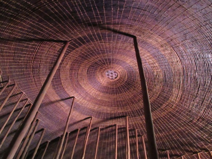
But we went to the bridge anyways because I could go to the first platform (there are actually two platforms and three bridges, with the big center bridge between the two platforms out of commission) and check it out. It was in fact pretty neat. Jean insisted on a like, full on photo shoot so I have 20 pictures of me on and around the bridge.
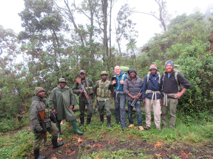
After the bridge I had a nice little lunch at the place. I was heading out and the receptionist guy asked for a lift to Gisikoro and I was happy to oblige. That was pretty neat because he answered some questions in the car. Along the road in the forest there is an army guy stationed every few hundred meters. I figured they were for poachers but he said they were also there because the forest is on the border with Burundi and there is fighting there. So that’s kinda scary? We saw a monkey along the way, and he told me that the name of the swamp in Kinyarwanda means “Swallows Elephants” because back when there were forest elephants in the park I guess they would get stuck in the swamp.

The tea process.
I dropped him in Gisikoro and then went to the Gisikoro Tea Factory for a tour. That was very informative! It cost $10 and I was again alone so I had what I think was the foreman leading me around. The tour was of the processing facility. We went to the loading dock where the tea leaves are delivered from the fields. They are first tested for the proper ratio of good and bad leaves. “Good leaves” are the new tea leaf shoots, so the end of the branch plus one or two leaves. They require 65% of the incoming leaves to be “good” leaves. The other 35% are the “bad” leaves, which are any leaves other than the apical portion. Once they verify the ratio, they go on “withering” beds, which are large beds with screens on the bottom through which warm air is blown. This happens for 12 hours and the leaves lose 30% of their mass from water evaporation. After that they are loaded into bags and onto a hoist system, and then taken to a chopper. They are chopped very finely using first a regular looking cutter and then like shredder wheels. These wheels go so fast they make steam come out of the leaves. The smell in this portion of the process is a lot like fresh cut grass.

Tour guide and fermentation beds.
So the leaves come out into very fine chunks and then go onto these conveyors that use paddles (and speed I assume) to control the heat and there the leaves ferment. They go from green to brown in this step. What makes black tea black is fermentation; green tea is just dried with no fermentation. After fermentation the leaves are dried using a steam drier. Then they are sorted and graded. Apparently tea bag tea is lower quality and contains stems. He showed me a tray with different grades of tea and you could really see the difference. It was pretty neat. We went out back to check out the machine shop which was very nice and used to maintain equipment like the cutting rollers. We also saw the wood-fired boilers that provide the drying steam. They are very large and there were dudes tossing in logs. They made sure I got some good pics. The boilers were made in England and have been operating since 1974.

Tea grades.
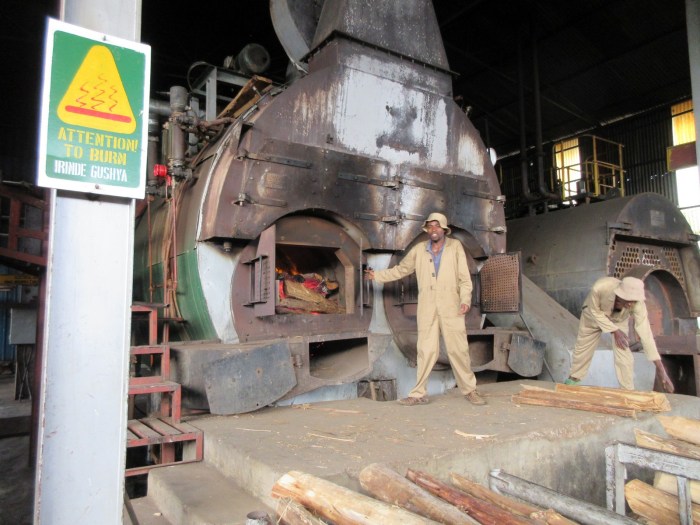
ATTENTION TO BURN. I always brake for boilers.
After that I set off and found a lodge. That involved me driving some places I shouldn’t have, and I very nearly got stuck in a bad spot of road where the necessary wheels of the car were not on the ground. At the lodge I ran into some people that knew a friend of mine, and some other people that climbed Nyiragongo the day after I did, which goes to show that Rwanda is I guess a small country. I spent some time reflecting on how one day could involve seeing genocide victims and then hiking through the most stunning natural beauty of Rwanda, and finish with a tour of a tea factory. Africa is a great deal more complex than most people give it credit for.

Tea fields.


You must be logged in to post a comment.