
 Looking up Itimbwe Gorge. Reading this week:
- Ringworld by Larry Niven
- Zambia: The First 50 Years by Andrew Sardanis
- The Ringworld Engineers by Larry Niven
- The Ringworld Throne by Larry Niven
- Ringworld’s Children by Larry Niven
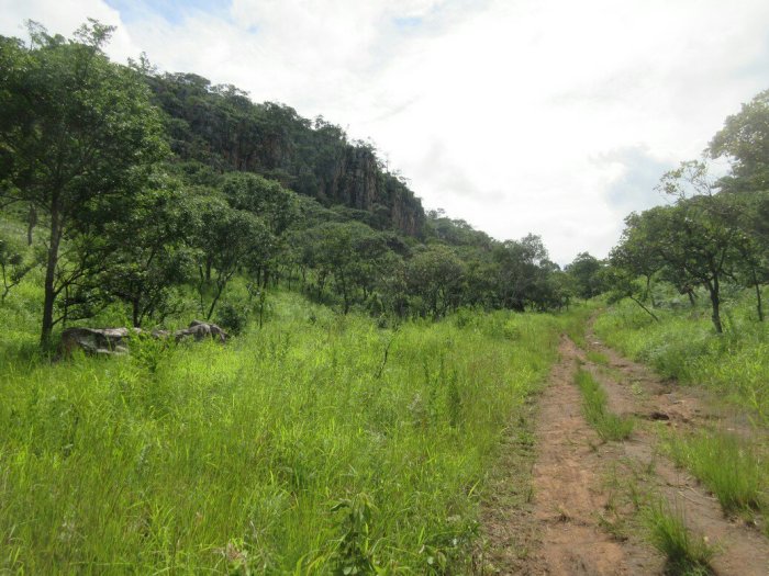
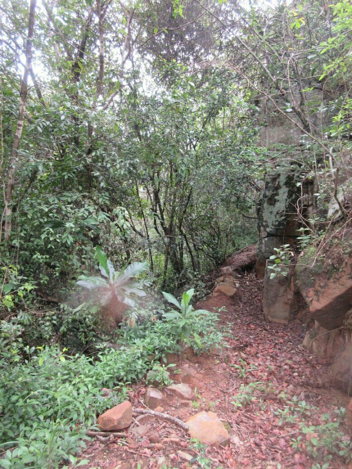
This week I went to go check out Itimbwe Gorge. Itimbwe Gorge is a bit outside Mbala, down a dirt road that is about 6-7km down the Nakonde road past the turnoff. The gorge is the site of several caves that were used by early man. I found out about Itimbwe Gorge via the very useful site Abercornucopia, and specifically this pdf here. This being Zambia, the caves and the gorge itself is unmarked, but by googling some coordinates and asking around for Itimbwe I was able to find it and bike there. 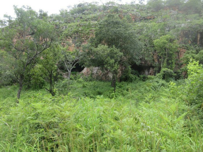 The caves as viewed from the road. Once I made it to the gorge, I found the caves really quickly on the right side as you’re facing downhill, about halfway down the gorge. I actually initially decided these weren’t the caves I was looking for because they didn’t look exactly like the pictures in this pdf. I decided to keep exploring and kept going down the gorge.
 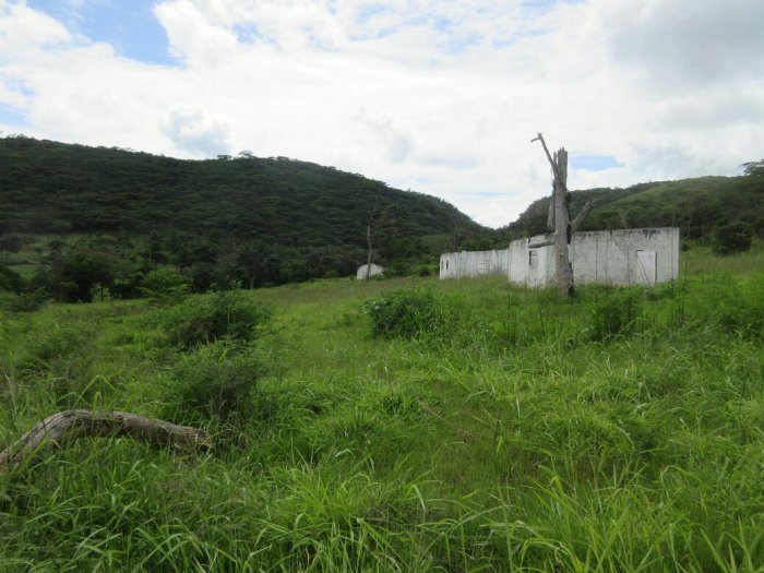 Abondoned farm buildings.
 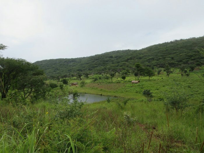 The pool referenced in the first pdf, and the current residents of the valley. At the bottom of the hill I found some of the landmarks referenced in the first pdf (“Notes on Archeological Indications in Abercorn Township and Vicinity”):
The stream formerly running down this gorge now runs underground, surfacing at a small pool near Itimbwe farm house, but water was formerly easily available here and in living European memory the gorge was a favorite haunt of klipspringer and similar small game
The farm buildings were long abandoned, and I figure they must have belonged to white settlers that left sometime after independance in 1965. Continuing my exploration, I went up a path that traverssed the pass between the two points I identified as Malawe Ridge and Kazawa Hill. I turned left and hiked up Malawe Ridge, giving some stunning views of the valley and cliffs. 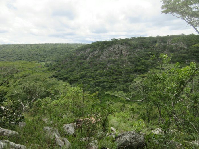 Itimbwe Gorge is on the other side of that ridge.
 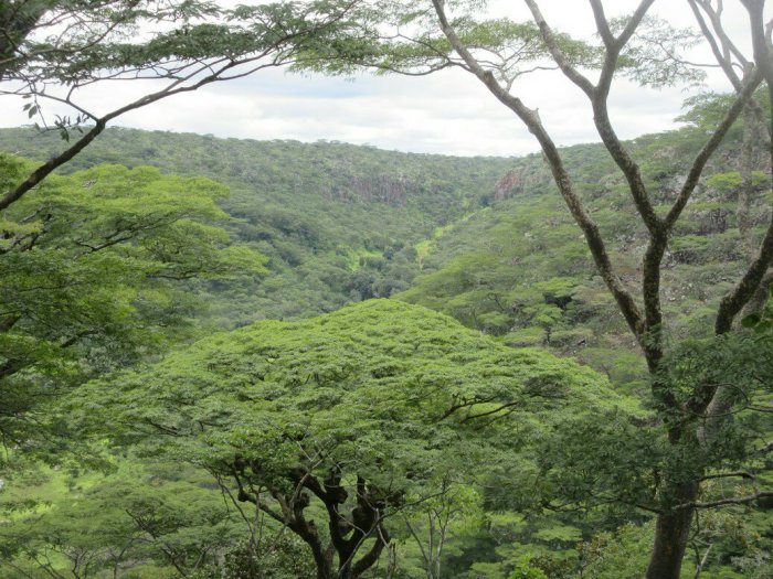 After walking along Malawe Ridge for a bit I descended back into the valley to start heading back up Itimbwe Gorge. The coolest part about living in Mbala is all the history that has happened like right here. Up at Kalambo Falls there is evidence of occupation from 100,000-200,000 years ago, meaning that this region is one of the longest continually inhabited regions on Earth.
  As I descended into the valley and looked around with little evidence of human habitation (well, minus the trails and evidence of annual burning to keep the vegetation down), I tried to imagine the landscape 1000 millenia ago, teeming with wildlife and inhabited by literal cavemen. This area would have provided everything they needed, from water to game to shelter. It’s worth pausing to realize that agriculture is a realtive newcomer to the region, having been introduced by the Bantu people only 1000-2000 years ago. Pulled from my reveries by the realization I had better find these caves and then start heading home, I went back up Itimbwe Gorge to explore the caves. The first two caves described in the pdf wre the ones I eventually explored, but they only mention occasional habitation. The pdf mentions a third cave “at the foot of a high vertical face nearby” in which there are abundant signs of permanent occupation. I never found that cave, but hiking up to one pot that wasn’t cave did give yet another pretty view.
  The cave I did find is described as:
In another rather spectacular cavity in which the strata has weathered away horizontally leaving a long, deep cave in the cliffe face (Its floor some ten feet above gound level) quartz chips are present in the earth filled crevices of the floor but the floor is broken and sliping and thus not very suitable for any but occasional occupation.
They of course mean human occupation, because I can confirm the cave is currently occupied by several bats and one large hawk. Judging by the cup I found in there, it still receives occasional human occupation as well. 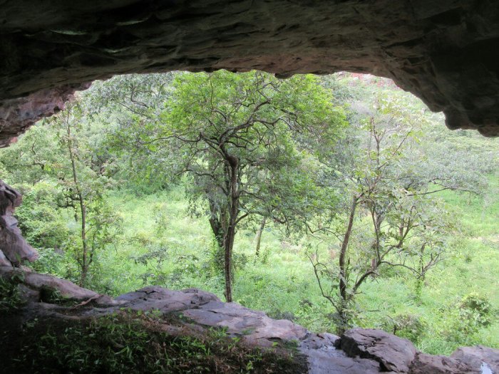 Still, despite it being kinda hard to scramble up the 10 feet, it is easy to imagine taking refuge in the cave, cooking a meal and watching the klipspringer run by. It is pretty amazing to me that all this is within biking distance of Mbala and there’s not even an informational marker saying what this site is. There is so much tourism possibility in Mbala, not to mention the cultural importance of these sites, that just a little development I think could go a long way. In a way that makes it cooler to be able to go out and explore these things, but you wish there were more resources to take care of them properly. After leaving the caves I biked home, running into a rain storm on the way, but overall it was a pretty awesome day.
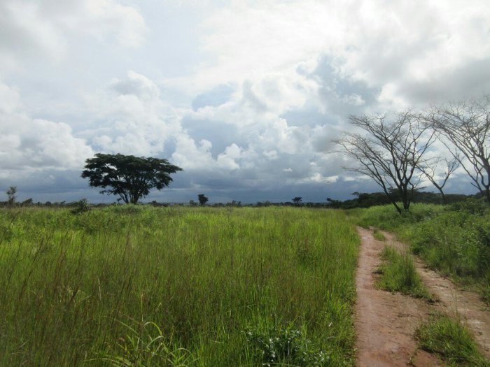


 Continuing along the river, first on top of the ridge and then closer to it, I eventually came back to Isanya Estates. The above picture is a furrow the plantation has dug running off the river, but it looks sorta tropical-y and jungle-y, so I took a picture. With the hike over, I hadn’t really identified any likely locations for the village. I do think it is probably closer to modern-day Mbala than they think, but I don’t have an exact spot. The best part of the hike for me was discovering that these were these deep, beautiful valleys near me. My own valley is less steep (probably why they put a village here), so that is how I think of the surrounding landscape, but I am right on the cusp of the Great Rift Valley. The scenery and geography around here is pretty breathtaking and it is good to get out and take a look.
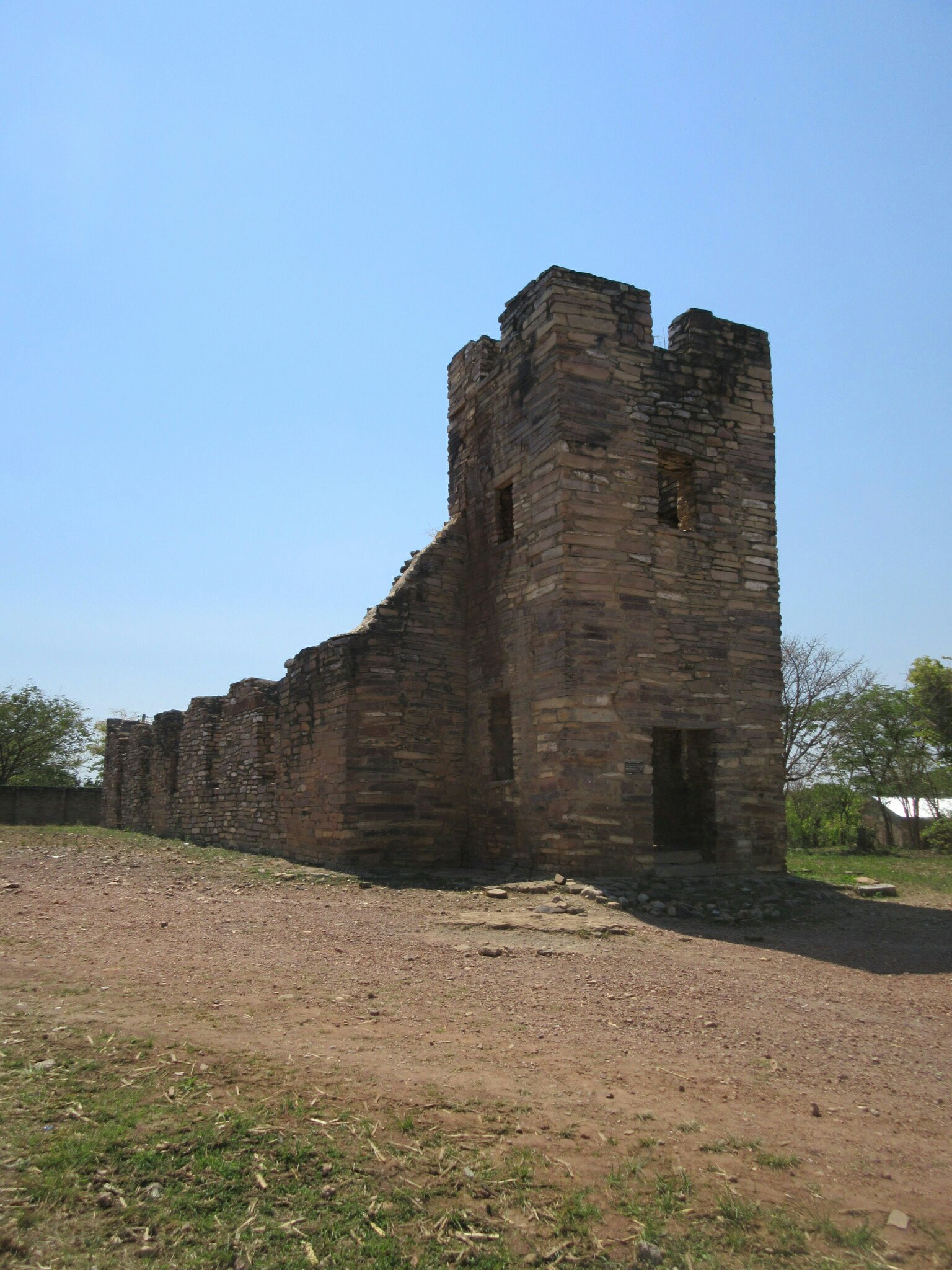
 For Christmas, Lily came up to visit my site in the Mbala area. While she was up here, we went to go visit Kalambo Falls. We stayed at the Kalambo Falls Lodge, which is right next to the falls. Getting to the falls is a 40ish km ride from Mbala over a pretty terrible road, but at least it is a very scenic drive so it’s got that going for it. Kalambo Falls Lodge is pretty new and when we stayed there we were the only two people, so that was neat.
 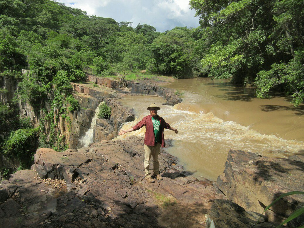 After arriving at the lodge and unpacking, we walked down to the path to start checking out the falls. We were the only visitors at the time. There is a well-maintained concrete path that takes you to various viewing areas and to the top of the falls. Kalambo Falls is notable for being the highest waterfall in Zambia at about 222m. This is far taller than Victoria Falls, but of course far less wide. Kalambo Falls is also the second highest waterfall in all of Africa, and the 12th highest in the world, so, you know, quite an attraction. Kalambo Falls is on the Kalambo river, and forms the border between Zambia and Tanzania.
 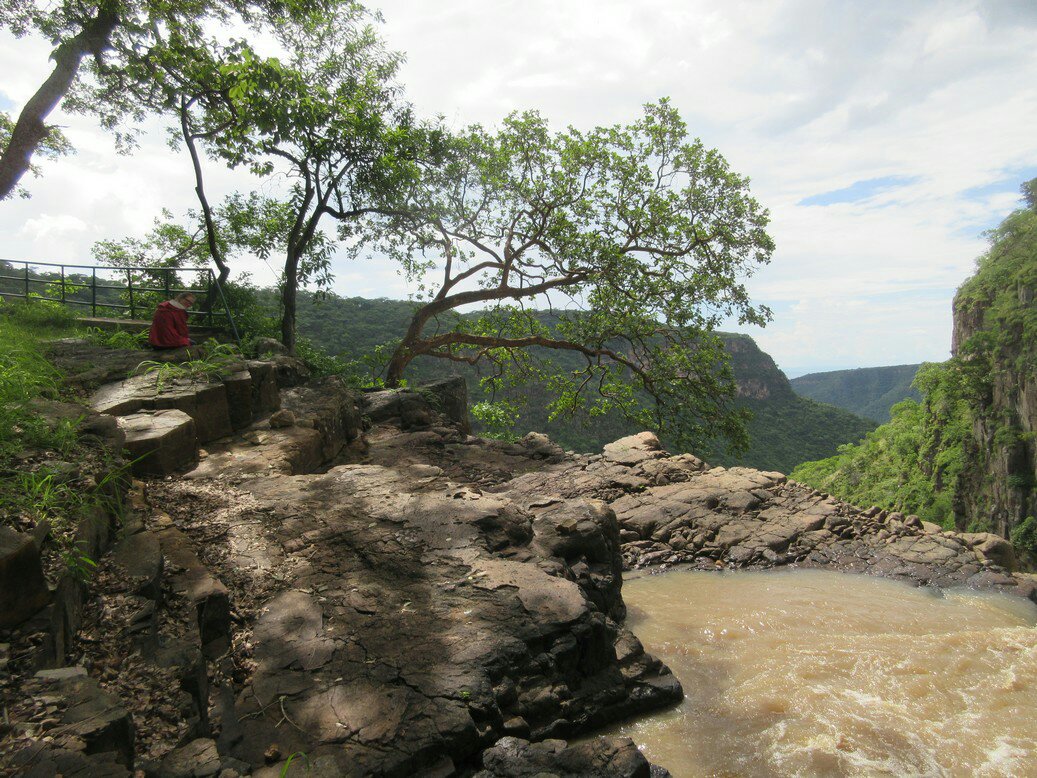 Lily, overlooking the falls and wondering when I’ll be done. Besides its physical characteristics, Kalambo Falls is known for being an extensive archealogical site, with evidence for habitation at least 200,000 years old. I’ve read on other
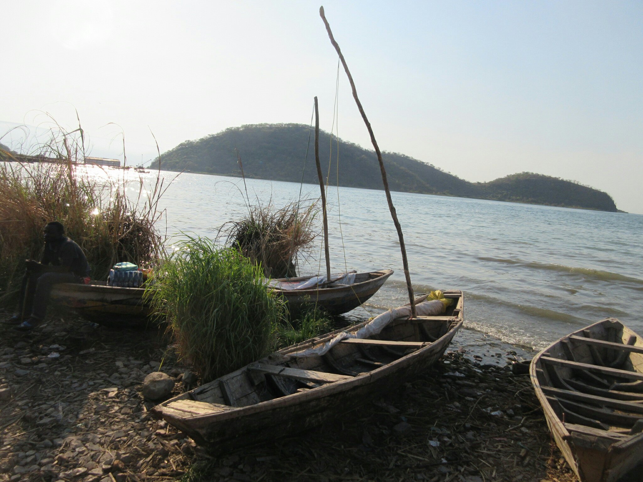
 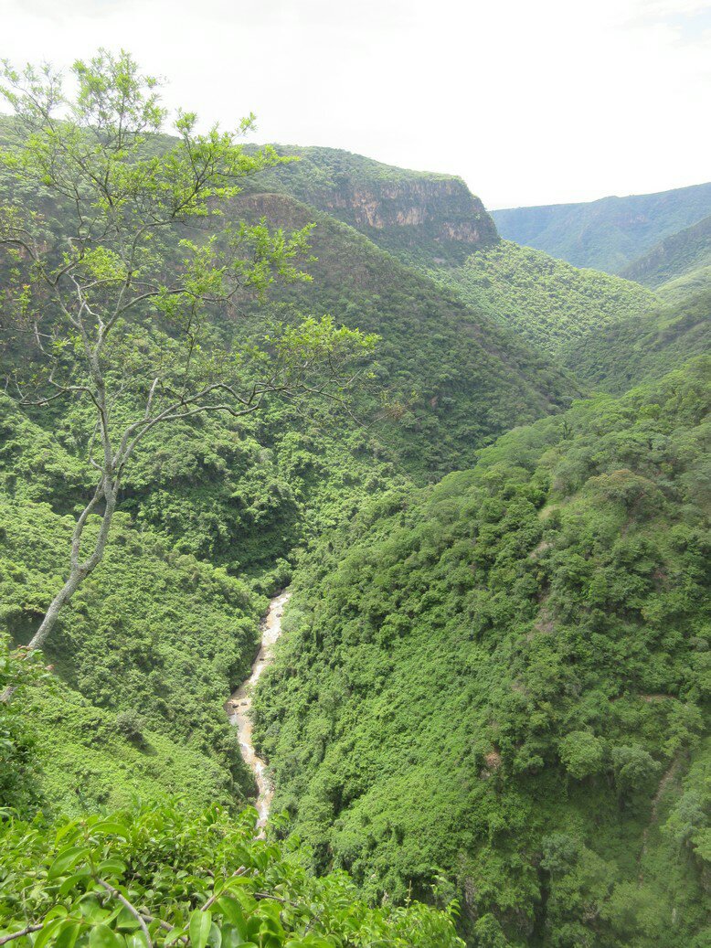 Even without seeing the ancient man sorta stuff, the site is fantastically beautiful. Most people visit the lodge by hiking up from one of the lodges on the shore of Lake Tang, but since we were staying at the lodge we got to see the site in both the evening and the morning. The falls plunge into a deep gorge lined with mysterious-looking jungle. At the bottom, the Kalambo river winds the last 6km to Lake Tang. Standing on the edge looking down at the birds swooping around gives a massive sense of vertigo. There are some baboons in the area (thankfully a lot more scared of people than the Victoria Falls brand) which we managed to catch a glimpse of. Kalambo Falls is gorgeous and I recommend anyone in the Mbala area do their best to go take a look. There can’t be many more places in the world like it.
 Reading this week:
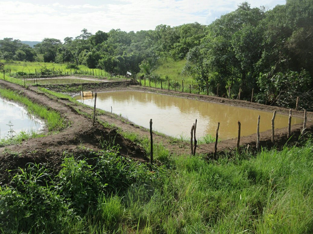
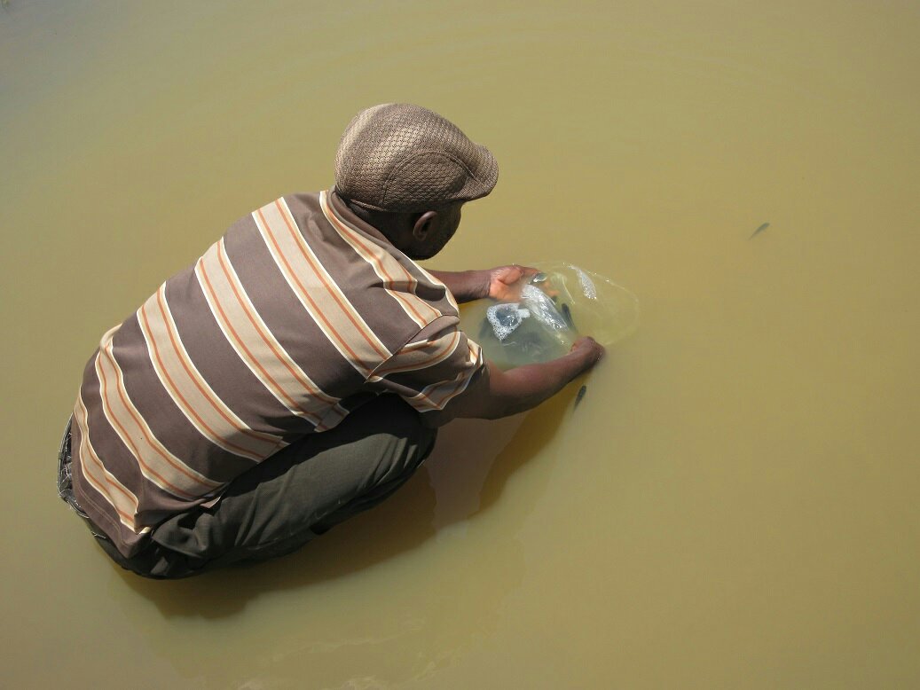 All the ponds have been stocked. The photo above is my host dad stocking one of the ponds. He got involved in an experiment on supplemental feeds. He has been supplied with commercial feed, and also makes his own feed. One pond he’ll provide commercial feed, and the other pond he’ll give the feed he makes. When we harvest we’ll see which fish grew the best.
 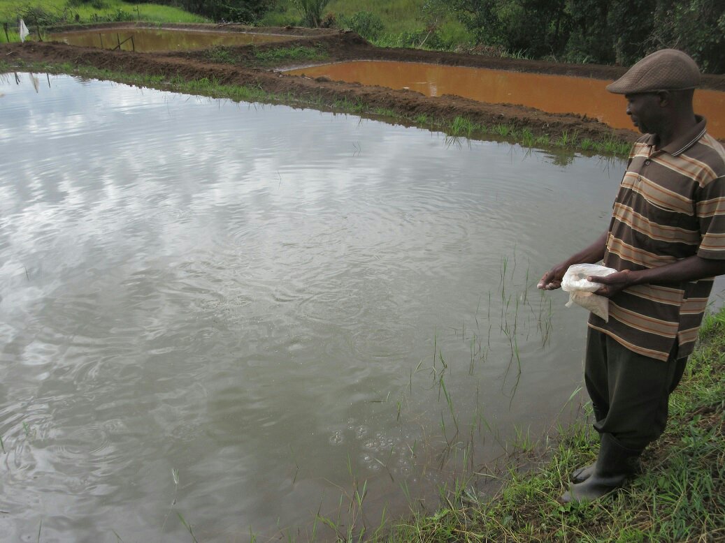 My host dad feeding fish. If I had one criticism of the ponds, it is that they don’t have a very good bloom. With rainy season we are getting more mud and run-off into the ponds, which makes it harder to tell if we have a good bloom and is also not great for the fish. The fish don’t seem to be suffering too much for it so I am not worried, and he’s been good about providing feed so the fish are growing no matter what.
 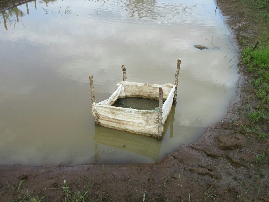 My host dad has been doing a lot of work to improve the ponds. He’s in the process of building a fence around the ponds to keep out predators. He always refers to it as “preventing THE predator,” like there is a particular lizard that is his nemesis or as if there is an alien hunter eating his fish. He also invented the above contraption. My host dad fertilizes his ponds with manure, and the usual RAP suggestion is to put the manure in a sack to place in the pond. He has instead made a basket out of mealie meal sacks and suspended it on four sticks. This has the same effect of holding the manure in a certain location, but makes it a lot easier to add manure just by dumping it in the top. I’m looking forward to harvesting these ponds in February or March and seeing how the fish have grown. At that point we’ll have completed all parts of the fish farming cycle, and both my farmers and I will have had hands-on experience with all portions of it. My big hope is that once people see my host dad make money after the fish harvest, everyone will be exited about fish farming and come to me wanting to stake ponds.
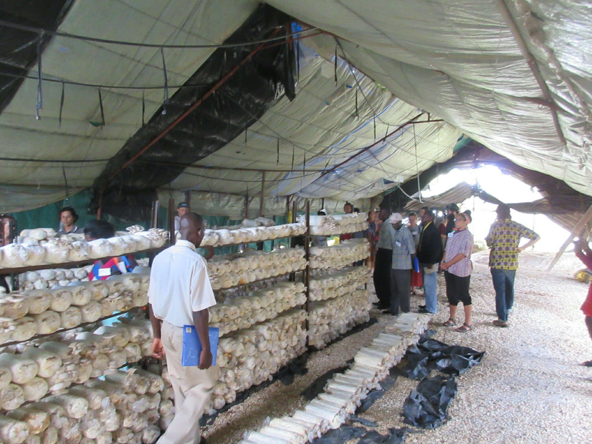 The cultivation center of a model mushroom farmer. Reading this week:
 My biggest criticism of the workshop is that it wasn’t very village-based. They did talk about the technologies you would use in the village, but it was mostly along the lines of “…and if you don’t happen to have an autoclave, you can use an old oil drum!” However, with work, it does seem very possible in the village to grow mushrooms all the way from scratch, eliminating the need to buy cultivated products from China. I am excited to give it a whirl. Maybe once I am back in the States I can use my skills to sell like artisan mushrooms and the local farmer’s market. Hand crafted!
 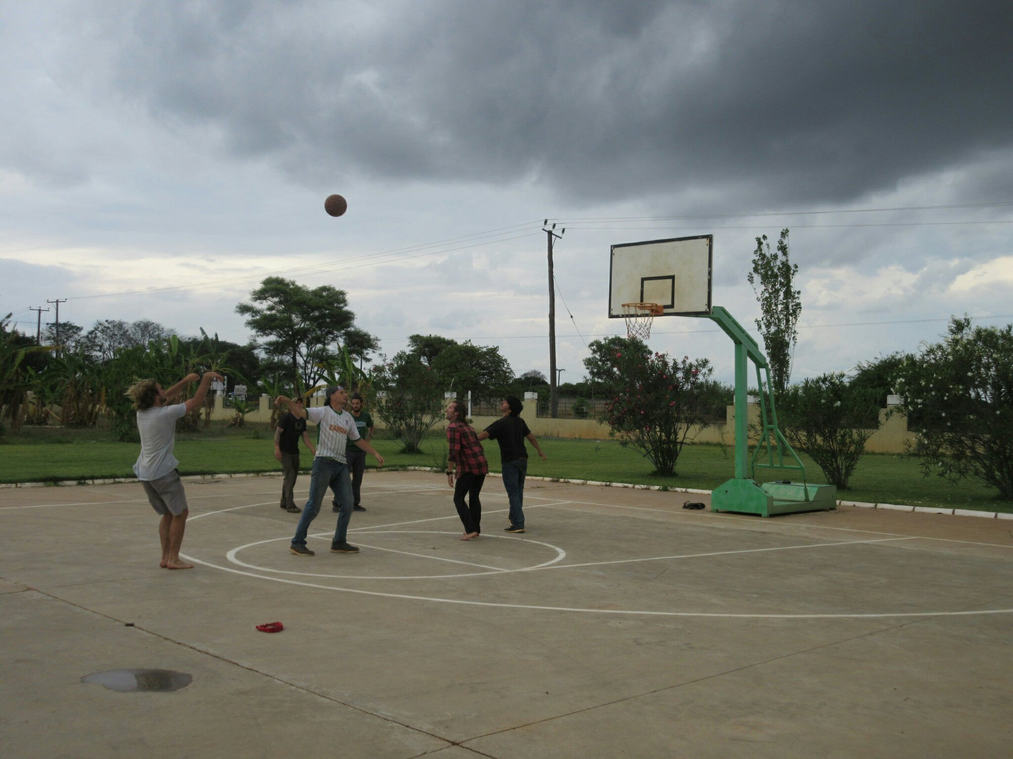 On a final note, the other awesome part of the China Aid research complex is a sweet basketball court. We had driven by the place many times but never seen anyone play, until now. Between sessions there was a pickup game or two, which for any passerbys must have been kinda confusing. But there we go.


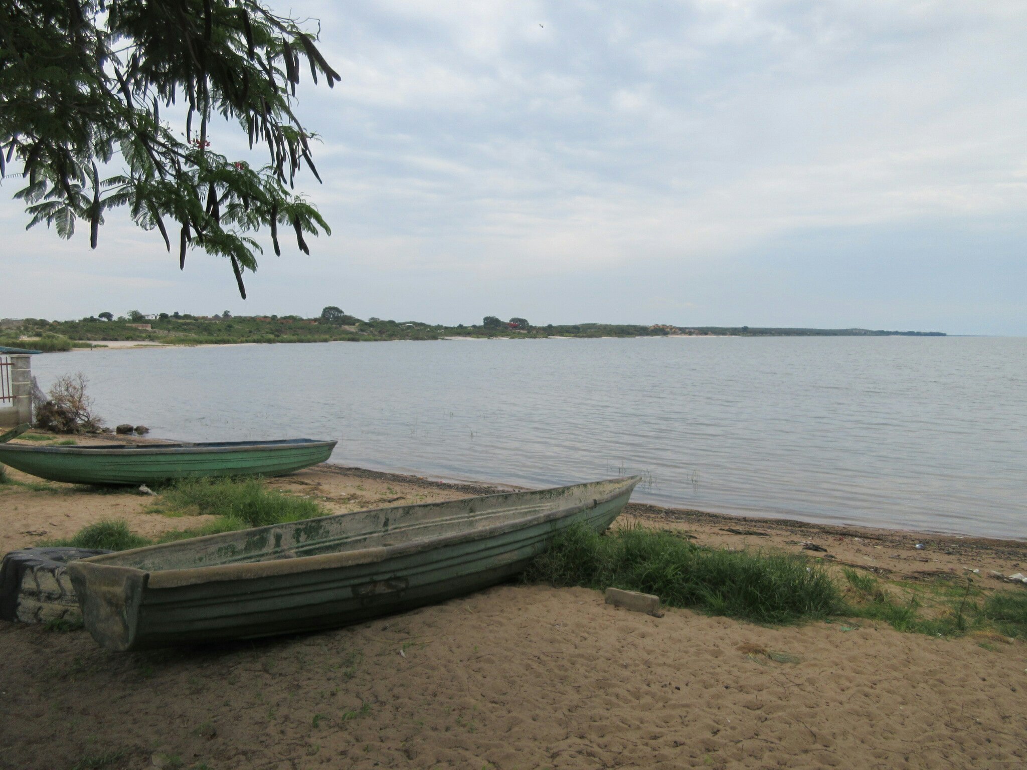
 Ever intrepid, I reasoned that maybe the mighty cryptid wasn’t a fan of surf and sun, and instead I found a patch of jungle and marched right into that. It was quite jungle-y, and full of bugs and trees and some lily pads, but unfortunately there were no flying reptiles.
  Stumbling out of the mighty jungle, however, and conveniently close to a rather nice beach bar, I did run across this canoe. Given the large gash in the side, I reasoned it could possibly have been the victim of a Kongamato attack, given their penchant for flipping over canoes.
 Given the elusive nature of the Kongamato, despite my utmost efforts in finding it, we must conclude that it is very endangered and has possibly suffered habitat loss. I therefore recommend the Kongamato be immediately added to the endangered species list. Thank you.
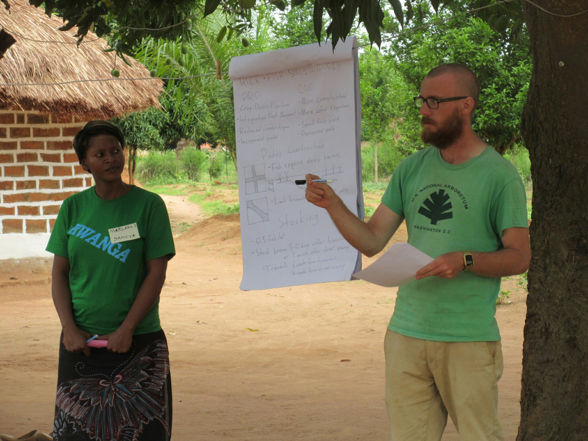
 The JICA rice demonstration was pretty interesting and it seems fairly simple to grow rice. JICA recommends the use of NERICA rice, which stands for “New Rice for Africa.” It is a hybrid of Asian varieties, which produce large yields, and African varieties, which are acclimated to the climate and diseases of Africa. Together, they produce a hardy rice suited for growing in areas where the land isn’t constantly inundated.
  In addition to rice, we learned about a variety of other topics, such as making charcoal from corn husks. Since maize is such a large crop, there are a large number of husks come harvest season. These are usually wasted, but can be converted into charcoal relatively. This requires a longer process than using charcoal made from wood (the corn husks are less dense than wood, and therefore need to be pounded and shaped into briquets to match the characteristics of wood charcoal), but are more environmentally friendly because they don’t require chopping down trees. Overall it was a really great workshop and I learned a lot along with the counterparts and other volunteers. I’m excited to get back up to Luapula to see more of the sights and learn more about rice.

You must be logged in to post a comment.