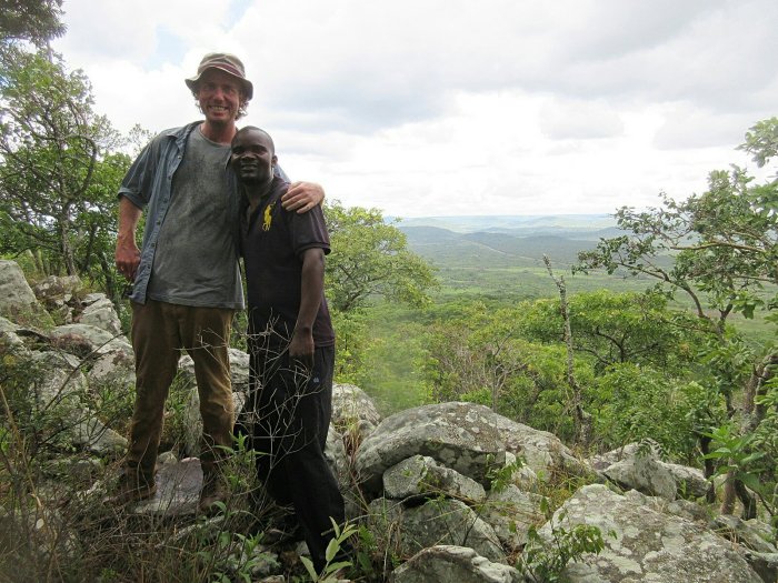
Iron Smelting

Me and the lungu.

The final adventure Katie and I went on during my visit was to visit an iron smelter near her site. I had been wanting to see one of these for a while, and the one pictured above is within walking distance of Katie’s house.

One of the more significant things about the Bantu people is that they were an iron-age culture when they first arrived in the area, displacing the stone-aged bushmen. Being an iron-age culture of course requires iron, and the way you get iron is by smelting it. You smelt it in an iron smelter, called a lungu.

Please excuse the poor quality of the above two pictures (I took them in the museum in Lusaka, where photography, it turns out, is not permitted), but they demonstrate how the iron smelters worked. They were basically tall clay cylinders with holes in the bottom and open at the top. To smelt iron, you layered them up with wood, charcoal, and iron ore. Iron is fairly abundant in the region, and if you have seen any of my other pictures this is evident with all of our red clay. Once you lit this sucker on fire, the intense heat from all the burning wood and charcoal, fanned by bellows leading into the bottom of the smelter, would melt the iron out of the ore and leave it in the bottom of the lungu. The iron could then be taken and shaped into different tools or implements, such as hoes or spear points. The act of smelting itself involved a ceremony with naked men, and women were not allowed lest their presence ruin the iron.

The whole Mbala area is, or was, littered with these lungus. Since they’re really just clay cylinders, it is safe to assume the majority of them have been knocked down, but a few (like the one at the top) survive. They are pretty significant for the region. I’ve mentioned it before, but the tribe I (and Katie) live with is actually the Lungu tribe (close relations of the Mambwe), and it is my assumption that they are named after the iron smelters (a book I have on Mambwe proverbs theorizes that “Mambwe” is actually derived from the word for “stone,” so if I were the Lungu I would play up that rivalry, even though both are Bantu and iron-age cultures). One of the things that struck me about this particular lungu is that it is in the very shadow of Liamba Hill. Liamba Hill is a giant stone-aged tool factory, and in the shadow of it is an iron smelter, the first step in iron-age tool production. That means the whole area has been a fairly continuous center for tool production and industry for literally hundreds of thousands of years. Not too shabby Mbala, not too shabby.

As a final note on my visit to Katie’s, the above picture is of orange-fleshed sweet potatoes she is growing. She grew her original vines from potatoes I grew and then distrubted to different PCVs after I attended the OFSP workshop. Distributing seed to a bunch of different PCVs has worked really well and really got these Vitamin A powerhouses spread out all over Mbala and Northern & Muchinga Provinces. Katie (and others) have gotten their community interested in orange sweet potatoes and she has already distributed vines with more planned in the future. I was just especially proud to see those vines above in person, because they’re like my grandchildren potatoes. Grandpotatoes. They just grow up so fast, you know?

Tanzanian Munada

Entrance to Munada.

Reading this week:

  • The Family Trade by Charles Stross
  • The Hidden Family by Charles Stross
  • The Clan Corporate by Charles Stross
  • The Merchant’s War by Charles Stross
  • The Revolution Business by Charles Stross
  • Trade of Queens by Charles Stross
  • Calypso by David Sedaris

This past weekend I went to go visit my friend Katie, and while I was there she took me to Tanzanian Munada. I wrote about Munada before, but it is just a regularly occuring shopping day that happens once or twice a month in different spots. The vendors, I am lead to believe, travel around so different villages have access to a market day. Katie lives pretty near the border to Tanzania, so it is pretty easy to pop over there to go shopping.

Actually, it is phenomenally easy. The above picture is the border. This is looking towards Zambia from the Tanzania side, and there are no border controls. There is the ruins of a little guard shack further up the hill, but unless the bridge goes out there is nothing keeping people from crossing over. I suppose that isn’t so weird. The people just across the border are, you know, stunningly similar to the people on the other side of the border, both being Mambwe and all. To make things even easier, Munada here accepts both Zambia Kwatcha and Tanzanian Shillings. Handy!

Munada over in Tanzania was a pretty standard affair. Katie tells me it is usually bigger, but it appears in the rainy season a number of the vendors are scared off. Plus it was pretty early on a Sunday, so maybe we just hadn’t hit the big crowds yet. The wares for sale at Munada were pretty standard, but covered just about everything. You need bowls? They got bowls. You need chitenge? They got chitenge. You need second hand clothing? They got it. Animals? Check. Seeds? Fertilizer? Got it in droves. Random electrical components or cell phones? Bro, we got you.

I did like the setup of this Munada though because it had more corridors, which lent the whole thing more of a bazaar feel, which was cool. As we wandered around, we didn’t wind up buying much of anything. They had some neat chitenge, but nothing we were really looking for. I admired a tropical-looking polo, but while it was neat it wasn’t the 20 kwatcha they were asking for neat. We did wind up with some vegetables, and we also bought a watermelon as a treat. Overall it was worth seeing, even if just for the novelty of taking a jaunt over to Tanzania just to go shopping. So a good way to spend a Sunday morning.

Fort Zombe Update

This past week I have been talking with Colin of Abercornucopia, who reached out to the Moto Moto Museum for more information about Fort Zombe. Turns out, it is not an indigenous fort, contrary to the information I had before.

Mary Mbewe, the Assistant Keeper of History (one of the cooler job titles out there) at the Moto Moto Museum forwarded (via Colin) a report she put together on Fort Zombe. She concluded that there was no way the fort was indigenous and was built by the British during WWI. This is disappointing to me, because it knocks several hundred years of history off the structure. As she details in her report, the fort comprises 2km of stone walls, and it rather stunned me that the British would go through all that effort to construct such an extensive fort. I also learned that the fort complex includes trenches on the northeast corner of the hill, which also included a water source which presumably was used to supply the fort.

In addition to the report, Colin forwarded some pages of A History of the Northern Rhodesia Police by Tim Wright. The relevant part of that book detailed that the garrison of Fort Zombe included one company of the Northern Rhodesian Police, armed with two machine guns and a 2.5 inch mountain gun.

I would like to upload the report, but WordPress apparently won’t let me do that. I’ll link to it when Colin posts it on Abercornucopia, but in the meantime let me quote some of the relevant portions:

The fortifications in Mbala were built by British forces at unknown dates but between 1917 and 1918, the period when the war between Zambia and Tanzania intensified… [Fort Zombe] was constructed on a hill called Kalwazi – “foot” in iciLungu – because the top of the hill is shaped like a human foot. The hill is sometimes referred to in the local language as Kamba, meaning camp, for the fact that British soldiers camped on the hill for a considerable duration of time as evidenced by the fortifications. Kalwazi hill on which the stonewall fortifications are found is one of the highest hills of the range of hills in this mountainous area, and was strategically chosen for the fortifications because it has a commanding view of all directions, especially on the side facing Tanzania…

The fortifications comprise an outside enclosure measuring approximately two kilometers all round. These stonewall fortifications were built as a defensive fortress by British soldiers. Before collapsing, the walls of the fortifications are reported to have been about 4 meters high and of considerable thickness. The fortifications have since collapsed.

Inside the enclosure are separate systems of stone fortifications which must have been used as bunkers, sleeping quarters, observation/sniper points and for storage of weapons among others. The inside fortifications are very elaborate and interesting. At several places along the outside enclosure are heaps of stones forming approximately a meter buffer which military personnel whom I took to the site conclude were sniper points. There are at least four such heaps on the
North Westerly side of the camp which is also the side were the German forces were advancing
from.

In the centre of the camp, about 100 meters away from the inside fortifications is an unmistakable remain of a gravesite with part of the tombstone still intact. The concrete slab reads ‘erected by E P Chesnaye, est dist comm., Abercorn.’ The grave belonged to a British soldier who must have met his fate at the hill. The grave was reportedly exhumed by ‘foreigners’ in the 1980s and the
remains of the deceased presumably taken back to his homeland.

One of my friends, another PCV, lives in Zombe (he was on vacation when we visited the fort) and has been told that the last soldier to die in the war here in Zambia died on that hill. Presumably the gravesite in the report is the gravesite of that soldier, whether or not he was in fact the last soldier (European soldier, anyway) to die in the conflict.

Also last week I said that I was unable to identify this large structure in the middle of the fort:

The report has a similar picture to this one and identifies it as a “bunker.” So that is interesting to find out.

I was really hoping Fort Zombe was an indigenous structure to rival Great Zimbabwe and similar structures found farther to the south here in Africa. As a British fortification, it is still a very interesting piece of history, and worth visiting for the views alone. What I said last week about encouraging tourism in the area holds true, I hope the site is better publicized in the future. The report also says that the Zambia National Broadcasting Corporation put together a two-part documentary on the fort, so perhaps Fort Zombe’s fame is well on its way.

Fort Zombe

Me and the headman.

12/30/2018 – Update to this post: It’s not indigenous.

This past Monday I got to visit Fort Zombe, which is one of the cooler things that I have gotten to do, frankly. Fort Zombe is not well publicized, and I only found out about it via the very well done A Guide to Zambia’s Heritage, which is published by Zambia’s National Heritage and Conservation Commission. Allow me to quote the book in its entirety on Fort Zombe:

Fort Zombe is located about 10km from Mbala on the Mbala-Kasesya Road. It is west of Chief Zombe’s Palace and is perched on a high hill overlooking the valley. The site is the only known indigenous fortress built in dry stone walls in Zambia. The site, high and vast is overwhelming to the visitor. One immediately thinks of transfiguration when on top of this historical masterpiece of a compound built in dry stone. Apart from the Iron Age Communities that had settled there several hundreds of years ago, the British Soldiers had also used the Fortress during World War I as evidenced by remnants of battle gear like helmets and bullet shells.

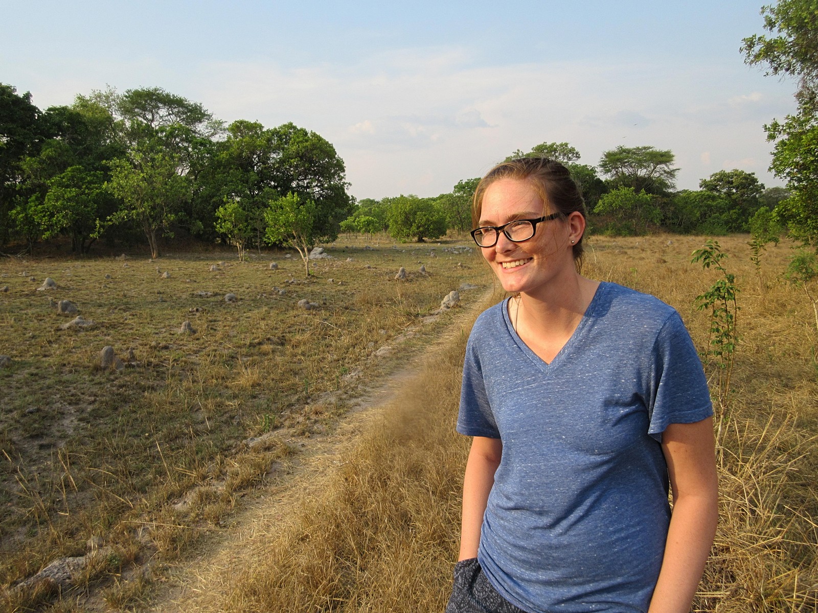
So this is more than a little bit mind-blowing. When you’re talking stone fortifications in southern Africa, the only real other example that comes to mind is Great Zimbabwe. So here in my own backyard is a stone fortress and you’ve never even heard of it. So I roped in my friend Katie and off we went to go see it.

Seeing it is actually not so simple. The first step is talking to Chief Zombe. Fort Zombe is not the original name of the site, which currently appears unknown, and is instead named after the village of Zombe along with Chief Zombe. I don’t think the uh, Zombians were the original builders of the site, because I know Zombe village was at the site were Mbala is now, at least circa the 1870s when David Livingstone visited. But it resides in what is currently Chief Zombe’s chiefdom, and to see it you have to go through him. I happened to run into him at the Centennial, and he gave me his phone number, so when we wanted to see the site we called him and set up an appointment.

We arrived at his palace at about 1000 and greeted the Chief. He invited us inside and served us rice, potatoes, and pumpkin, along with tea which was extremely kind of him. He introduced us to his daughters, including both his firstborn daughter, and the first daughter born after he became Chief. He told us this daughter is the Chisulo, and the first child after becoming Chief has to be a daughter. This signals that the Earth has blessed his chieftanship. If he were to have a son, he would lose the chieftanship. The second child, however, must be a son. But since the chisulo has the blessing of the Earth, if she greets you it is extremely good fortune, and “you will find you become a minister or president!” So watch out world, vote PatInTheWorld for President in 2024.

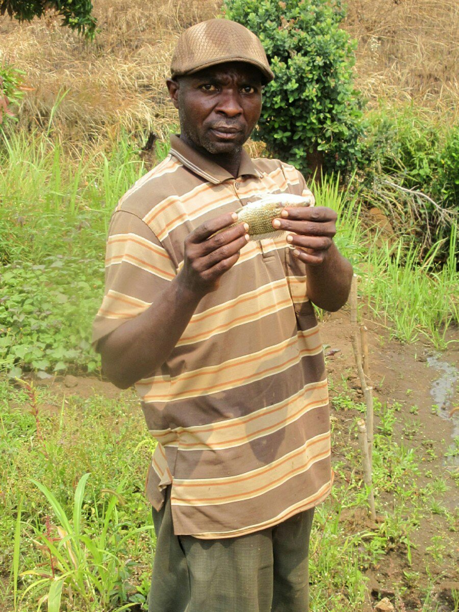
We told Chief Zombe that we wanted to see the fort, and if he isn’t busy the Chief apparently generally likes to take people up himself. He was busy, however, and so he went to the village headman of Zombe village and asked him to take us up. So off we went!

Commanding views of the surrounding valleys.

The fort itself is on top of a hill right behind Zombe village, and is only about a 3km hike, but that is largely straight up the mountain. Walking up the hill, it’s easy to see how hard it would be to attack the fort and why it was built there. The fort offers a nearly 360 degree view of the surrounding valleys, and is a commanding vantage point for many many miles around. When we finally got to the top of the hill, the whole fort was much larger than I expected. From what I could measure on Google Maps, it appears to be a little over 4 acres in total, just within the fortress walls.

The fort must have been designed to house a very large population of people. There isn’t any information that I could find about the original purpose of the fort, but my guess is that it was built to protect against Arab slave raids. The area around Mbala, where I live and where the fort is were all on Arab slave trading routes in East Africa. The Moto Moto Museum has a diorama detailing how during the time of Arab slave trading, people in the area lived in fortified, stockaded villages to protect themselves against attack. My theory is that people the lived in the area got together and built Fort Zombe in order to protect against these attacks. I don’t think people were stationed in there long-term. It is on top of a mountain, so I don’t think there could be a source of water. Hauling water all the way up there would be difficult, and impossible under siege. Food would also be an issue; I spotted a few collapsed stone structures that seemed like they could have been storehouses to me, but they were not very large. I think that when it was evident that a slave raid was approaching, the village could haul enough food and water up to Fort Zombe to hold off the attackers until they gave up and left for less fortified villages.

Walking around the fort, I tried pretty hard to identify different aspects of it. The outside wall as it currently stands is in most places about waist height, having largely collapsed. It is built from stones that look to me like they mostly came from the top of the mountain, so people weren’t hauling building materials all the way up. Besides the walls and the “storehouses” I mentioned, there was a large structure in the middle of the fort that I couldn’t identify. At one end there was a circular section with a depression in the middle, and then a long, thinner section (pictured above) running for maybe 20-30 yards. I asked the guys showing us around, and they said it was a “house,” but I don’t think that is right. My only other guess is some sort of water storage, but that is a long-shot guess.

A section of the wall.

Our guides, and a section of the wall running into the distance in the back.
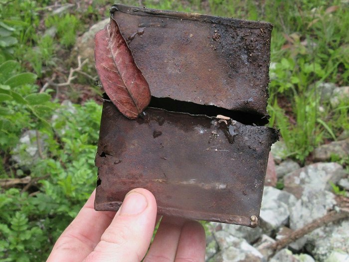
Evidence of WWI?

The most recent use of Fort Zombe was during WWI. Chief Zombe related to us how during WWI, British soldiers took advantage of the existing fortifications and commanding view and used it as a Fort to keep an eye on the Germans approaching from German East Africa. They have apparently found helmets and bullets on the site. As I was walking around I found the above tin can sitting on a wall. I like to believe it is evidence of WWI rations, but I guess it could be more recent. But maybe it’s from WWI! I put it back.

Katie, our guides, and myself probably spent about an hour wandering around Fort Zombe. I wish there was more to know about it. I haven’t heard of any archeological research into the site and it is quite phenomenal. I didn’t even know there was a stone fortress in Zambia, and it turns out it is right here in my backyard. Chief Zombe taking such a personal interest in it means it is important to local heritage, but nearly all history about it has been lost. The area has to be such a great opportunity for an archeological dig to find out about how the local people protected themselves and, if I’m right, the effects of the Arab slave trade in this area. If Zambia were to invest in making it more accessible, adding a walkway to it, and putting up some signs, it could be a major attraction in the area. I hope more people visit.

Gardening This Year

The whole shebang.

Reading this week:

  • To a God Unknown by John Steinbeck

The rainy season appears to have finally begun in earnest so it is time to do some gardening! The above picture is mostly all of my available gardening space. Last year my gardening started with just a few sunflowers, but pretty soon the project snowballed and I had taken over the whole yard. This year I felt like I couldn’t back down from what I did last year, so I did the whole yard again. This actually gets me a lot of credit; because everyone farms or gardens here, me having a somewhat sizeable plot earns me some street cred.

This year I wanted to mix it up a bit from last year. However, orange sweet potatoes are of course a necessity, so I have planted about half the yard with vines just this morning. Of the half of the yard that is sweet potatoes, about half are the same variety that I grew last year (“Olympia,” I think), and half are a new variety we got this year, called Chumfwa I think. That wasn’t super intentional; I just didn’t harvest enough Chumfwa vines down by the ponds and I was too lazy to go back. But some of the vines from last year grew back and so I just used those as seed. This picture is a few of the ridges I just planted; it doesn’t look like much right now, but promise there are some vines in there and it is gonna be like, so many potatoes:

In the rest of the yard I have planted groundnuts, soya, and pigeon pea. The groundnuts I planted literally just to make Jimmy Carter comparisons. Of all the things I planted so far, they’re actually doing the best, and I am excited for a nice big harvest. Gonna boil, mash ’em, and stick ’em in stews even. The pigeon pea I am growing because it grows into a nice big tree and I am excited to have a whole forest of it in the yard. I intercropped it with both the groundnuts and the soya, so hopefully those ripen before the pigeon pea has grown to its full height. The goats will of course probably tear down all the pigeon pea by the time the rains are even over, but until then I can dream of my pigeon pea forest. The soya I decided to grow to encourage other people to do the same, as it is a great source of protein, and way more profitable to grow than maize. All three of these crops should also do a lot to put nitrogen in the soil, and I am hoping that next year when they plant stuff their minds will be blown at how well it grows in my (then former) yard.

The groundnut/pigeon pea/soya beds.

Finally, on the other side of the house I have a small garden, currently in need of some weeding. There I am growing garlic, which is going like gangbusters, and carrots, which have just sprouted. In just a few months I am going to be able to make a super awesome sweet potato, ground nut, pigeon pea, carrot, & garlic stew. I didn’t bother to put a fence around the tinier garden this year, because it did nothing to stop the goats anyways.

Two beds of garlic in the middle (the left one I planted much earlier), with one of the carrot beds in the background and weeds everywhere.

And finally for dessert? Pineapple. As it turns out you can just grow more pineapple from the top of another pineapple, I decided to plant pineapple this year. Unfortuately, turns out it takes a few years for it to fruit, but in the meantime I hope it will look pretty cool. I also hope it will root; I just planted it today after letting it dry out for a bit (per the instructions). Once it roots I’ll plant it over in the garden with the garlic and carrots.

My pineapple with some moringa in pollipots my host dad planted behind it.

My garden here has been my biggest project for the past few weeks. I tried to get an early start this year but some ill-timed events somewhat delayed me, and most recently a week long dry spell put a damper on planting activities. Hopefully now rain is pretty consistent and everything will grow quickly. Just gotta keep it all weeded, and it’ll be legumes for days.

WWI Centenary Commemoration

The cenotaph decked out in flags.

This past weekend I got to witness a once in a lifetime event, the WWI Centenary Commemoration here in Mbala. Ever since I figured out that I would be living in Mbala district on the 100th anniversary of the end of WWI, I’ve been looking forward to this event. For those not in the know, WWI actually ended here in Zambia. Although the armistice was signed in Europe and went into effect on November 11th, 1918, it took some time for the news to reach Zambia (then Northern Rhodesia). Fighting ended on November 14th when General Von Lettow-Vorbeck was handed a telegram informing him of the armistice. A monument marks the spot where this occurred on the banks of the Chambeshi river, about 100km south of Kasama. British forces then ordered him to march his troops to Mbala (then Abercorn) for the formal surrender. That took just shy of two weeks, so the formal surrender ending WWI in this region was signed on November 25th, 1918.

I tried to encourage as many PCVs to come as possible to come to this event. Since centenaries only come every 100 years or so, it was a unique opportunity to witness it. As well as it being important to commemorate the sacrifices Zambia and other African countries have made, I figured it would be a lot of fun and I am always eager to show off Mbala. In the end we had 18 PCVs make it up here, including some from as far away as Southern and Northwestern Provinces. A good chunk of us showed up the night before the Centenary, because according to the schedule I got from my host dad, there was supposed to be a cocktail party and fireworks. Both of those events were a bit of a bust but we had fun anyways. In anticipation of the cocktail party, everyone dressed up as well as they could, all of us being Peace Corps Volunteers that live in mud huts. But we looked good and what we lacked in tailoring we made up for in enthusiasm. First we swung by the Golf Club which I had never been to before. The Mbala Golf Club has a good vibe and I recommend it. While we were there we spotted some armored vehicles over at the Yacht Club, so we went over there to check them out, but by the time we arrived they had left. We had a few drinks anyways. Back to the Golf Club where we watched some live music and had a good time. We asked if we could play, despite none of us knowing how to play any instruments, and they seemed enthusiastic but it never quite happened. At the appointed time we went over to the Cocktail Party at Lake Chila Lodge only to find out that it wasn’t happening. We had our own party anyways. Fireworks also happened, but two hours late, and by that time we were all in bed.

A whole lotta Chiefs.

The next day dawned very bright and very hot and after breakfast we assembled at the cenotaph to watch the ceremony. This event was the most crowded and most colorful I have ever seen Mbala. They really pulled out all the stops. For a few months we had been watching them spruce up the roundabout that contains the cenotaph. The day of however, the whole area was filled with flags from around the world. Several tents had been set up to shelter the hundreds of Chiefs and other dignitaries that had assembled for the event. The crowd was huge and it was hard to jostle for a spot. I eventually settled into a spot next to the dignitary tent, which had a relatively good perspective on the cenotaph and the stand where President Lungu was going to deliver his speech. It was hard to see over the crowd, but I am so glad so many people were so excited to come and witness the event.

It took a little while for all of the dignitaries to make their arrival. There were various ministers and the service chiefs of Zambia’s armed forces. Representatives from a lot of organizations came, including from various Commonwealth soldier organizations, the German military, and General Von Lettow-Vorbeck’s grandson even came. The ceremony kicked off with prayers and an invocation, and then the centerpiece of the ceremony, which were a series of wreath-layings. President Lungu laid a wreath, and then many many more wreaths were laid by the many representatives in attendance. Then it was time for speeches.

Wreath laying at the cenotaph.

The first speech was by General Lord Richard, who is a former Chief of British forces and was representing the African Rifles Association. He outlined a lot of the events of the war, and detailed the roles of Africans in the conflict and the hardships they suffered. He also commented on the wider world not forgetting the conflict here in Africa. After that was the Provincial Minister for Northern Province, talking about the legacy of the war in the area. Finally, the keynote address was given by President Lungu. Unfortunately, his microphone was broken and we couldn’t hear him, but according to news articles he spoke about the sacrifices people made, and how he intends to increase awareness of the contribution of Zambia to the conflict by making sure it is covered better in school textbooks.

President Lungu addressing the crowd.

At about this point we ducked out because it was hot, we couldn’t hear President Lungu, and to beat the crowds. After getting some lunch, most of the rest of the evening was spent relaxing again over at the Mbala Golf Course. We found a great spot fairly near the bar but overlooking Lake Chila (confusingly labeled in the banners around town as “The Lake Chila Mystery”). Good times, great friends, and an historic moment. I am really glad I got to see the Centenary and I hope that the wider world gets a better perspective on Africa’s contribution to WWI. I didn’t know anything about it before coming here, and still a lot of my PCV friends are confused as to why Germany was even in Zambia (despite me droning on about it like every chance I get). It is well worth remembering the hardships that Africans had to suffer as colonial forces fought a European war, and I am glad Zambia pulled out all the stops to commemorate the event. Can’t wait for the next one in 2118.

Chillin’ at the Golf Club.

Northern Tourism Expo

This week as I was in Kasama to have Thanksgiving dinner, I also went to the Northern Province Tourism & Investment Expo. This is an event being held in tandem with the centenary commemoration taking place in Mbala to mark 100 years since the end of WWI in Africa.

I was pretty excited to go to the expo to see what all they had. I couldn’t really muster up any enthusiasm from anyone else to go, but I managed to drag my friend Noah there. He’s glad he went! I had high hopes for the expo because I had high hopes for Northern Province; this expo is supposed to attract a lot of development and investment to the province so I was rooting for its success. Frankly I was worried it was going to be a slightly larger district show, with booths made out of grass and sticks and people displaying beans. Many people did display beans but the whole expo was really big and really amazing.

At the expo there were several very large tents filled with booths like any other expo you would go to. There was a healthy mix of different things being displayed. In the photo above are the different district booths, where different districts showed off their wares. I was surprised to find out there are gold deposits in Northern Province, and one booth had a demonstration of traditional salt making processes. There was locally processed palm oil and other agricultural products (those beans) and it was cool to see how much stuff is up here.

Besides booths for the district, there were booths for different business that operate up here in Northern. Noah and I, both being RAP volunteers, were interested in a lot of the aquaculture stuff. Above is a picture of a mobile hatchery that was at a booth manned by one of our RAP technical instructors, so that was cool. Everyone at the expo was pretty enthusiastic about talking to us, despite just being two schmucks wandering around. We got whole in-depth explanations of how the local water purification process works from the Chambeshi Water & Sewage Company, and the government’s Weights & Measurement and Consumer Protection Bureaus gave us run-downs of everything they do.

A booth from the Ministry of Tourism & Arts demonstrating the wildlife of Northern and showing the seized possessions of poachers.

Walking around the expo we picked up a lot of literature people were excited to hand us, and we both bought some really sweet matching shirts from the Ministry of Tourism booth. I’m excited to wear it to the Centenary Celebration. I think the expo did a really great job of showing all the tourism and investment opportunities here in Northern, and the organizers must have worked really hard to make sure the thing went off so well. I really hope it brings a lot of investment to this province, which could really use it. But the opportunities are here!

Kasanka Bat Migration

IMG_0611

Reading this week

  • The Consuming Fire by John Scalzi (I meant to take more than a day on this one)

This past weekend my girlfriend and I went to go see the Bat Migration at Kasanka National Park. The bat migration is the largest mammal migration on the planet. So it is very worth going to. The bats of the bat migration are the straw-colored fruit bat. They come from all over Western Africa (not just the DRC, according to our guide) to feed on the musuku fruits that abound near Kasanka at this time of year. Somewhere in the range of 8-12 million bats all gather in the park. The most remarkable part of it all is that all those bats choose to roost every day in a very small portion of the forest in the park, only about 1km long by 400m wide. So every day in the morning and in the evening the bats all return to and fly out from the same patch of forest, giving a hell of a show.

Most volunteers when they go to see the bats choose to camp, but I decided to splurge and stay in the lodge for two nights. It was a pretty nice experience. The meals were included and we got some extra activities thrown in. We arrived on Friday in time for lunch. Wasa Lodge, the lodge we stayed at, is right on Wasa Lake, which is a small lake about 12km into the park. Besides the bats, Kasanka is known for its wide variety of birds and for its sitatunga. The lodge being right on the lake gives a good opportunity to see both, especially from the porch of our chalet or from the dining area.

IMG_0549

A sitatunga pokes its head above the grass by Lake Wasa.

That evening we went on a Wasa Walk, which was a hour or so long walk around the lake; it isn’t a very big lake. Going around the lake makes for a pleasant walk. We saw some puku, which are everywhere, and had some good looks at some birds. We spotted some elephant tracks, and then next day we got to see an elephant walk through the lake and enjoy some grass.

IMG_0426

Lily on the lake walk.

Our first bat experience was the next morning. We woke up at 0315 and were served coffee and tea at 0330 before bundling up and heading out to the blind at 0400. It was pretty chilly that morning but they gave us blankets for the ride out there, which Lily really appreciated. We got to use the BBC blind. It’s called that because it is the blind the BBC used when they came out to film the bat migration. The blind has two levels, with the highest being at least 40 feet above the ground, near the top of a tall tree into which it is built. This put us right at eye level with the bats returning in the morning.

IMG_0488

Bats returning in the morning to their roosts. My camera lens has a scratch right in the middle of it which is distressing.

For both the evening and the morning, the bats start at a trickle and slowly build up to a whole gigantic amount of bats just streaming to or from this patch of forest. When it really reaches its max amount you’re left thinking like, man this is a whole bunch of bats. And then it just keeps going for another 30 minutes or an hour, which bats just going at a constant stream. In the half square kilometer or so of the forest, some 3 million kilograms of bats wind up roosting, which is something like the equivalent of 550 elephants. 550 elephants all flying through the air and then roosting in trees. I am astonished there is enough fruit around to feed them all.

After watching the bats all return to their roosts, we went back to the lodge just in time for breakfast. The morning was spent napping and listening to the hippos grunt in the lake. Not a bad way to spend the day. After lunch and at about 1600, we got ready again to head out for the evening experience. We had more company this time, and we all gathered in a hide at the other side of the forest. This hide wasn’t as tall, but was in the flight path of the bats so we got to watch them all flying overhead and were relatively close to them. I even saw a bat flying with a baby clinging to her belly; that’s gotta be tough flying around with a baby strapped to you.

IMG_0625

Bats streaming out to the surrounding forests to feed on fruits.

Again it is just so many bats. Half an hour in you’re thinking “man they gotta be about done” but then they just keep coming. It is quite an experience and if you find yourself in Zambia around November or December quite worth going. After our evening bat experience it was back to the lodge. We decided not to do anything the next morning and had a leisurely breakfast before heading out to the gate to hitch back to our sites. Now that I’ve seen the world’s largest mammal migration, I suppose the second largest one would just be a bit lackluster.

Fish Harvest

My host dad gazes upon the fruits of his efforts.

My host dad finally did a fish harvest this week. I had been in town for most of the day submitting some paperwork. After returning, I went down to the ponds and was surprised to find a harvest in progress. Two of my host dad’s ponds had been part of an experiment with Scaling Up Nutrition (SUN) comparing commercial feed and home-made feed. The ponds have been stocked for the better part of a year but I guess they finally got around to harvesting l them. I suspect I didn’t get told it was going to happen because my host dad didn’t get told either. Either way, I am glad they finally harvested the things.

The channel is in the back corner with the net keeping fish in the pond.

The first step in harvesting is to drain the pond. This makes the whole process a lot easier. The fish wind up concentrated in the bottom of the pond, and there is less water to wade through as you drag the net through the pond. Plus, after harvesting it is better to let the pond dry for a week or two before filling it back up with water. That kills off frogs and unwanted fish that can burrow into the mud. Draining the pond is accomplished by cutting a channel in the wall of the pond, and a net is used to ensure the fish don’t escape.

The trick is to make the kids get muddy while you stay on the bank.

After the pond is drained, it is a pretty simple affair of dragging the net through the pond. This harvest yielded about 20kg of fish. Frankly, that’s about 1/5 of what you would really hope for. But these ponds
have been suffering from predators due to their proximity to the river. I kind of suspect if they had harvested after 6 months instead of a year they would have gotten more fish. There are also more steps that can be taken to help prevent predators from eating the fish, and this should maybe spur my host dad into taking those steps. I don’t feel too bad about it all since SUN provided the fingerlings and my host dad got fish out of the deal. At about 20 kwatcha per kg, a 400 kwatcha payday isn’t the worst.

I told him to pose with the fish. I got this Blue Steel look.

I’m really glad we actually got to do a pond harvest while I was here. My host dad’s other ponds are ready for harvest too, but aside from occasionally harvesting a few fish to eat he has been mostly keeping those as a future source of fingerlings. I don’t think that’s the greatest strategy, and I’ve told him that, but they’re his ponds after all. But we harvested some fish we ate some for lunch the next day, so that was cool.