Paperwork enthusiast seeking new frontiers of paperwork. Former submariner, former Peace Corps Volunteer. Opinions, thoughts, and comments reflect no actual persons, living or in the Navy.
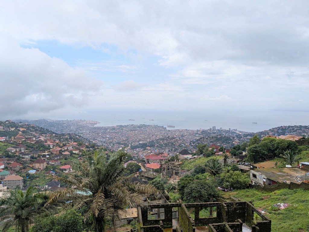
Towards the bottom of the peak, looking north-northwest over downtown Freetown and King Tom
After an embarrassingly long time we finally went up Leicester Peak!
To be clear it only took us like 30 minutes to walk on up to the top. So that was not embarrassing, but given it is just a 30-minute hike my point is why didn’t we do this earlier? Leicester Peak is, by a significant margin, not the tallest mountain in Sierra Leone’s Western Area. I have only just learned that the honor goes to Pickett Hill at 888 meters above sea level. I had thought it was Sugar Loaf mountain, which of course I previously climbed up, but that seems to only be about 735 meters. Leicester Peak is only about 565 meters. However what it lacks in height it makes up for in proximity, looming over Freetown. Elizabeth Melville in A Residence in Sierra Leone described the mountain as “bleak,” though that seems unfair.
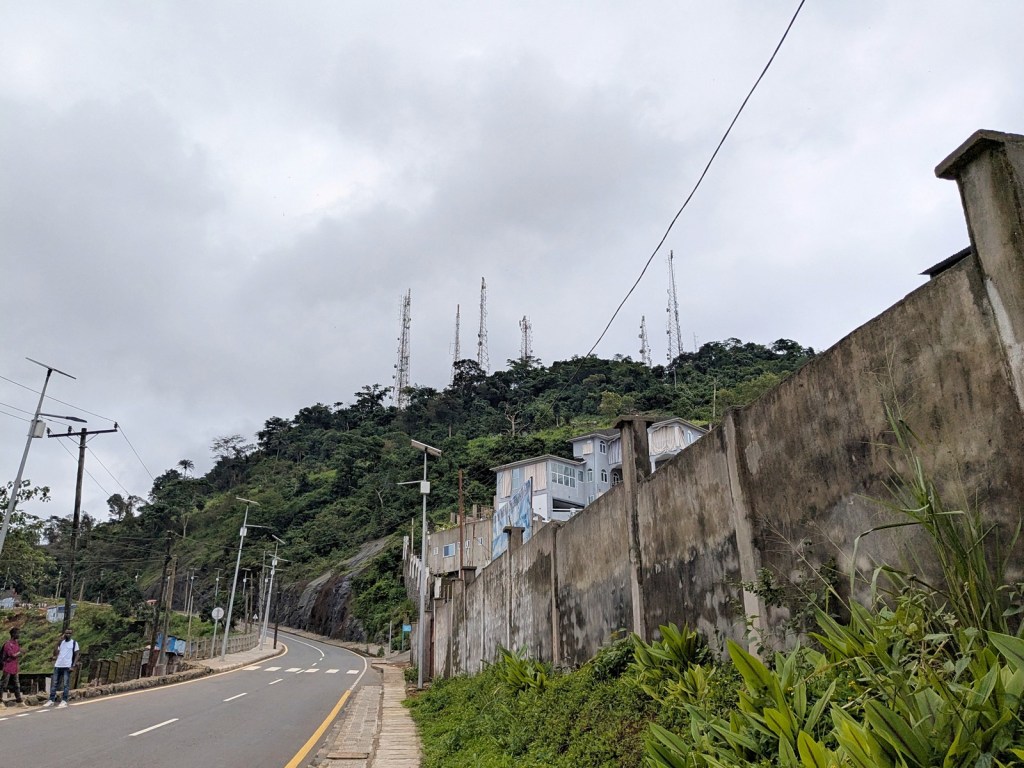
Looking up at the transmitting station
A major part of the reason we had not hiked up Leicester Peak during our time in Sierra Leone is that for much of our time it has been a construction site. The World Bank is leading a tourism development project for the mountain, the main focus of which is the construction of a large viewing platform at the top. This Youtube video shows the site under construction (and welcomes potential vendors). As you can see it is going to be really nice when it is done. It would have been exciting to see it finished, but alas we will have left Sierra Leone before that is the case.
Since the viewing platform is still under construction, we couldn’t actually get to the very tippy-top of the mountain but a major advantage of the project already is that they have paved a very nice road that winds it way around the mountain. It’s got a lovely sidewalk which makes for an easy trip. And although you can’t get quite all the way to the top, the views are lovely nonetheless, the trip up providing a view in every beautiful direction of Sierra Leone.
Looking northeast over the town of Leicester and up the Sierra Leone river
The photos in this post are in altitude-order, starting at the bottom and proceeding to the top. We did the walk/hike just this past August, so still in the midst of the rainy season. It was sunny when we started though as we reached the top a cloud started rolling in, obstructing our view a bit. Oh well. The biggest impact of the cloud rolling in though is we did get misted on a bit. I have been doing all this reading about Victorian explorers with all their opinions about how intense sun or dampness affects their health and maybe it has affected me. After being slightly dampened by this early afternoon mist the rest of the day I felt weak and hot. Not even a good cuppa put me right. Or maybe I am just more out of shape than I thought, who knows.
Anyways, if you are in Freetown hike or at least drive up Leicester Peak, the views are beautiful. And I am excited to see what sorts of things get installed at the viewing platform. It will be a magnificent sight.
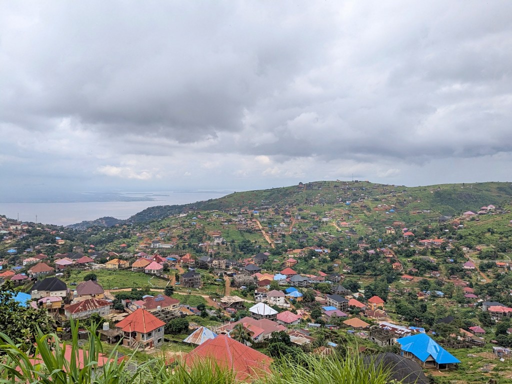
Looking south-southeast toward the town of Regent, with the Western Area National Park to the right
The Histories by Herodotus, translated by Tom Holland
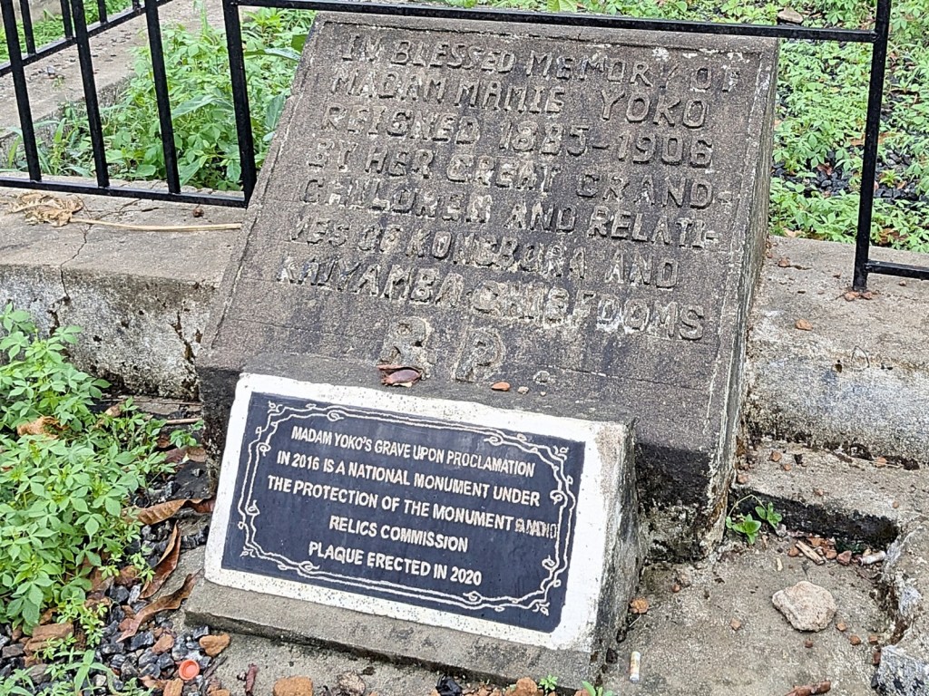
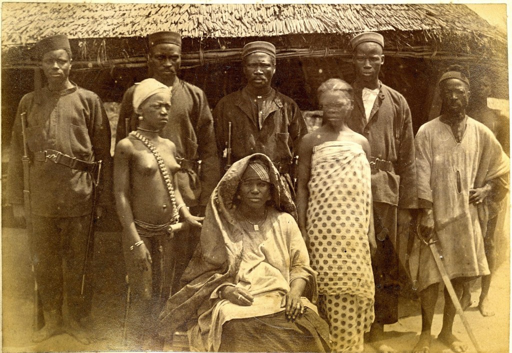
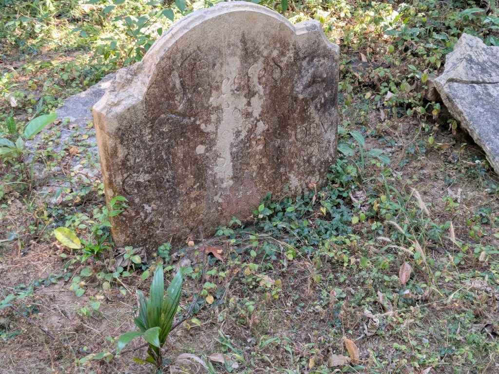
Last weekend (less than a year ago now as I am writing this), I went off to go visit Madam Yoko‘s gravesite!
Madam Yoko is in the pantheon of Sierra Leonean heroes. I mean that roughly literally; she is in the book Sierra Leonean Heroes: Fifty Great Men and Women who Helped to Build Our Nation. That book was published in 1988 during the presidency of Major-General Dr. J.S. Momoh (as he signed the foreword to the book) in order to bolster national pride. You can read Madam Yoko’s entry in the book here. Potentially a controversial figure to be exalted as at least some of her power derived from a cozy relationship with the British (the exact opposite of Bai Bureh, also on the above-linked page), but hey we are not here to debate that, we are here to take a road trip.
Speaking of Bai Bureh, I had initially contemplated going off to visit his gravesite, but I think it is in fact in a sacred grove that takes some arranging to enter. Plus it is up in Port Loko, one of the few general areas I had at least driven through, and going down to Moyamba gave me a chance to check out someplace new. I still have not travelled nearly as much as I would have liked within the country, and the rainy season is fast approaching (again, as I write this), so I had to go out and see things while I had the chance. Madam Yoko’s gravesite, as far as I could tell, was accessible, even if no one had been kind enough to pinpoint the exact location. Until now, anyway, because it is exactly here: 8°09’28.2″N 12°25’46.9″W.
Also, a quick note that whenever you see a photo of Madam Yoko, it is the one taken in W.J. Johnson’s studio and published as a postcard c. 1906. It is the one used in Sierra Leonean Heroes, for example, and also the German Wikipedia page (though not the English one). But there is another photo! The British Museum has it (surprise surprise). It is right here and depicts Madam Yoko in 1889, which was the Hut Tax War and so was before Queen Victoria gave her the medal she’s depicted with in the post card:
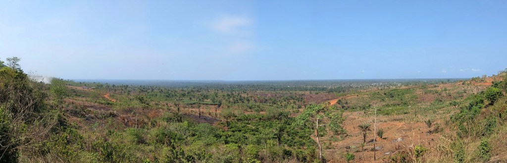
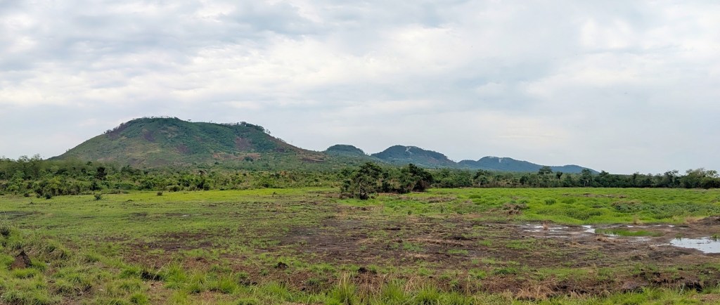
Anyways so to go find the gravesite I set off relatively early in the morning and had a very lovely drive. Driving up-country in Sierra Leone, between major cities anyways, is a pleasant experience as they have very nice roads and very little traffic and the sites are just stunning and gorgeous. I took several opportunities to hop out of the car and just take photos of the landscape, which the camera can never capture, but here is my try nonetheless:
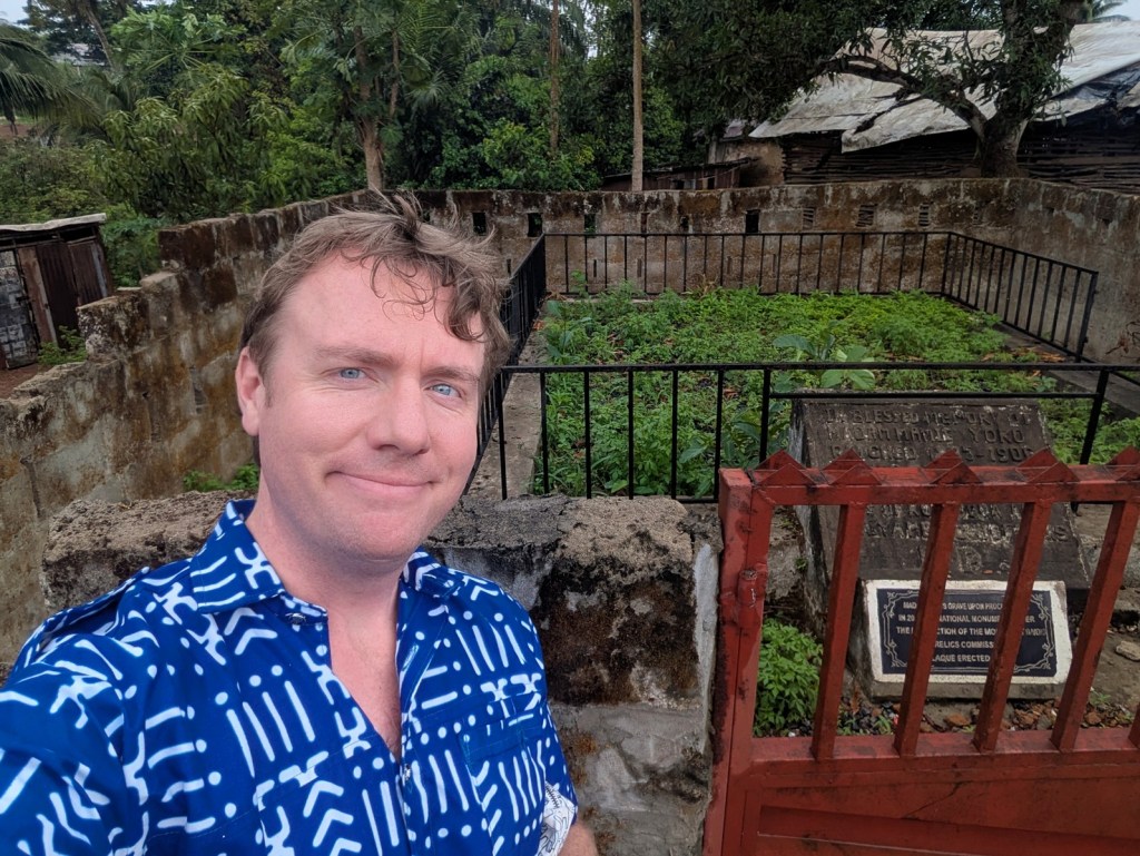
All in all from Freetown the trip to Moyamba took about three hours. I only made one wrong turn, because I hadn’t noticed that the town of Moyamba Junction is the junction for Moyamba and you need to make a right there, but I noticed my error pretty quickly and turned around and made what was now a left turn instead of a right turn. And then I pretty quickly came to Moyamba and started my hunt. I had pictures of the grave itself and a brief video courtesy of Gary Schulze, but neither gave a great amount of context clues. I knew though it was in “the market,” so I started off by driving around the town to spot “the market.” My plan was to park somewhere likely and go around on foot, but I was somewhat quickly thwarted by rain. So that kept me stuck in my car for a while because despite the looming rainy season I hadn’t thought to like, bring any rain gear. I tried to tool around in the car for a while looking closely for the gravesite and eventually became paranoid that I was looking suspicious.
So then I tried to ask some people. The nice man at the gas station, Olu, told me he was familiar with the place (I showed him the photos), but his directions didn’t quite pinpoint it. I was briefly led astray when a nice lady I asked thought I was just looking for the graveyard and pointed me to the edge of town. The graveyard was there but Madam Yoko wasn’t. By this time I was starting to despair a bit; I would have to start making the drive back home soon. I finally decided to make one last go and pulled into a place that I thought was a closed government building but turned out to be an operating car wash. This however was a stroke of luck because when I showed the two kids who wanted to wash my car the picture, they knew exactly what it was. I asked if they could take me there instead of washing the car, they were game, and so off we went!
Turns out I had driven past the gravesite a few times. As I eventually divined from the pictures, the gravesite had a low wall around it which obscured it. But the kids took me right up into the market there and led me to it. And uh yeah that was it. I took some photos, happy to have reached my destination:
And um yeah with that there wasn’t a whole lot else for me to do in Moyamba. I gave the kids some cash for their troubles and we head on back to the car. I contemplated lunch but the weather was turning a bit and I thought I should start the drive home, so off I went. I wasn’t in so much of a hurry that I didn’t stop to take more landscape photos:
This country really is just so gorgeous. And especially with the rains starting a bit and things starting to get green the forests and hills are just dazzling, and the views from even just the road monumental. There is also shopping to do. I picked up a mortar (which did not come with a pestle, so now I don’t know where to get one of those) and later on closer to Freetown picked up some rather large baskets my super amazing wife especially liked. So that all was pretty successful. I did also run into some traffic on the way back:
A thrilling conclusion to a very fun adventure. I just enjoyed having a reason to go out on a drive in Sierra Leone, and I always like pinpointing monuments and landmarks that haven’t yet made it onto easily accessible maps. And I met some very friendly kids who were willing to play tour guide, so that is a bonus. If you’re ever in Sierra Leone I can’t say that the gravesite itself is worth the drive from Freetown, but seeing the countryside certainly is.
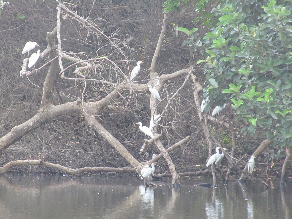
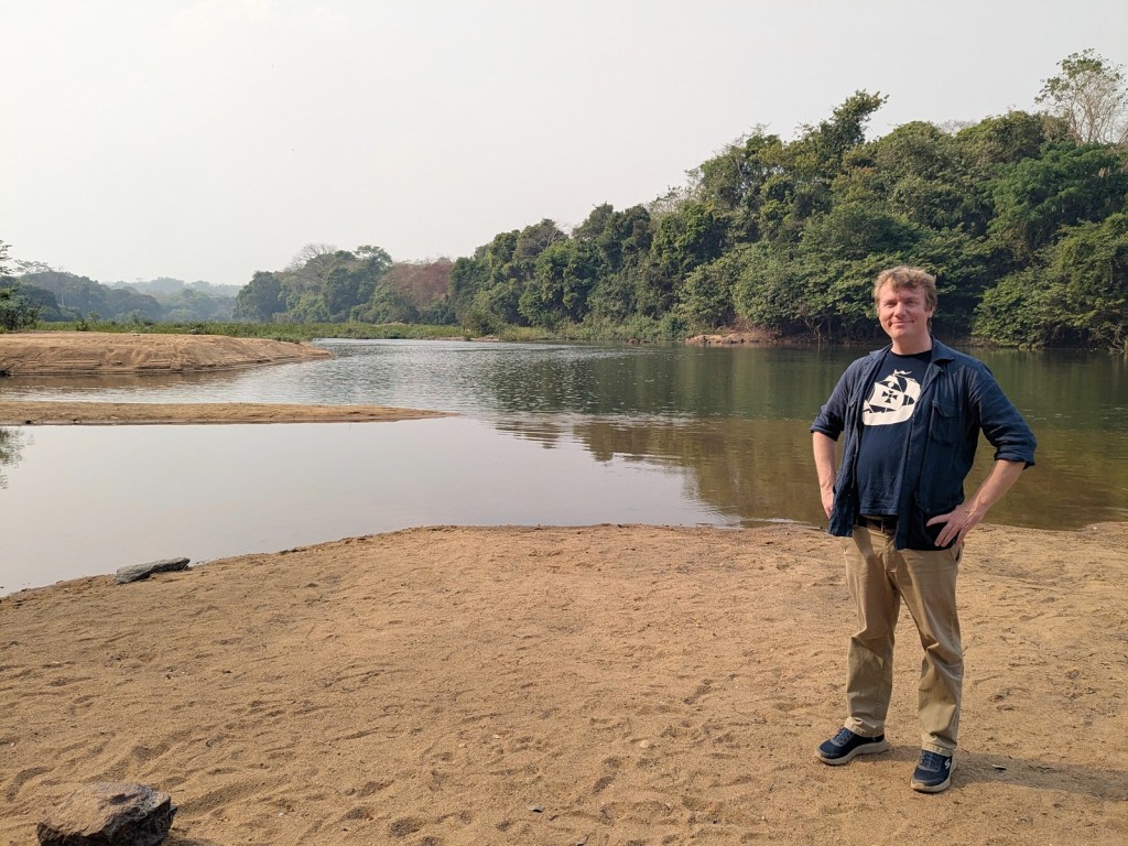
The big draw of Outamba-Kilimi National Park are the hippos, specifically the pygmy hippos (though can they be a big draw if they’re so small). In our outline for this safari the plan for the morning had been originally to hike Karangia Hill for the sunrise. But the previous night our intrepid boat captain had told us that the best time to see the hippos was in the morning, so the first part of our full day in the park was instead spent on the river.
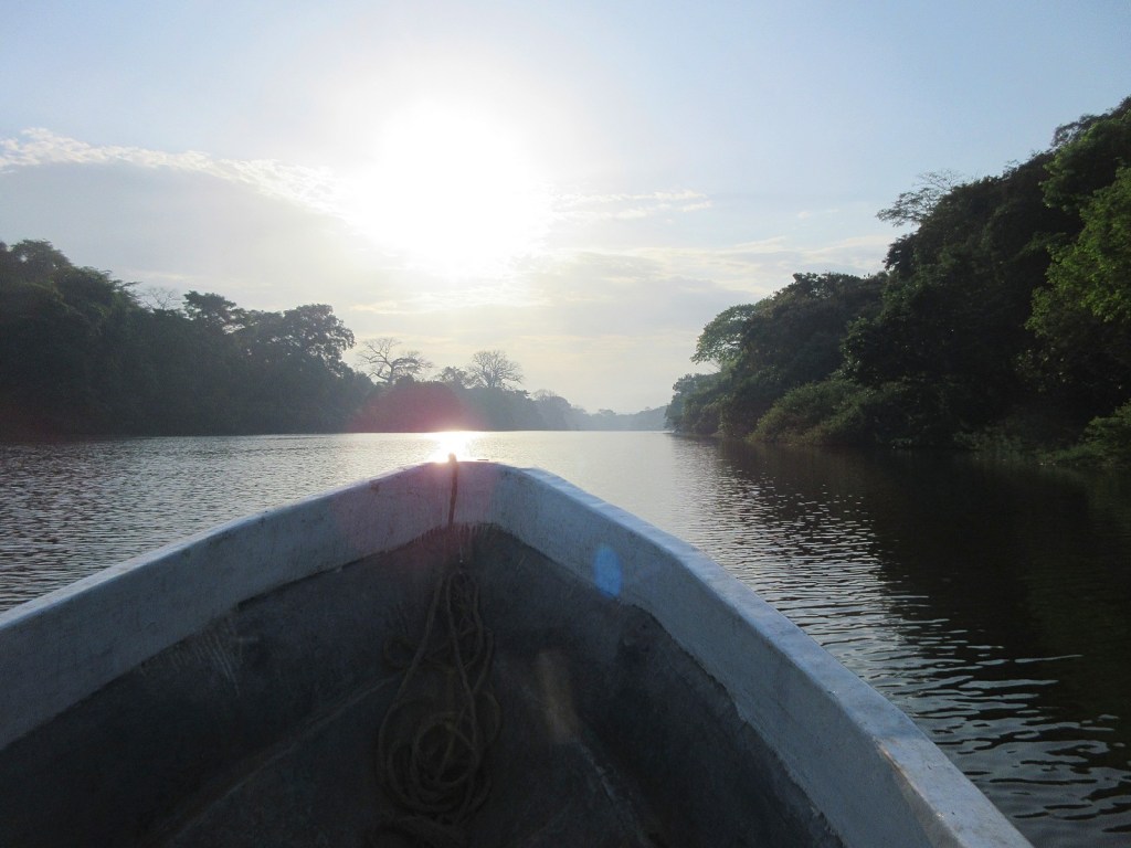
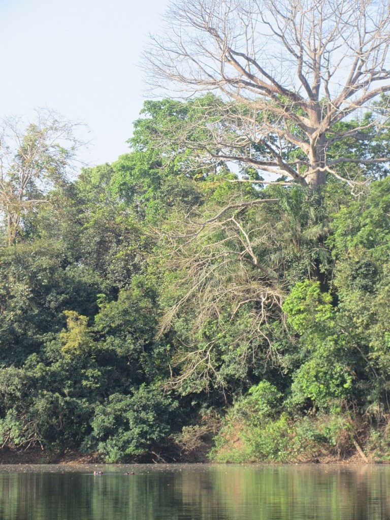
It was not a particularly early start. We woke up (for the final time anyway) later than we had expected and then were served a massive breakfast each of us could only really nibble at. Our just-referenced intrepid boat captain Mohamed had said the best time to set out was at 8, and so at the appointed hour we got into the very sturdy fiberglass craft (courtesy of Tacugama) and set off. It reminded me of the boat trip to Aguateca, but much less speedy. It was very pleasant though. We just cruised along the river admiring the sights. Along the way we passed a camp where a local family had set up for a while to fish, and saw some birds and admired the trees.
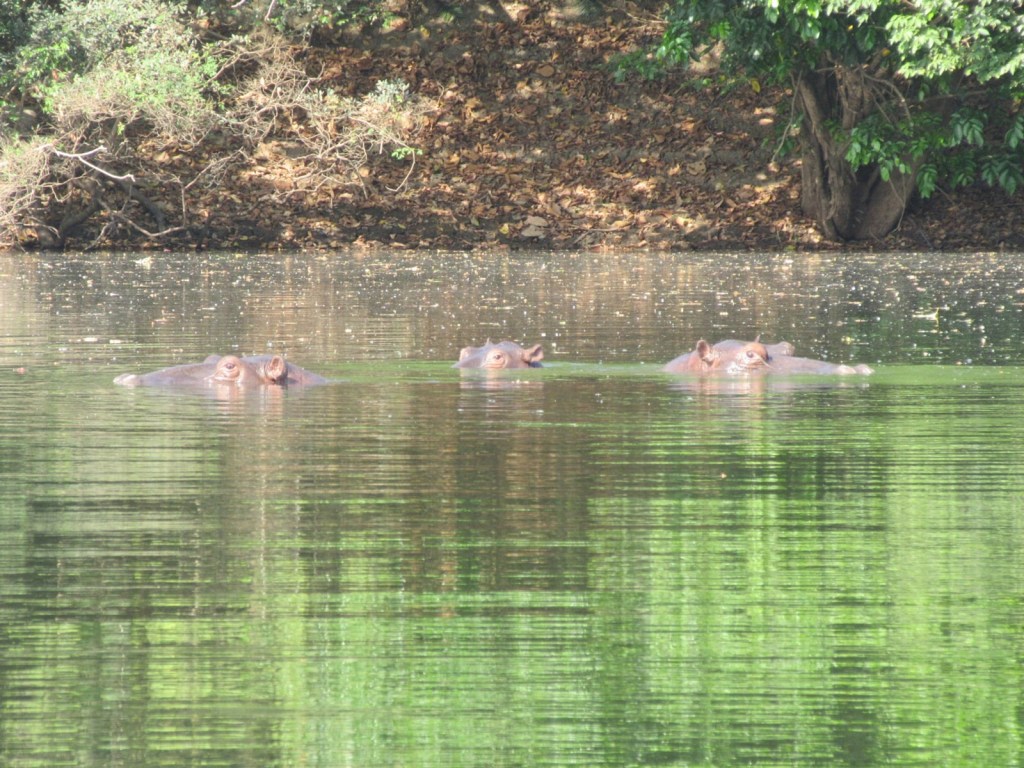
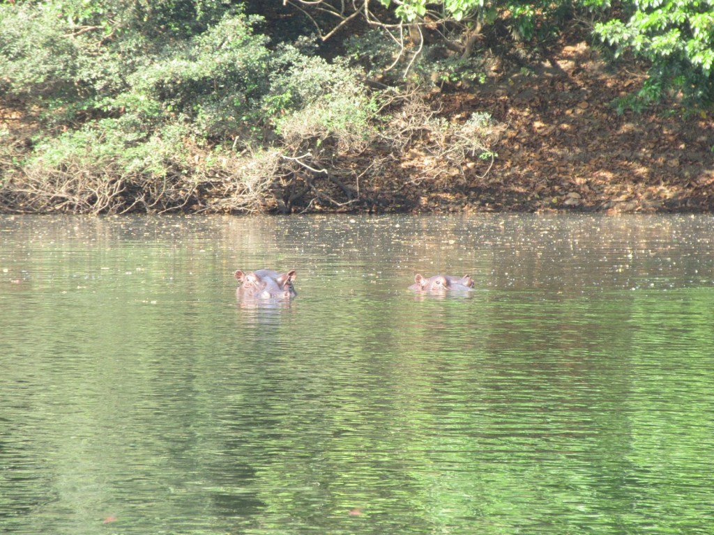
Eventually we came to the spot where the hippos were and shut off the engine. They looked like hippos I suppose. There were at least five of them, occasionally putting their eyes and ears and nose above the water and giving us a hard look, in the way that hippos do. In return, we stared back. Our guide told us these were regular hippos instead of pygmy hippos. They looked pretty small to me but upon review of various photos online I suppose the pygmy hippos have more rounded and less angular faces.
This was a very peaceful time. Our boat captain shut the engine off so we just drifted in the very slow-moving river, repositioning only occasionally. We stayed for a long time. The most harrowing moment was when it seemed like one of the hippos was moving slightly toward us, but the game of chicken ended still quite some distance away. As we got comfortable with the pod eventually we spotted that there was a baby among them, who would pop up only briefly behind another hippo which I assume was its mother. As we admired the hippos other wildlife would make an appearance, with a pair of I think fish eagles swooping down and the trees along the river bank being shaken by monkeys.
Eventually we turned around and head back up river, puttering back past the fishing village and keeping an eye out for more birds. But like the monkeys the birds eventually came to us. As we were lounging during the afternoon back in camp some green turacos started flitting about the treetops in camp. These are gorgeous birds and were great to admire via binoculars.
Cattle egret in this photo (I guess confused about what they are supposed to sit on), not green turacos.
Our final scheduled event was another forest walk, with the same ranger that took us on the previous one. Although we hadn’t hiked Karangia Hill in the morning, we were rather wiped from all our relaxing, so at the time I was fine with not hiking it. Looking back, I would have maintained the schedule as outlined on the website, with the Hill hike in the morning and hippo boat ride in the afternoon. Though I have heard of other visitors not seeing any hippos in the afternoon, so perhaps if you stay only two nights hippos and the hill are an either/or thing.
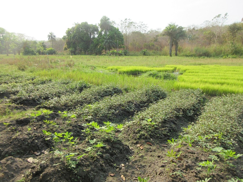
The forest walk though was still pretty great. We didn’t actually do much forest hiking. Instead the ranger took us through the nearby gardens and fields. As we were driving into the park we had passed several rice paddies and other gardens and I had really wanted to get a closer look, and now here we were. After all I love integrated farming and they were integrating this farming in spades (or with spades I guess). Although the garden the ranger took us to was specifically the garden of one of the other rangers, the stretch of land around and outside the park is where the local village does their food production. My super amazing wife was particularly interested in all the goings-on. We saw oil palm seedlings in polypots and rice that was about ready to be transplanted, along with pineapple and sweet potato and cassava. The rice paddies were surrounded by fruit trees and it was entrancing to see the layout of the different food systems, from the rice nurseries down in the “swamp” (the broad and low stream), fruit trees next to that, tree nurseries and sweet potatoes along the banks, and finally highest up the cassava fields and “local beans.” Gorgeous, all of it.
Man I love integrated farming; cassava, sweet potato, rice, and bananas all in one photo!
And with that, our last scheduled event was over. Our VSL guide had spent the time while we were on the forest walk buying a fish to replace the one he had bought in Makeni; apparently he had not secured it the night before and a civet had made off with it (I had wondered what that sound was). But dinner was great and the evening spent reading once again by flashlight. The next morning we had breakfast and set off soon after, enjoying the air conditioning in the car as we reversed our journey from two days before, arriving home in the early afternoon.
Overall, it was a good time, despite all the bug bites. As far as safaris go, it was pretty hokey; the boat ride to see the hippos was the best part, though probably not worth the drive from Freetown. The VSL team was pretty great and made everything run smoothly, and all we had to do was try to eat the massive meals they had prepared for us. For OKNP, I think a serious safari-goer would be better served by trying to get a more adventurous tour company to put together some sort of trek into the park itself. The rangers, after all, do treks into the park, and they enthusiastically explained all the great wildlife inside the park which you couldn’t see from just skirting its edges, like we did. Sierra Leone is just a tough place to travel in many ways, and I am very glad to have gotten upcountry to see such a gorgeous place, but luxury it ain’t.
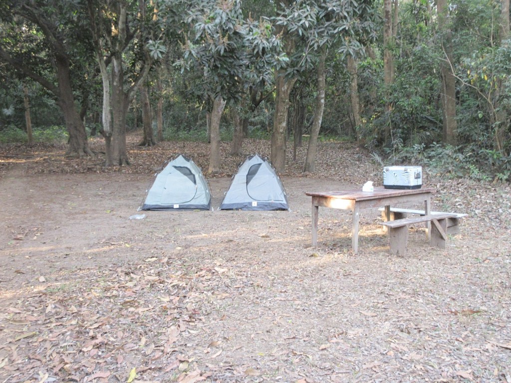
In the last entry my super amazing wife and I had just finished the journey across rivers and hills to arrive at Outamba-Kilimi National Park (OKNP) in Sierra Leone, on the border with Guinea. And now it was time to set up camp.
Sierra Leone has potential as a tourist destination. Perhaps they don’t want it but there is certainly potential, as there is any place. It could definitely be a world-class birdwatching spot. But so far it is not really set up for it at all. This was evident in OKNP as we pulled up to the campsite. There was not really much there. As I am writing this Wikipedia has a picture of a nice-looking miniature cabin but by the time we visited it more closely resembled a termite mound than tourist hut. The remains of the bathroom facilities were still usable, though that is only because a drop toilet doesn’t require all that much upkeep. Some low walls provided privacy and the lack of roof kept any bats from residing there.
But of course this is why we had arranged the trip with VSL. Upon arrival the guides quickly worked to set up camp. Our sleeping arrangement was a small tent with another to store the stuff we had brought. They provided bedding though if I were to do it again I would bring my own pillow. I think an enterprising visitor could arrange to stay in some of the park rangers’ accommodations and procure food locally but a tent and buying supplies in Makeni is probably indeed the way to go. Be also sure to bring plenty of water.
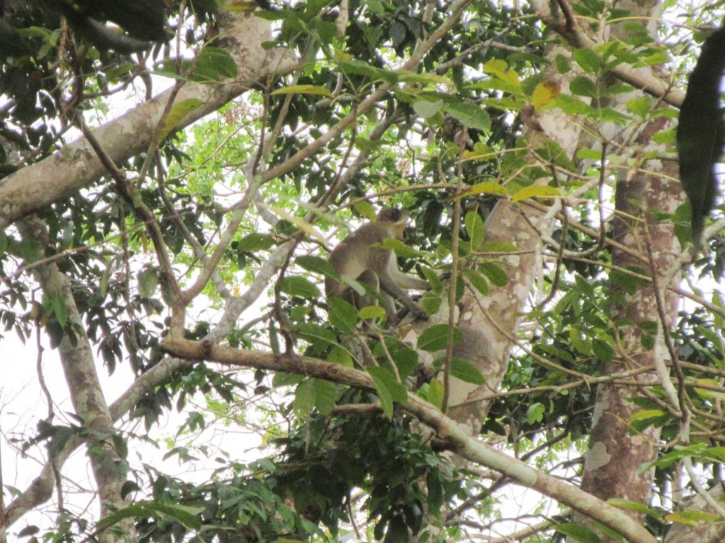
As everything was getting set up and unloaded our guides sent us off on our first park experience, a forest walk with the park rangers. This was pretty short. The park entrance and campsite I think are not actually quite in the park, but instead across the Kaba river. We never actually wound up setting foot in the park itself. I’m not sure if it was just inconvenient or if there was a deeper reason. Instead we skirted along the river to see what we could see. It was late afternoon and I think the rangers were worried about it getting dark. We spotted several monkeys traversing the trees. The rangers identified them as Colobus monkeys but having done some googling here I think they were actually Green monkeys. The most adventuresome part of the walk was crossing a stream via log (“local bridge,” the rangers said) but we survived dry and intact.
Camera-shy monkey.
And from there it was a relatively relaxing time in camp. On safaris I do appreciate the large amount of down time and on this one we had down time in droves. As we were hanging out the same green monkeys we had seen on our walk came through the treetops over camp, giving us a good look but making it seem a little silly we had gone off to find them just before. Later in the evening, having been served a massive dinner we settled down with flashlights to do some reading. This we did outside, as the tent was much too hot still to relax in.
One interesting part of living in Sierra Leone is that I feel like I have learned a lot more about what all these Victorian-era African explorers and missionaries I like to read about went through. Like you read about palm wine all the time but I never had any until we went to Banana Island (we chose to not bring any alcohol on our trip to OKNP, but on our second night, shortly after I was lamenting to my super amazing wife the lack of sundowners, our guide appeared with some poyo he had procured in the neighboring village and poured us each a mug out of the cooking oil bottle it had been stored in; from God to man indeed). For this trip, our experience was bugs. The most bothersome of these in the moment was what I think were the stingless bees that Livingstone wrote about. I can confirm that indeed “the bees are easily known from their habit of buzzing about the eyes, and tickling the skin by sucking it as common flies do.” They broke skin if you didn’t get them soon enough. Though the following week we would find ourselves itching from a hundred bug bites that we hadn’t even noticed we were accumulating. We used bug spray but we should have used much much more.
Finally tired enough that the heat was no longer so bothersome, we settled in to sleep.
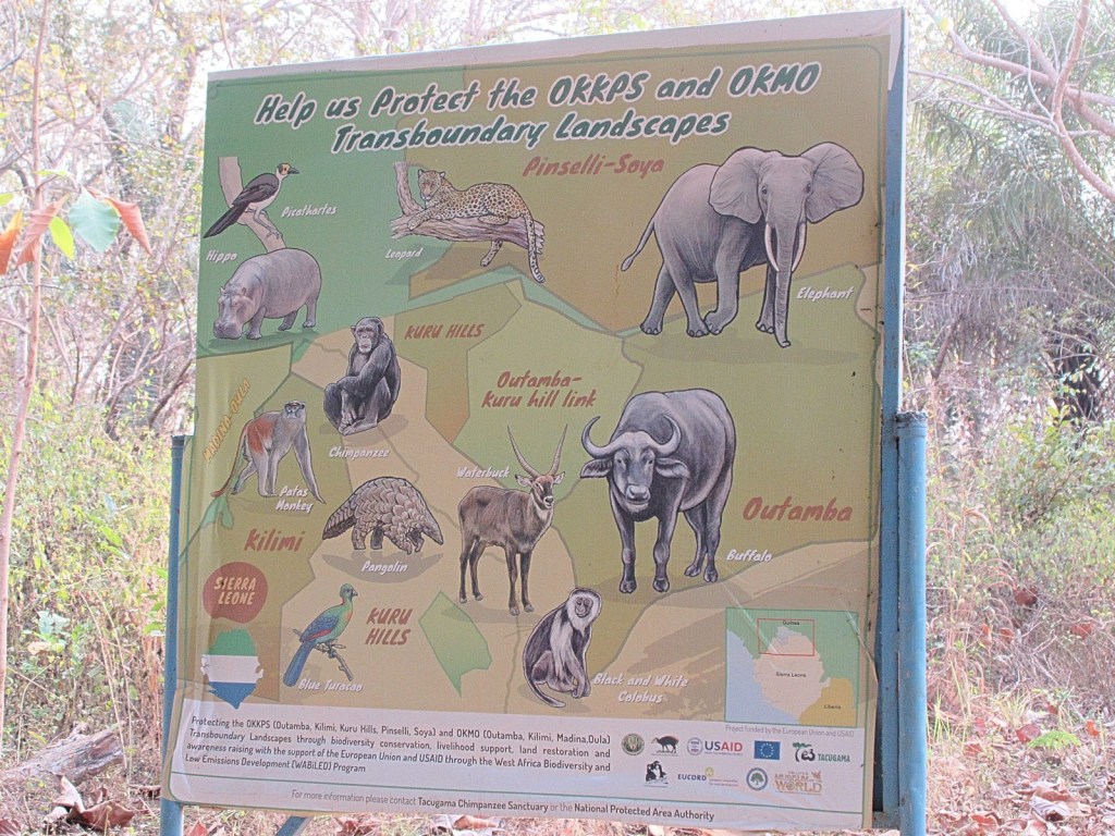
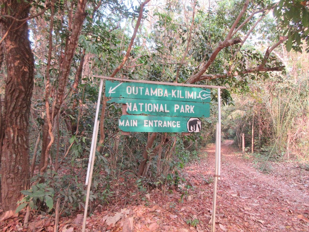
I have not been able to spend much time outside of Freetown during our time here in Sierra Leone. This has been for reasons both specific to my situation and more general to Sierra Leone. I was however determined to at least see something of the country and so with the help once again of Visit Sierra Leone (VSL) I booked my super amazing wife and I a trip to Outamba-Kilimi National Park. I chose OKNP, as the cool kids call it, for two reasons: 1) it is there, and 2) VSL had a trip outline we could do over a three-day weekend.
Getting there went very smoothly. Our guide and driver picked us up at our house and off we went for the approximately six-hour drive to the park. Along the way our guide tried to give us a bit of a tour of the country, in large part consisting charmingly of driving directions to various other cities. The main road network in Sierra Leone is both paved and seems to see little traffic (little traffic outside Freetown anyway), so on the first part of the trip we positively flew. I spent the whole time just looking out the window.
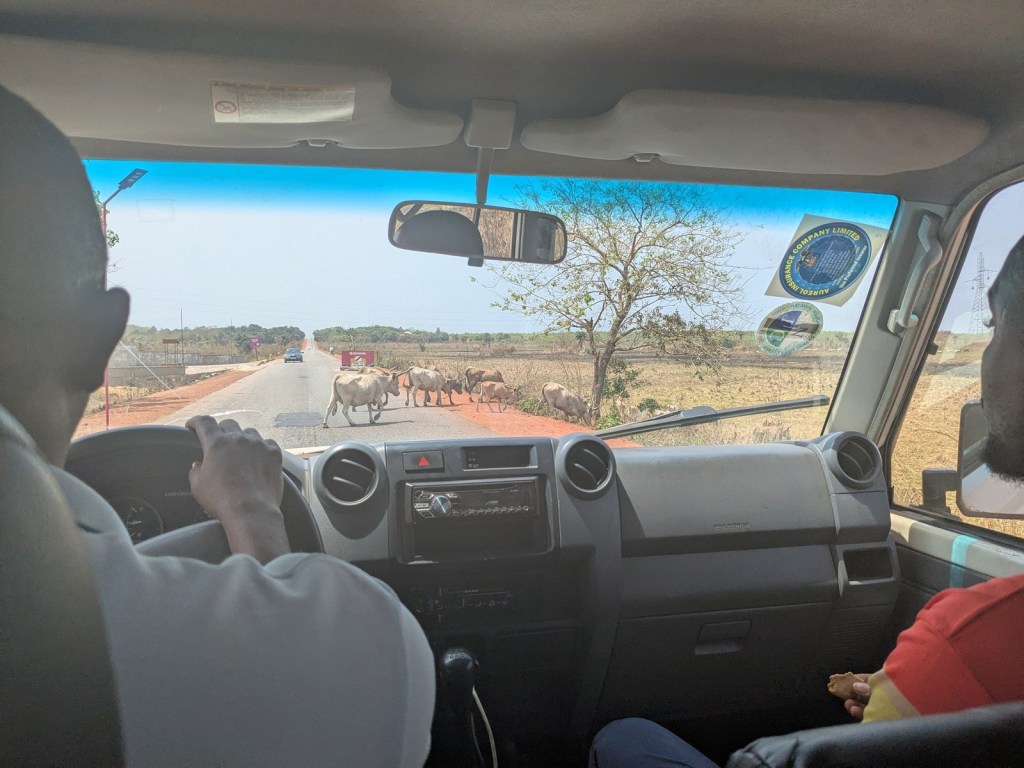
I am tempted to be reductive and say Sierra Leone is gorgeous but every landscape has its intricate charms if you embrace them. In Freetown you get used to living in and on the hills but as you depart Freetown you are traversing the broad plains that comprise most of the western half of the country. There are big skies and low forests. I enjoyed particularly looking at all the various agricultural research and demonstration centers we passed. You see some interesting stuff on the road, which included for us a single motorcycle carrying five people; the man in charge was scootched all the way up on the fuel tank with his four companions stacked behind him. This got an impressed whistle even from our driver and guide. As we moved upcountry we also saw lots and lots of goats and excitingly even some cows.
Along the way we pulled over briefly to pick up plantains but our main mid-journey break was at Makeni. This was our lunch stop but our guide’s main goal was to do all the shopping necessary for our weekend in the park. That could have been interesting to join but we were also happy to relax at a nice restaurant where we ate on the patio and watched the traffic go by. The guides probably also got better prices without us hovering around. In addition to the food the guides also picked up the chef which would join us for the weekend. She was phenomenal and the only flaw with the food on the trip was that it was too much and too good. Three gigantic meals a day that I felt terrible to not be able to finish. The menu was Sierra Leonean, with chicken and fish in peanut sauce the first night and cassava leaves the second. Lunch was pasta with hotdogs, which I understand is a slightly more recent import, but the breakfasts were also heaping and we did not do enough physical activity to justify all these calories. And she whipped this up on camp stoves, to boot.
But that was still slightly in the future as first we had to get from Makeni to the park. As we went along this part the road would proceed to get worse and worse, as is the wont of roads as you extend farther from city centers and the corridors between them in this part of the world. It was also outside Makeni that the hills started, which made the landscape remind me so much of Mbala district in Zambia. It was harmattan when we visited, which meant the distant parts of the landscape faded into blue dust, bolstered by smoke from the occasional brush burning. It was also dry which meant the landscape could have been greener, but I don’t know how far we could have possibly gotten in muddy roads.
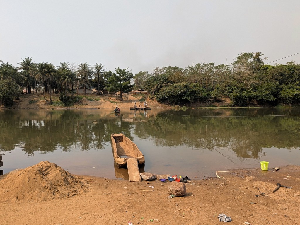
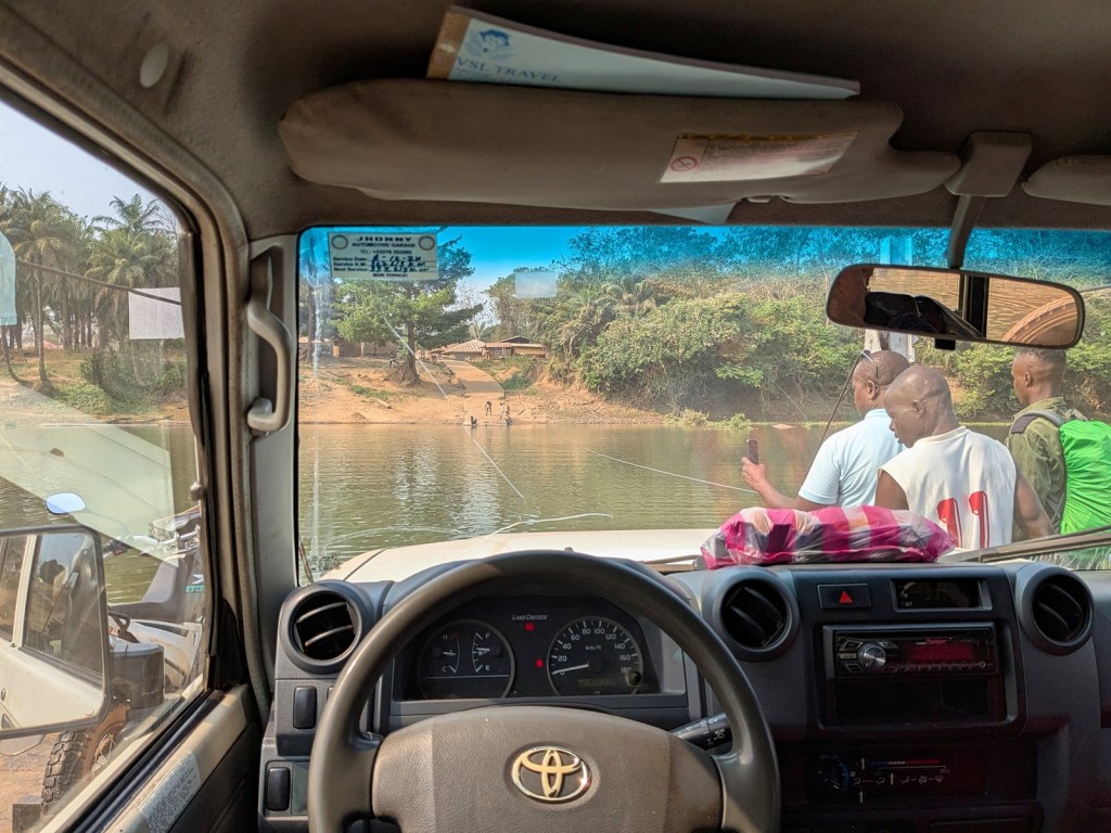
The final barrier to the park was the Little Scarcies River, which we had to cross by ferry. I thoroughly enjoyed this experience. I don’t know how old the ferry is or who built it, but it is a pretty nice system. It is attached to either bank by cable though it is entirely person-powered. The ferry was at the far side as we pulled up so we watched as it was pulled across to our side. On either end of the ferry there are ramps, and as another fun feature they are balanced so as one side goes down the other goes up. We drove onboard and were joined by a motorcycle and smattering of other people looking to cross. After boarding the man slowly pulled us across, and we had a very peaceful time floating over the river. Having not sunk, we drove the last few miles to the park entrance.
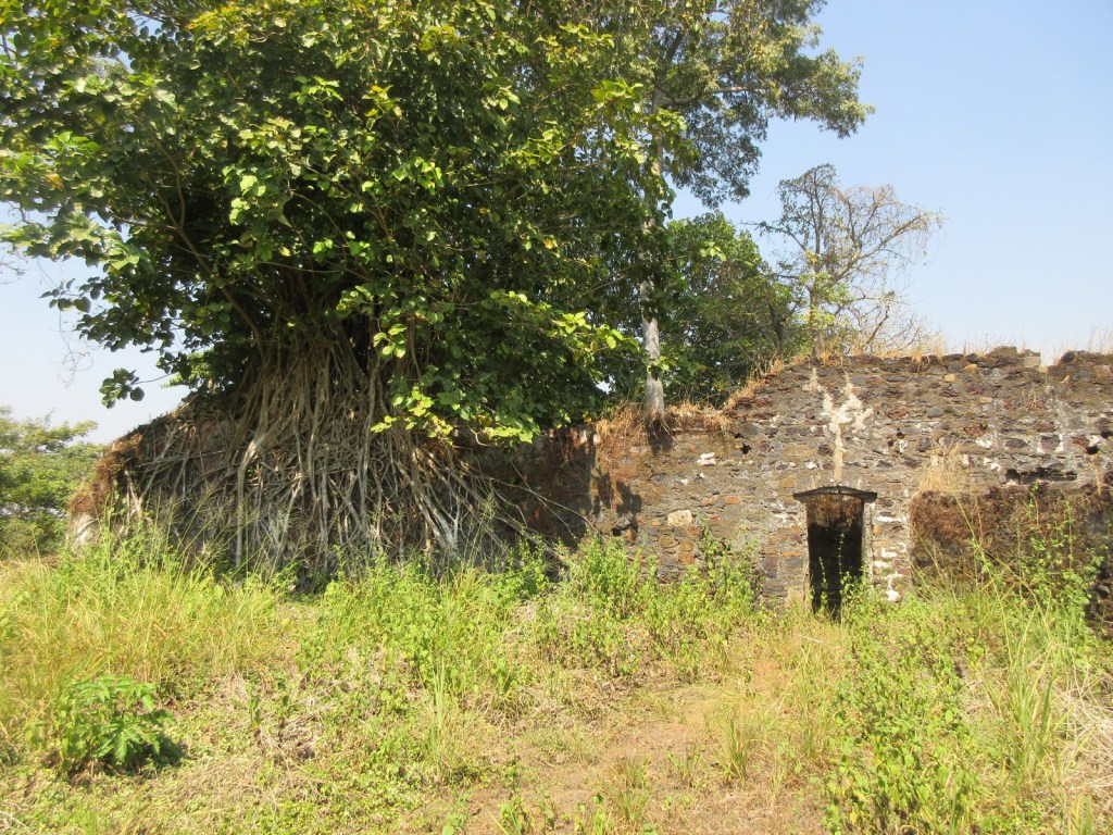
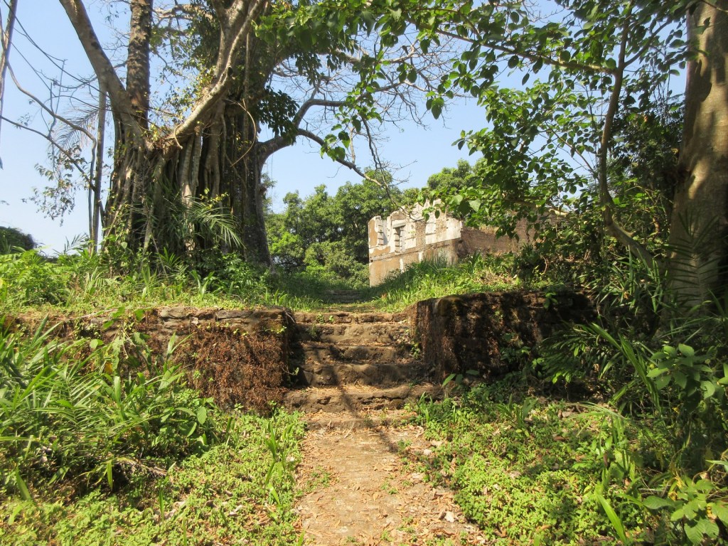
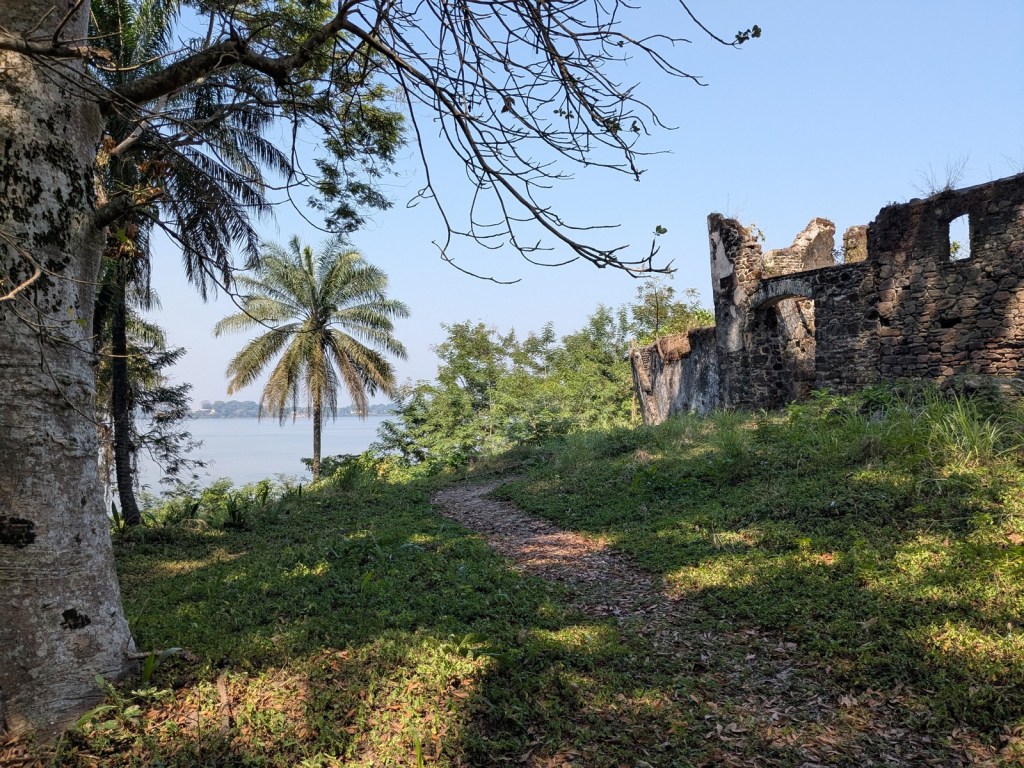
Turning away from the river you are looking at the main part of the castle itself, with the ruins still standing two stories tall. Looping around clockwise the guide pointed out the remains of what he said was the secretariat (record storehouse), a blacksmith shop, and the kitchen, before taking us through the gate into the main slave yard. Here the enslaved people would have been housed while their captors waited on another ship to come.
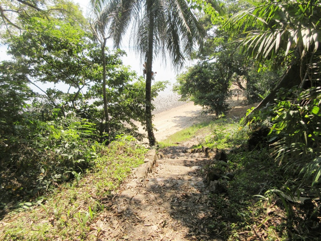
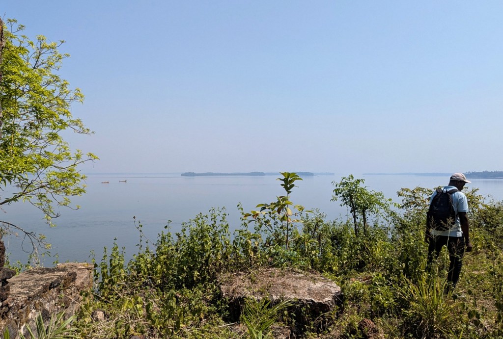
From within the slave yard.Path down to the upriver beach.Looking back up at the fort from the path to the beach.Looking upriver.
Outside the slave yard and on a path leading down to the beach there is a cotton tree with roots that have followed the square of the brickwork, making a convenient photo spot. Our guide encouraged people to cycle through to take pictures, if they liked. He explained that behind him was the powder store room, in which now lives a large number of bats. On the beach side there is a very small door into the cave-like room, which must have attracted the bats. He said that you could hear the bats, “singing hallelujah praises,” and you know what you could. It must be really cool when they all come out at dusk. Along the beach he also pointed out old piles of oyster shells that would have been used to produce lime. After walking back up the hill this concluded the tour of the fort itself. From there we walked down a short path to the other side of the island to see the graveyard. We didn’t linger and guide shuffled us back to the boats playing more praise songs on his speakers.
With the A Boat having been replaced in the interim, it was a short hop over to Tasso Island, which was an unexpected treat. Going to Tasso wasn’t unexpected, we were always going to have lunch there, but our short visit was really something. The tide was far out when we landed which meant we alighted onto a rock/concrete structure that looks like it is covered at high tide and got to walk along the beach, admiring some very cool rocks and having a lovely stroll. Up at the restaurant we had a great lunch of rice, fried fish, and plantains, but then the real surprise was being taken up to the Tasso Heritage Center.
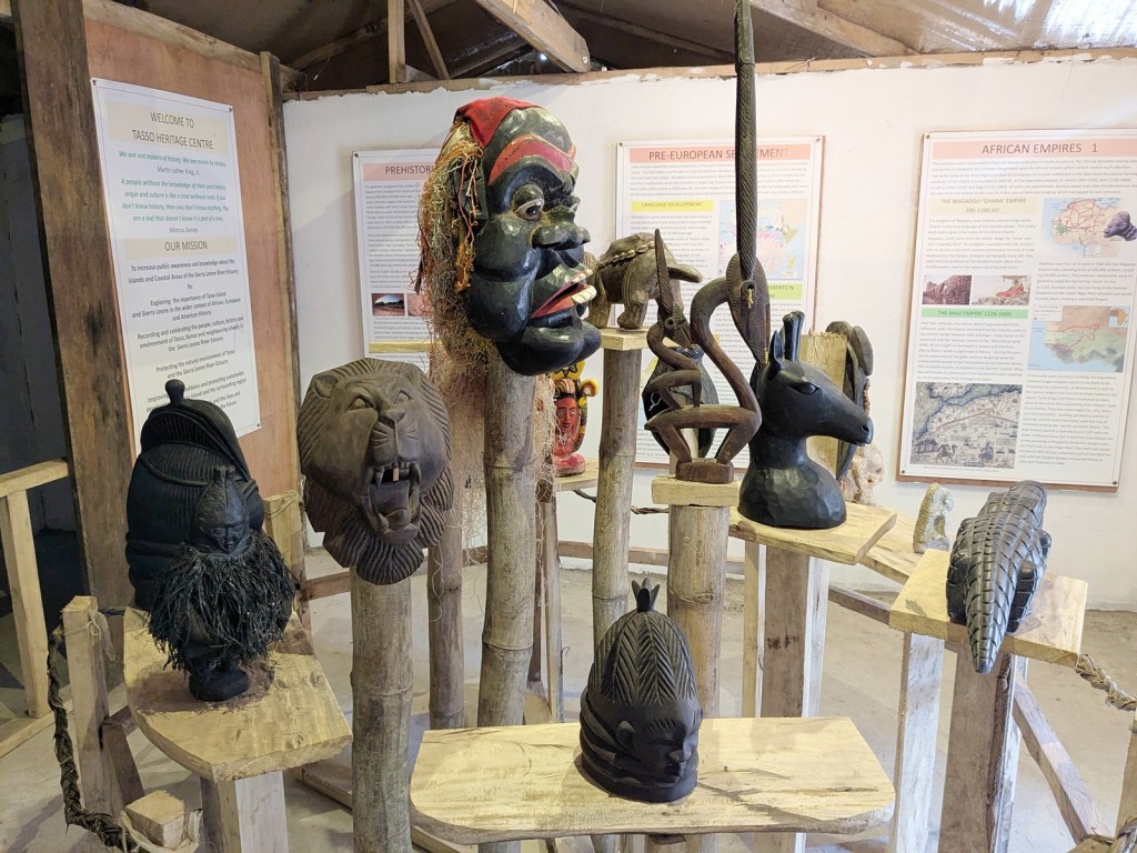
The reason Tasso had lunch facilities is because of the Tasso Ecotourism Project, which as the name suggests is encouraging ecotourism on Tasso Island. It’s part of these overall efforts along with the tour companies that they developed the Heritage Center, which was brand new when we visited, having opened only two months prior. One of the people from the island showed us around the center. Right inside the door there is an impressive collection of Sierra Leonean masks, including Temne, Bundu, and Krio masks. The pride of their collection is an “original carving of the ‘camel’ or ‘horse traveler,’ still wearing its cowrie bead charm, which was carried in front of the Chief on long journeys. It comes from the time of the African Empire invasions, when camels were first seen in Northern Salone.”
Masks of Sierra Leone.
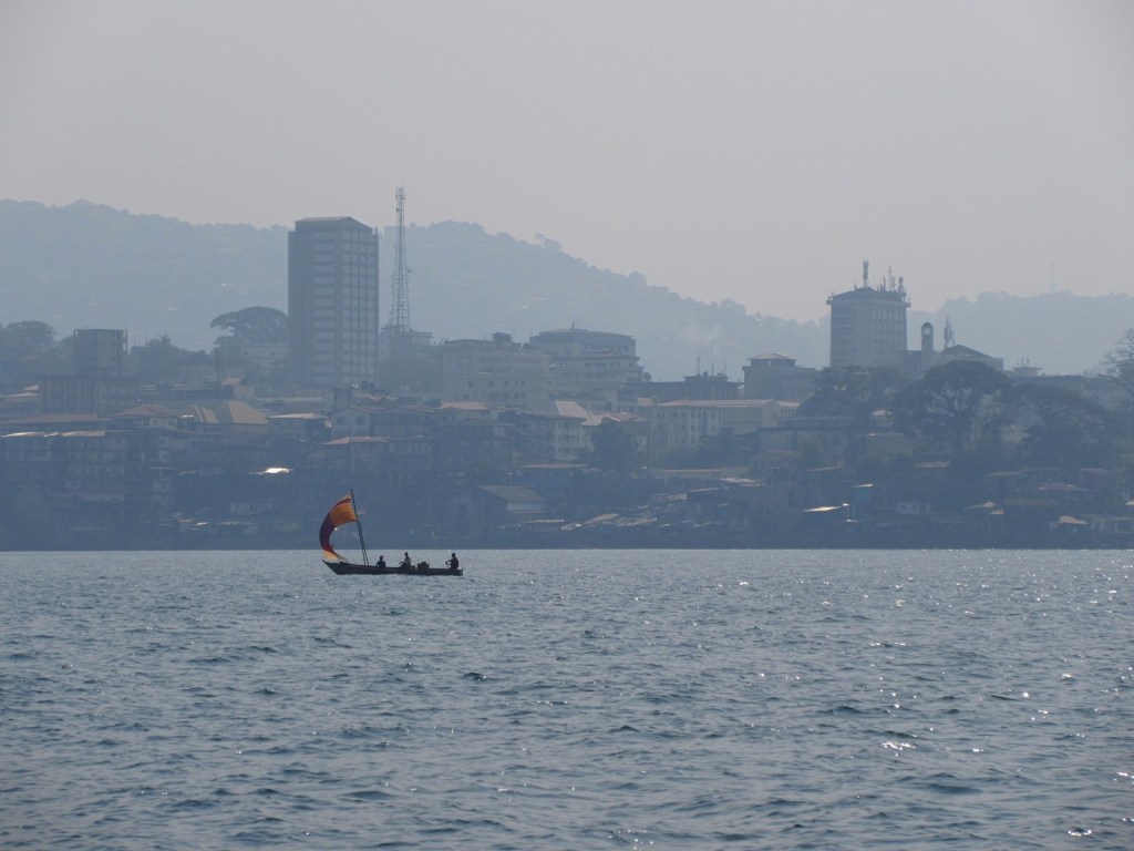
The largest room of the museum discusses the history of slavery in Sierra Leone, and especially the relationship of Tasso to Bunce Island. Since, as discussed, Bunce is very small and primarily chosen as a fortification, Tasso was used as a plantation to provide food and water to Bunce. There were also signs on the longer history of Sierra Leone and its relationship to the rest of west Africa, and a room displaying some of the normal wares of a household. We didn’t get too long to linger but frankly the heritage center rivals the national museum in Freetown, especially for the scholarship on display. But from there it was time to load up onto the boats for the final ride back to Freetown. This went smooth and quick. I ensured my super amazing wife and I sat on the port side for the ride back so I could see all the things I didn’t see on the way out to Bunce. It was so lovely seeing Freetown from the water, spotting downtown and the different hills over which the city spills. It was the cap to a fantastic trip full of history and a showcase for the enduring connections between Sierra Leone and the world.
The sign on the baobab tree says “Welcome to Bunce Island.”
Reading this week:
Between Meals by A.J. Liebling
At the very tail end of 2024, my super amazing wife and I managed to get to Bunce Island! It was really fantastic and is a must-see if you ever find yourself in Sierra Leone. Unlike a lot of things in Sierra Leone, Bunce Island is in fact pretty well documented online. That means there is no need to belabor the history here, but Bunce Island was home to a slave fort/factory that was a base for enslavers along the Sierra Leonean coast for centuries. The site has a particular connection to the United States because of the local rice-growing culture. People from the region were especially prized as slaves in the Carolinas for their knowledge of rice growing, and there is a direct connection between Sierra Leone and the Gullah/Geechee culture in the United States.
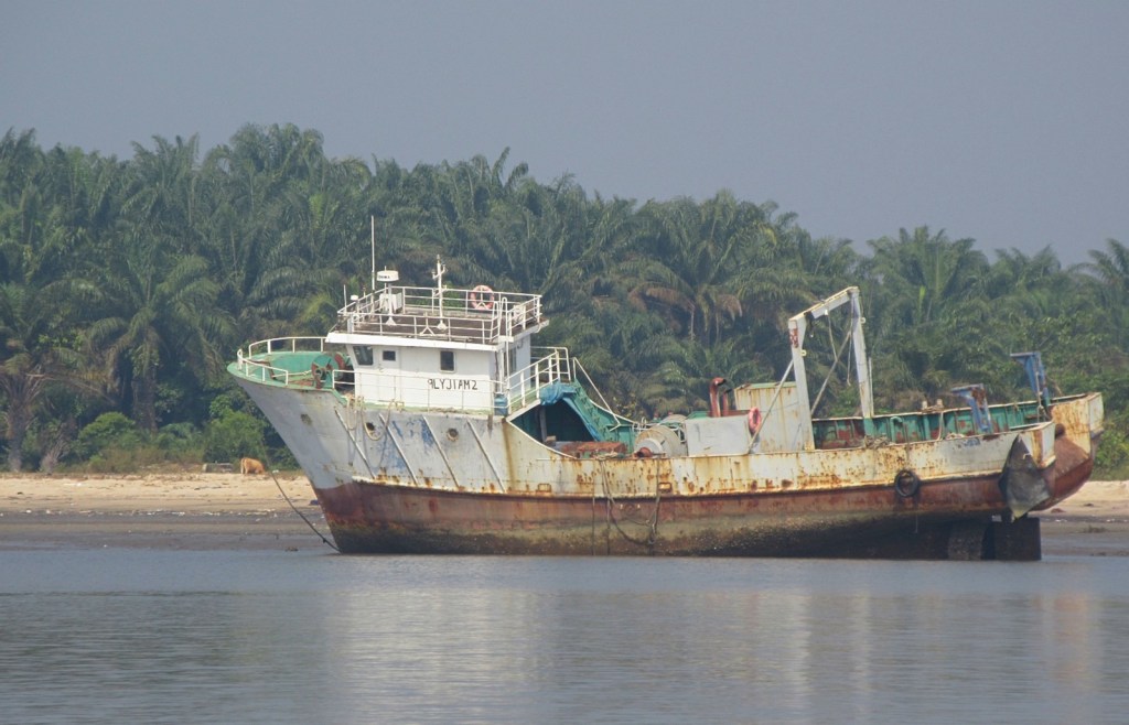
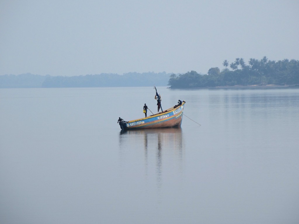
Since Bunce is an island we had to take a boat to get there. We were joining a trip put together by VSL Travel, and so joined up with our trip companions at the SeaCoach terminal. The VSL crew was great and I can highly recommend them. At the terminal we loaded onto two boats. We were on the B Boat, but as we went along it became clear that the A Boat was having trouble. There was a lot of plastic in the water outside Freetown harbor and apparently their engine had sucked some up. That didn’t bother me too much because I was having a grand ole’ time looking at all the different boats in the harbor from slightly closer up than usual. As we went further up the river I really enjoyed seeing all the different fishing villages and fishing boats out and about. At one point we had to veer sharply to the right to avoid running over a line of nets.
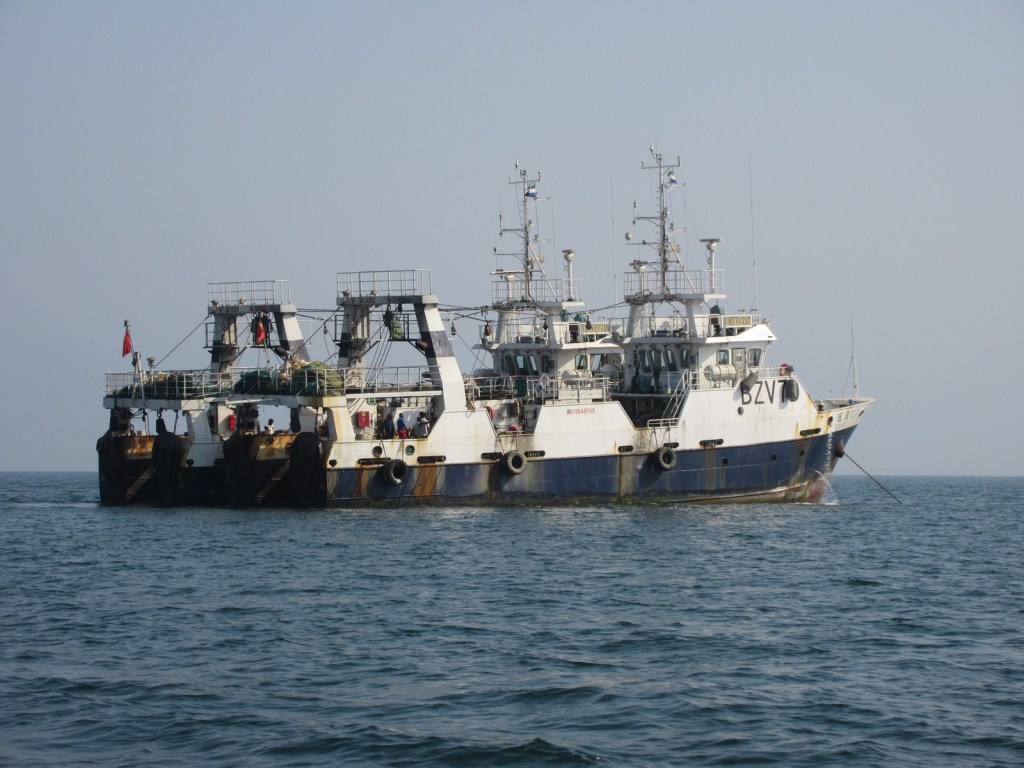
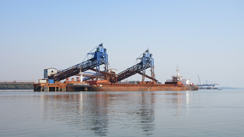
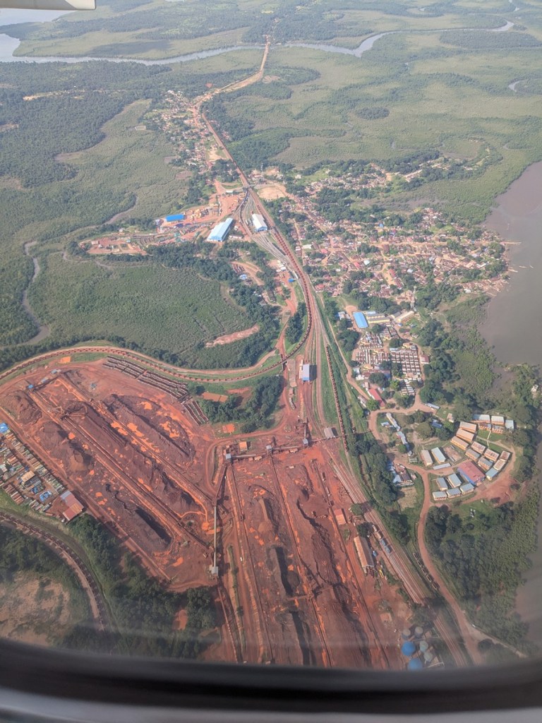
The most unexpected thing we saw was the port of Pepel, where a bulk carrier was being loaded up with ore. The current major export of Sierra Leone is iron ore, and from the Marampa and Tonkolili mines it is transported via rail to Pepel, where it is loaded onto ships for transport elsewhere to be refined. That explains all the bulk carrier ships I always see in Freetown harbor, which is a connection I should have made earlier. It also explains the rail yard I saw from the plane. Happy that things all tie together.
Bulk carrier being loaded with ore.View of Pepel from the air.
After passing Pepel, we were soon at Bunce. From the dock at Bunce you can look across and see the ships being loaded with ore. There’s a metaphor in there if you care to use it. Bunce Island had been neglected for a while as a historical site but that started getting rectified in 2007, so the infrastructure is pretty good. There is a caretaker on the island with a nice little house, keeping the brick paths fairly clear, and you land at a convenient dock. The fort itself is of course in ruins but as far as ruins go they are well preserved.
Once the A Boat had limped to the island and we were all gathered, the first thing the guide had us do was pray, “no matter your religion.” This prayer consisted of him drawing a circle in the sand and pouring water into it as he played “Amazing Grace” on his speaker. It was better than it sounds in that sentence, I promise. The significance of the circle was lost on me but the guide mentioned that the song was by John Newton, describing him as a former enslaver turned abolitionist. What he didn’t mention I don’t think but was clearly a part of the decision to play the song is that John Newton was in fact himself enslaved in Sierra Leone, when he annoyed the crewmembers of his ship so much they abandoned him here.
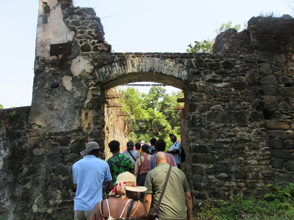
The main gate of the fort.
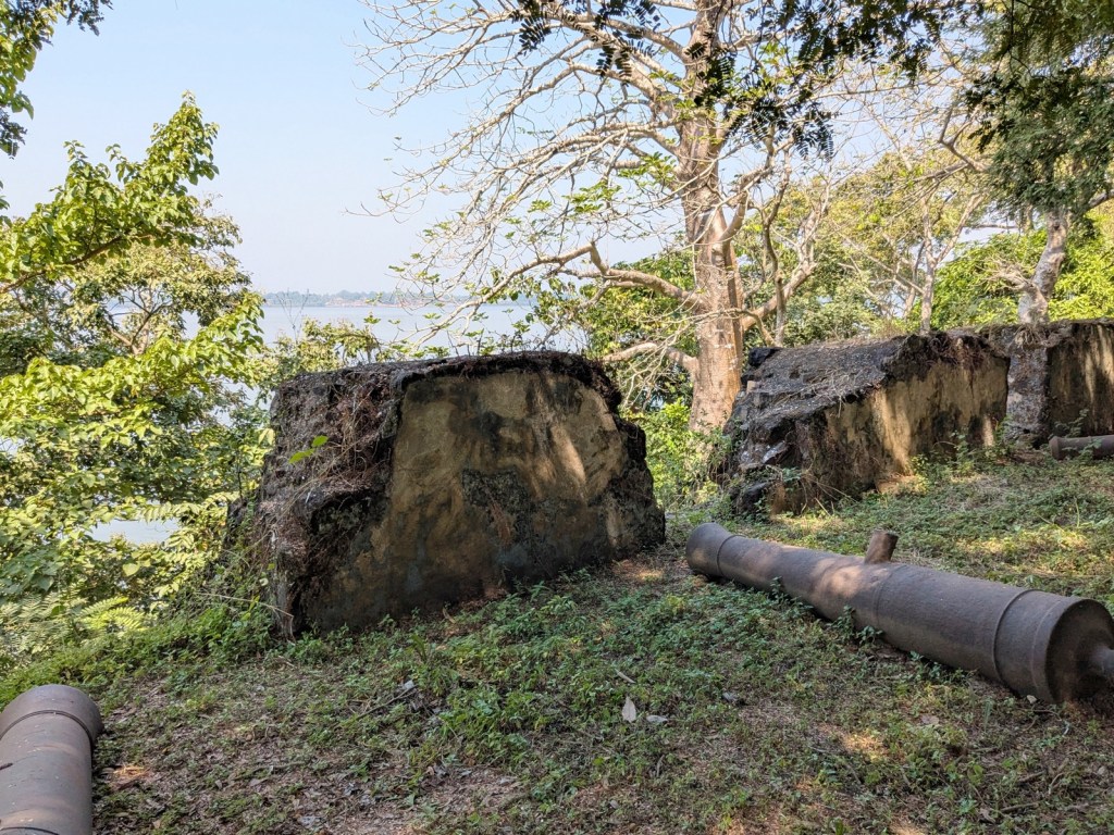
After the prayer the guide gave us a short history of the island and the slave trade in Sierra Leone, which was necessarily compressed but pretty alright. Then we hiked the 100 feet or so on up to the fort (it’s a very small island). The fort is on a gorgeous spot to be the site of so much pain. You can see why they picked it. It’s about as far up the river as you can go in a ship (as evidenced by the ore loaders a mile away), and the island has a small bluff on which the fort is built. With the trees cleared you could see any threats coming from a ways off. We entered the fort through the main gate which brought us past the ruins of the apartments and then onto the main bastion, with cannons on the ground still overlooking the main approach.


You must be logged in to post a comment.