

Yesterday, (as of writing this), I hiked on up Sugar Loaf Mountain! It was fun and I am still exhausted. My super amazing wife was out of town and a group of people were going hiking up the mountain and invited people along. I was expecting a big crowd but there was not a big crowd instead there was a relatively small group of people who were all much much fitter than me and I spent the whole time struggling to keep up.
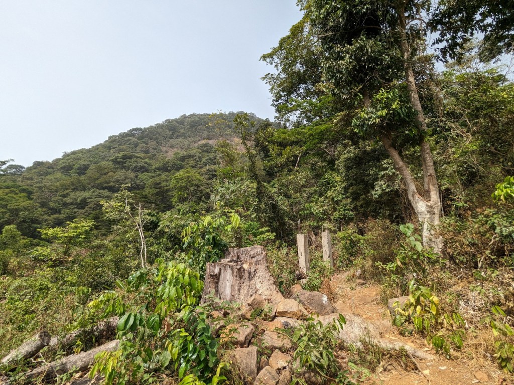
The hike starts in Regent. If you want to do the hike yourself, the trailhead starts here. Follow what Google Maps displays as a road until the end and then keep going along the waterpipes and on up the trail. The picture above is the trailhead, at least how it looked the day we hiked it (at least two years ago as you are reading this), but Freetown keeps expanding its borders so who knows what it will look like when you give it a go.
According to the Visit Sierra Leone site, you are supposed to get a local guide and pay a small donation to hike on up the trail. As far as I could tell we didn’t do that and no one really approached us about it (not clear where one would ask for a guide), but it might be helpful to try to figure it out if you’re not going with someone who already knows what they are doing. The trail is supposedly marked, which is sort of true. It has definitely been marked many times. Hiking up we passed by arrows painted on rocks, paint on trees, and ribbons tied to branches. The trail itself was also usually pretty visible, though people have taken multiple paths around various obstructions, and it seems there are plenty of stories of people taking a wrong fork and winding up on the wrong mountain. If you haven’t seen a discarded water bottle in a bit, you’re probably on the wrong path.

Climbing up Sugar Loaf seems to be a long-time tradition in Freetown. While trying to figure out why it was called Sugar Loaf (turns out people named a whole lot of sugar loaf-shaped mountains Sugar Loaf), Wikipedia pointed me to an account of the ascent from 1855:
Two guides were engaged, and about eleven o’clock I started, and was one and a half hours making the ascent. No one had been up for a long time, and the path was much overgrown, so that my guides missed their way twice. I never saw any thing like it. It was like going up a ladder, from rock to rock, up, up, at every step – at times pulling ourselves up by the bushes; at other places walking on an extended bare rock, with the inclination of a steep roof, while precipices of thousands of feet lay beneath. It was a very wearying effort, but we reached the top.
The Palm Land; Or, West Africa, Illustrated by George Thompson
It hasn’t changed much (the trail was less overgrown than he described like I said above, but I think he did it closer to the rainy season). Since the internet said it was a marked trail I had expected, like, switchbacks. The straight-line distance for the trail is not even a mile, and before the hike I had been worried about how long a reasonably curvy trail up the mountain would be. Turns out the trail goes pretty much straight up from the trail head to the tippy-top, gaining (again as far as I can tell from Google Maps) 1000 feet of elevation in about 3000 feet of walking. Steep! I don’t think it would be too too bad if you were taking your time instead of running after people way more in shape than you, but there are definitely some slippery leaves and tricky bits. On the descent I resorted to crabwalking a few times. In the picture above you can see the rock faces our dear man George was talking about, but those were actually easy sections; the rock was grippy enough that you could just (“just”) walk up, though in the rainy season it might be much more hairy.
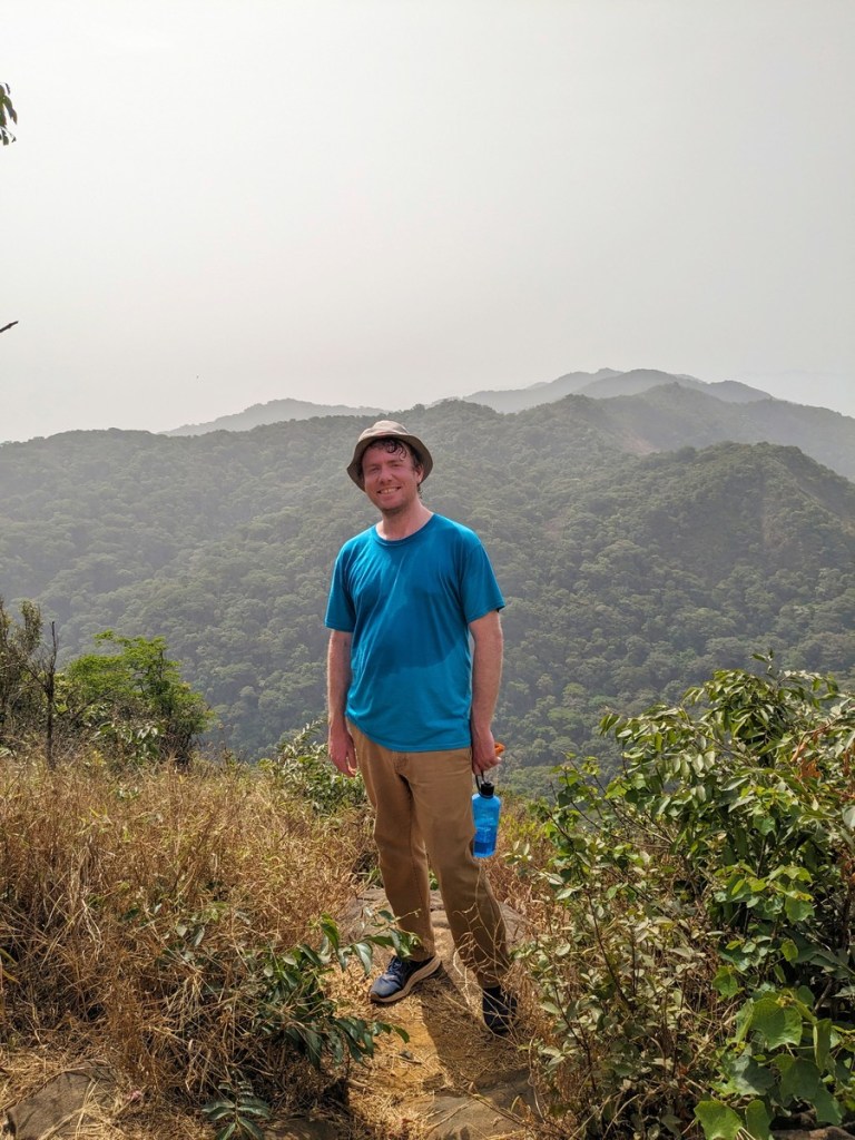
Further down in the paragraph quoted above George describes wondrous sights but unfortunately on the day we hiked up it was more than a bit hazy with the tail end of the Harmattan. What we did see was still rather pretty, but given how pretty it was I can only imagine the sights when the skies are clear. The photo at the top was about 3/4 of the way up and was the best view of Freetown itself, while the photo right above this paragraph was at the summit (I tried smiling I promise but I guess this is the best I could muster so exhausted) looking south into the forest preserve. It’s a gorgeous landscape, so unlike the port side of Freetown which really isn’t far at all, and must be unlike anything else in Sierra Leone until you cross the lowland plateau and hit the hills 100 miles inland. Worth the walk even if it is a doozy!

You must be logged in to post a comment.