

We return to our series on “things I took pictures of in the SOAS LMS archives” with two more maps, these ones drawn by Ed Hore:
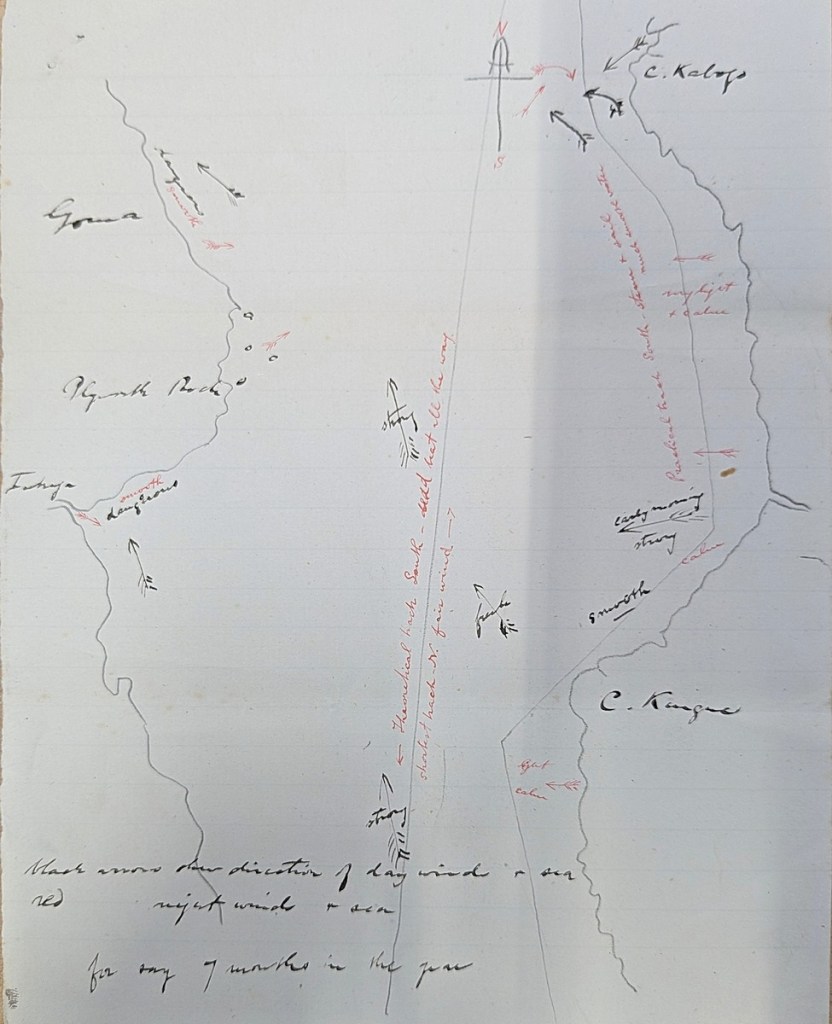

Reviewing my notes I don’t think I noted when these are dated, if indeed they came with dates. I think it might be around 1881. I included transcriptions of some letters from Hore in this post, and in the 1881 letter he is discussing the prevailing winds and some of the different port conditions around the lake as an argument for a sailing ship with steam auxiliary for the Good News. Since the maps are of sailing conditions and have bits marked as “dangerous,” they might be in support of the themes of the letter. Plus, Plymouth Rock/Mtowa is marked on both maps. This station was established by Rev. William Griffith and Walter Hutley in October 1879 (that story is covered here and also in the March 1880 edition of the Chronicle). What is not particularly marked on the map though is Kavala Island (the second map marks it but the first map only has a couple dots).
The lack of Kavala is significant because that is where Hore established the headquarters of the LMS marine station, from 1884 (Chronicle, November 1884) until I think Hore’s departure from the mission in 1888. So if the map was drawn after 1884 I think Kavala would have been much more prominently marked. Now the rest of this post will be sharing some relevant links and thoughts about Kavala Island. Hore had established the Marine Station up there when the mission thought the north end of the lake was going to be much more important to them, with iterant missionaries doing lacustrine preaching. Instead they wound up settling on the south end of the lake and into modern-day Zambia.
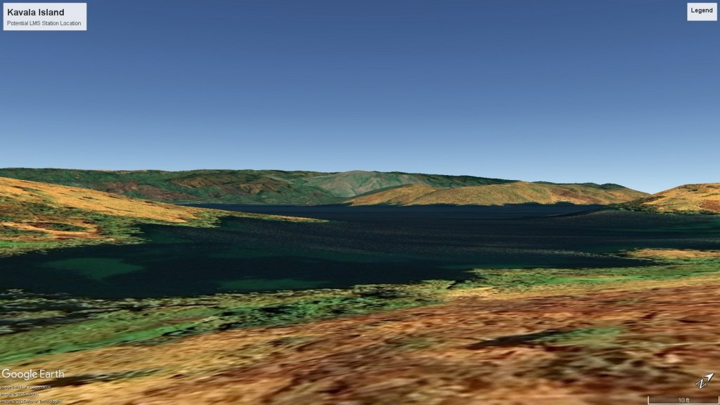
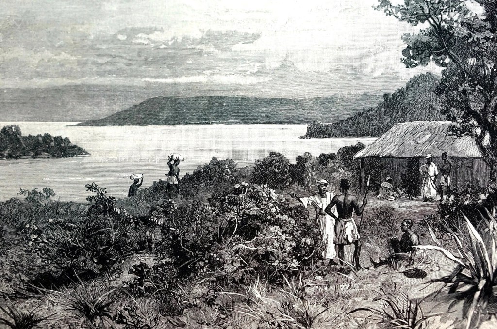
I’m not sure exactly where on Kavala the Marine Department was, though I think it was maybe right about here. This is based on trying to recreate the woodcut of the station in Google Earth. This technique has led us astray before but for now it’s all I got. First, the woodcut. The picture at the very top of the post comes from Tanganyika: Eleven Years in Central Africa, Hore’s book about his experience with the mission. When I was looking at the fold-out picture of Ujiji, I found out it was based on an earlier illustration. Turns out the picture of Kavala is too, though in this case it is still referencing Hore’s experience, being from a write-up of his missionary work in The Graphic in June 1890 (two years before Hore’s book). The book’s picture is a little different from the The Graphic, showing a more permanent house and road, but the background showing the mainland from across the strait looks the same, and in Google Earth you can get pretty close to the same picture.
Of course the dream would be to go to Kavala and tromp around and see if I could see it in real life. That would be difficult given visas and language and location, and anyway there probably wouldn’t be anything left to find without significant archeological work, but a boy can dream. There is also not a lot of documentary evidence online about what Kavala Island looks like on the ground as far as I can find. I linked to it for Plymouth Rock above but this website about cichlids (Tanganyika’s most famous export) has some photos of Kavala aka Bilila Island (like Zanzibar, apparently Kavala refers to the group of islands). Then besides that, this man visited the island, though the YouTube video of the trip doesn’t show much of the island at all (start right at the 13-minute mark):
And that are some maps of sailing directions and some more bits about Kavala Island. Lake Tanganyika’s long and interesting history continues.

You must be logged in to post a comment.